Spiritwood, North Dakota
| Spiritwood | |
|---|---|
| Census-designated place & Unincorporated community | |
|
US Post office in Spiritwood | |
 Spiritwood  Spiritwood Location within the state of North Dakota | |
| Coordinates: 46°56′10″N 98°29′44″W / 46.93611°N 98.49556°WCoordinates: 46°56′10″N 98°29′44″W / 46.93611°N 98.49556°W | |
| Country | United States |
| State | North Dakota |
| County | Stutsman |
| Area[1] | |
| • Total | 0.876 sq mi (2.27 km2) |
| • Land | 0.876 sq mi (2.27 km2) |
| • Water | 0 sq mi (0 km2) |
| Elevation | 1,480 ft (450 m) |
| Population (2010)[2] | |
| • Total | 18 |
| • Density | 21/sq mi (7.9/km2) |
| Time zone | Central (CST) (UTC-6) |
| • Summer (DST) | CDT (UTC-5) |
| ZIP codes | 58481 |
| FIPS code | 38-74660[3] |
| GNIS feature ID | 2584357[3] |


Spiritwood in 1925
Spiritwood is a census-designated place (CDP) in eastern Stutsman County, North Dakota, United States. An unincorporated community, it was designated as part of the U.S. Census Bureau's Participant Statistical Areas Program on March 31, 2010.[4] It was not counted separately during the 2000 Census,[5] but was included in the 2010 Census,[6] where a population of 18 was reported.[2]
It lies east of the city of Jamestown, the county seat of Stutsman County.[3] Although it is unincorporated community, it has a post office, with the ZIP code of 58481.[7]
References
- ↑ "US Gazetteer files: 2010, 2000, and 1990". United States Census Bureau. 2011-02-12. Retrieved 2011-04-23.
- 1 2 "2010 Census Redistricting Data (Public Law 94-171) Summary File". American FactFinder. United States Census Bureau. Retrieved 2 May 2011.
- 1 2 3 "US Board on Geographic Names". United States Geological Survey. 2007-10-25. Retrieved 2008-01-31.
- ↑ "Spiritwood Census Designated Place". Geographic Names Information System. United States Geological Survey.
- ↑ U.S. Census Bureau (2003). "Population and Housing Unit Counts, North Dakota" (PDF). 2000 Census of Population and Housing. Government Printing Office. Retrieved 2008-07-20.
- ↑ U.S. Census Bureau (February 13, 2008). "Census Designated Place (CDP) Program for the 2010 Census—Final Criteria" (PDF). Federal Register. Retrieved 2010-07-13.
- ↑ Zip Code Lookup
Municipalities and communities of Stutsman County, North Dakota, United States | ||
|---|---|---|
| Cities | 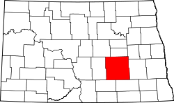 | |
| Townships |
| |
| CDPs | ||
| Unorganized territories |
| |
| Unincorporated communities | ||
This article is issued from Wikipedia - version of the 7/31/2016. The text is available under the Creative Commons Attribution/Share Alike but additional terms may apply for the media files.