Romeo, Colorado
| Town of Romeo, Colorado | |
|---|---|
| Town | |
|
Main Street, looking west | |
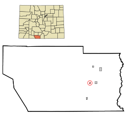 Location in Conejos County and the state of Colorado | |
| Coordinates: 37°10′21″N 105°59′5″W / 37.17250°N 105.98472°WCoordinates: 37°10′21″N 105°59′5″W / 37.17250°N 105.98472°W | |
| Country |
|
| State |
|
| County[1] | Conejos County[2] |
| Incorporated (town) | September 4, 1923[3] |
| Government | |
| • Type | Statutory Town[1] |
| Area | |
| • Total | 0.2 sq mi (0.6 km2) |
| • Land | 0.2 sq mi (0.6 km2) |
| • Water | 0 sq mi (0 km2) |
| Elevation[2] | 7,736 ft (2,358 m) |
| Population (2010) | |
| • Total | 404 |
| • Density | 1,732/sq mi (668.7/km2) |
| Time zone | Mountain (MST) (UTC-7) |
| • Summer (DST) | MDT (UTC-6) |
| ZIP code[4] | 81148 |
| Area code(s) | 719 |
| FIPS code | 08-65740 |
| GNIS feature ID | 0192991 |

Romeo is a Statutory Town in Conejos County, Colorado, United States. The population was 404 at the 2010 census.[5]
A post office called Romeo was established in 1901.[6] The community derives its name from the surname Romero.[7]
Geography
Romeo is located in east-central Conejos County at 37°10′21″N 105°59′5″W / 37.17250°N 105.98472°W (37.172602, -105.984680),[8] in the San Luis Valley region. U.S. Route 285 runs along the western border of the town, leading north 21 miles (34 km) to Alamosa and south 12 miles (19 km) to the New Mexico border and beyond. Colorado State Highway 142 is the town's Main Street, with its western terminus at U.S. 285 and leading east 3 miles (5 km) to Manassa and 32 miles (51 km) to San Luis.
According to the United States Census Bureau, the town has a total area of 0.2 square miles (0.52 km2), all of it land.
Demographics
| Historical population | |||
|---|---|---|---|
| Census | Pop. | %± | |
| 1930 | 188 | — | |
| 1940 | 392 | 108.5% | |
| 1950 | 404 | 3.1% | |
| 1960 | 339 | −16.1% | |
| 1970 | 352 | 3.8% | |
| 1980 | 308 | −12.5% | |
| 1990 | 341 | 10.7% | |
| 2000 | 375 | 10.0% | |
| 2010 | 404 | 7.7% | |
| Est. 2015 | 387 | [9] | −4.2% |
As of the census[11] of 2000, there were 375 people, 117 households, and 93 families residing in the town. The population density was 1,603.2 people per square mile (629.5/km²). There were 132 housing units at an average density of 564.3 per square mile (221.6/km²). The racial makeup of the town was 58.93% White, 0.27% African American, 0.53% Native American, 0.53% Asian, 32.80% from other races, and 6.93% from two or more races. Hispanic or Latino of any race were 77.07% of the population.
There were 117 households out of which 50.4% had children under the age of 18 living with them, 61.5% were married couples living together, 15.4% had a female householder with no husband present, and 19.7% were non-families. 16.2% of all households were made up of individuals and 5.1% had someone living alone who was 65 years of age or older. The average household size was 3.21 and the average family size was 3.63.
In the town the population was spread out with 37.6% under the age of 18, 6.7% from 18 to 24, 28.0% from 25 to 44, 18.7% from 45 to 64, and 9.1% who were 65 years of age or older. The median age was 30 years. For every 100 females there were 93.3 males. For every 100 females age 18 and over, there were 87.2 males.
The median income for a household in the town was $19,306, and the median income for a family was $21,806. Males had a median income of $23,438 versus $21,563 for females. The per capita income for the town was $10,175. About 30.5% of families and 34.3% of the population were below the poverty line, including 39.2% of those under age 18 and 29.4% of those age 65 or over.
See also
References
- 1 2 "Active Colorado Municipalities". State of Colorado, Department of Local Affairs. Retrieved 2007-09-01.
- 1 2 "US Board on Geographic Names". United States Geological Survey. 2007-10-25. Retrieved 2008-01-31.
- ↑ "Colorado Municipal Incorporations". State of Colorado, Department of Personnel & Administration, Colorado State Archives. 2004-12-01. Retrieved 2007-09-02.
- ↑ "ZIP Code Lookup" (JavaScript/HTML). United States Postal Service. Retrieved December 26, 2007.
- ↑ "Geographic Identifiers: 2010 Demographic Profile Data (G001): Romeo town, Colorado". U.S. Census Bureau, American Factfinder. Retrieved June 24, 2014.
- ↑ "Post offices". Jim Forte Postal History. Retrieved 9 July 2016.
- ↑ Dawson, John Frank. Place names in Colorado: why 700 communities were so named, 150 of Spanish or Indian origin. Denver, CO: The J. Frank Dawson Publishing Co. p. 44.
- ↑ "US Gazetteer files: 2010, 2000, and 1990". United States Census Bureau. 2011-02-12. Retrieved 2011-04-23.
- ↑ "Annual Estimates of the Resident Population for Incorporated Places: April 1, 2010 to July 1, 2015". Retrieved July 2, 2016.
- ↑ "Census of Population and Housing". Census.gov. Retrieved June 4, 2015.
- ↑ "American FactFinder". United States Census Bureau. Retrieved 2008-01-31.
External links
Municipalities and communities of Conejos County, Colorado, United States | ||
|---|---|---|
| Towns | 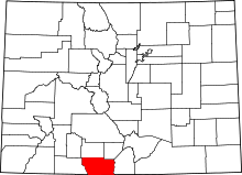 | |
| CDPs | ||
| Unincorporated communities | ||