Putnam, Oklahoma
| Putnam, Oklahoma | |
|---|---|
| Town | |
 Location of Putnam, Oklahoma | |
| Coordinates: 35°51′23″N 98°58′7″W / 35.85639°N 98.96861°WCoordinates: 35°51′23″N 98°58′7″W / 35.85639°N 98.96861°W | |
| Country | United States |
| State | Oklahoma |
| County | Dewey |
| Area | |
| • Total | 0.10 sq mi (0.26 km2) |
| • Land | 0.10 sq mi (0.26 km2) |
| • Water | 0.0 sq mi (0.0 km2) |
| Elevation | 1,962 ft (598 m) |
| Population (2010) | |
| • Total | 29 |
| • Density | 289/sq mi (111.6/km2) |
| Time zone | Central (CST) (UTC-6) |
| • Summer (DST) | CDT (UTC-5) |
| ZIP code | 73659 |
| Area code(s) | 580 |
| FIPS code | 40-61250[1] |
| GNIS feature ID | 1096970[2] |
Putnam is a town in Dewey County, Oklahoma, United States. The population was 29 at the 2010 census,[3] down from 46 at the 2000 census. It lies along U.S. Route 183.
Geography
Putnam is located in southern Dewey County at 35°51′23″N 98°58′7″W / 35.85639°N 98.96861°W (35.856334, -98.968550).[4] Via US 183 it is 13 miles (21 km) north to Taloga, the county seat, and 22 miles (35 km) to Seiling. To the south on 183 it is 23 miles (37 km) to Clinton.
According to the United States Census Bureau, Putnam has a total area of 0.10 square miles (0.26 km2), all of it land.[3]
Demographics
| Historical population | |||
|---|---|---|---|
| Census | Pop. | %± | |
| 1930 | 140 | — | |
| 1940 | 142 | 1.4% | |
| 1950 | 106 | −25.4% | |
| 1960 | 83 | −21.7% | |
| 1970 | 84 | 1.2% | |
| 1980 | 74 | −11.9% | |
| 1990 | 44 | −40.5% | |
| 2000 | 46 | 4.5% | |
| 2010 | 29 | −37.0% | |
| Est. 2015 | 30 | [5] | 3.4% |
As of the census[1] of 2000, there were 46 people, 20 households, and 16 families residing in the town. The population density was 455.1 people per square mile (177.6/km²). There were 30 housing units at an average density of 296.8 per square mile (115.8/km²). The racial makeup of the town was 97.83% White and 2.17% Native American. Hispanic or Latino of any race were 2.17% of the population.
There were 20 households out of which 35.0% had children under the age of 18 living with them, 70.0% were married couples living together, 10.0% had a female householder with no husband present, and 20.0% were non-families. 20.0% of all households were made up of individuals and 10.0% had someone living alone who was 65 years of age or older. The average household size was 2.30 and the average family size was 2.56.
In the town the population was spread out with 21.7% under the age of 18, 28.3% from 25 to 44, 34.8% from 45 to 64, and 15.2% who were 65 years of age or older. The median age was 44 years. For every 100 females there were 130.0 males. For every 100 females age 18 and over, there were 125.0 males.
The median income for a household in the town was $40,417, and the median income for a family was $42,083. Males had a median income of $16,875 versus $15,625 for females. The per capita income for the town was $17,928. There were no families and 3.4% of the population living below the poverty line, including no under eighteens and none of those over 64.
References
- 1 2 "American FactFinder". United States Census Bureau. Retrieved 2008-01-31.
- ↑ "US Board on Geographic Names". United States Geological Survey. 2007-10-25. Retrieved 2008-01-31.
- 1 2 "Geographic Identifiers: 2010 Demographic Profile Data (G001): Putnam town, Oklahoma". U.S. Census Bureau, American Factfinder. Retrieved December 11, 2015.
- ↑ "US Gazetteer files: 2010, 2000, and 1990". United States Census Bureau. 2011-02-12. Retrieved 2011-04-23.
- ↑ "Annual Estimates of the Resident Population for Incorporated Places: April 1, 2010 to July 1, 2015". Retrieved July 2, 2016.
- ↑ "Census of Population and Housing". Census.gov. Retrieved June 4, 2015.
Municipalities and communities of Dewey County, Oklahoma, United States | ||
|---|---|---|
| City | 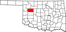 | |
| Towns | ||
| Unincorporated community | ||