Pollocksville, North Carolina
| Pollocksville, North Carolina | |
|---|---|
| Town | |
|
U.S. Route 17 in Pollocksville, March 2015 | |
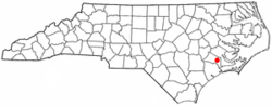 Location of Pollocksville, North Carolina | |
| Coordinates: 35°0′23″N 77°13′19″W / 35.00639°N 77.22194°WCoordinates: 35°0′23″N 77°13′19″W / 35.00639°N 77.22194°W | |
| Country | United States |
| State | North Carolina |
| County | Jones |
| Area | |
| • Total | 0.3 sq mi (0.8 km2) |
| • Land | 0.3 sq mi (0.8 km2) |
| • Water | 0.0 sq mi (0.0 km2) |
| Elevation | 16 ft (5 m) |
| Population (2010) | |
| • Total | 311 |
| • Density | 852.8/sq mi (329.3/km2) |
| Time zone | Eastern (EST) (UTC-5) |
| • Summer (DST) | EDT (UTC-4) |
| ZIP code | 28573 |
| Area code(s) | 252 |
| FIPS code | 37-53200[1] |
| GNIS feature ID | 1014565[2] |
| Website | Official website |

Pollocksville is a town in Jones County, North Carolina, United States. The population was 311 at the 2010 census. It is part of the New Bern, North Carolina Micropolitan Statistical Area.
History
The Bryan-Bell Farm, Foscue and Simmons Plantations, Foscue Plantation House, Bryan Lavender House, and Sanderson House are listed on the National Register of Historic Places.[3]
Geography
Pollocksville is located at 35°0′23″N 77°13′19″W / 35.00639°N 77.22194°W (35.006313, -77.222030).[4]
According to the United States Census Bureau, the town has a total area of 0.3 square miles (0.78 km2), all of it land.
Demographics
| Historical population | |||
|---|---|---|---|
| Census | Pop. | %± | |
| 1880 | 53 | — | |
| 1890 | 143 | 169.8% | |
| 1900 | 198 | 38.5% | |
| 1910 | 227 | 14.6% | |
| 1920 | 339 | 49.3% | |
| 1930 | 357 | 5.3% | |
| 1940 | 408 | 14.3% | |
| 1950 | 420 | 2.9% | |
| 1960 | 416 | −1.0% | |
| 1970 | 456 | 9.6% | |
| 1980 | 318 | −30.3% | |
| 1990 | 299 | −6.0% | |
| 2000 | 269 | −10.0% | |
| 2010 | 311 | 15.6% | |
| Est. 2015 | 308 | [5] | −1.0% |
As of the census[1] of 2000, there were 269 people, 126 households, and 76 families residing in the town. The population density was 852.8 people per square mile (324.6/km²). There were 153 housing units at an average density of 485.1/sq mi (184.6/km²). The racial makeup of the town was 79.55% White, 20.07% African American, and 0.37% from two or more races. Hispanic or Latino of any race were 0.74% of the population.
There were 126 households out of which 21.4% had children under the age of 18 living with them, 47.6% were married couples living together, 11.9% had a female householder with no husband present, and 38.9% were non-families. 38.1% of all households were made up of individuals and 22.2% had someone living alone who was 65 years of age or older. The average household size was 2.13 and the average family size was 2.83.
In the town the population was spread out with 20.4% under the age of 18, 4.5% from 18 to 24, 20.8% from 25 to 44, 32.7% from 45 to 64, and 21.6% who were 65 years of age or older. The median age was 47 years. For every 100 females there were 81.8 males. For every 100 females age 18 and over, there were 78.3 males.
The median income for a household in the town was $42,500, and the median income for a family was $51,250. Males had a median income of $36,429 versus $18,571 for females. The per capita income for the town was $22,528. About 7.4% of families and 9.1% of the population were below the poverty line, including 12.3% of those under the age of eighteen and 12.3% of those sixty five or over.
References
- 1 2 "American FactFinder". United States Census Bureau. Retrieved 2008-01-31.
- ↑ "US Board on Geographic Names". United States Geological Survey. 2007-10-25. Retrieved 2008-01-31.
- ↑ National Park Service (2010-07-09). "National Register Information System". National Register of Historic Places. National Park Service.
- ↑ "US Gazetteer files: 2010, 2000, and 1990". United States Census Bureau. 2011-02-12. Retrieved 2011-04-23.
- ↑ "Annual Estimates of the Resident Population for Incorporated Places: April 1, 2010 to July 1, 2015". Retrieved July 2, 2016.
- ↑ "Census of Population and Housing". Census.gov. Retrieved June 4, 2015.
External links
Municipalities and communities of Jones County, North Carolina, United States | ||
|---|---|---|
| Towns |  | |
| Unincorporated communities | ||