Pickering Township, Bottineau County, North Dakota
| Pickering Township Township of Pickering | |
|---|---|
| Township | |
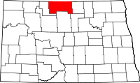
 Location of Pickering Township in Bottineau County | |
| Coordinates: 48°53′00″N 100°32′02″W / 48.88333°N 100.53389°WCoordinates: 48°53′00″N 100°32′02″W / 48.88333°N 100.53389°W | |
| Country | United States |
| State | North Dakota |
| County | Bottineau |
| Organized | circa 1920 |
| Area[1][2] | |
| • Total | 35.57 sq mi (92.1 km2) |
| • Land | 35.56 sq mi (92.1 km2) |
| • Water | 0.01 sq mi (0.03 km2) |
| Elevation[3] | 1,627 ft (496 m) |
| Population (2010 census)[2] | |
| • Total | 193 |
| • Density | 5.4/sq mi (2.1/km2) |
| Time zone | Central (CST) (UTC-6) |
| • Summer (DST) | CDT (UTC-5) |
| Area code | 701 |
| FIPS code[2][4] | 38-62300 |
| GNIS feature ID[2][4] | 1759290 |
Pickering Township is a civil township in Bottineau County in the U.S. State of North Dakota. Its population was 193 as of the 2010 census,[2] down from 213 at the 2000 census.[5]
History
Pickering Township was organized sometime between 1910 and 1920 from Vinge School Township and the western portion of Bottineau School Township.[6]
Reportedly, in 1883, Norwegian settlers from Polk County, Minnesota, established the first Norwegian settlement in Bottineau County near Carbury in present-day Pickering Township. Other Norwegians followed in 1886.[7]
Geography
Pickering Township is located in Township 162N, Range 76W.[6][8] North Dakota Highway 14 is a primary highway in the township, and the city of Bottineau, which is the county seat, is located in the southeast corner of the township.
According to the 2010 United States Census, the township has a total area of 35.570 square miles (92.13 km2), of which 35.557 square miles (92.09 km2) is land and 0.013 square miles (0.03 km2) is water.[2]
Carbury Dam is a public fishing area located 1 mile (1.6 km) south and 1 mile (1.6 km) west of Carbury. It is managed by the North Dakota Game and Fish Department.[9]
References
- ↑ U.S. Census Bureau. Census 2000, Summary File 1. "GCT-PH1. Population, Housing Units, Area, and Density: 2000 - County -- Subdivision and Place". American FactFinder. <http://factfinder2.census.gov>. Retrieved 2008-01-31.
- 1 2 3 4 5 6 "County Subdivisions: North Dakota". 2010 Census Gazetteer Files. United States Census Bureau. Retrieved June 29, 2013. External link in
|work=(help) - ↑ "Feature Detail Report for: Township of Pickering". Geographic Names Information System. United States Geological Survey. Retrieved June 29, 2013.
- 1 2 "FIPS55 Data: North Dakota". FIPS55 Data. United States Geological Survey. February 23, 2006. Archived from the original on June 18, 2006. External link in
|work=(help) - ↑ U.S. Census Bureau. Census 2000. "Census Demographic Profiles, Pickering Township" (PDF). CenStats Databases. Retrieved 2009-01-31.
- 1 2 U.S. Census Bureau (1921). "Number and Distribution of Inhabitants, North Dakota" (PDF). Fourteenth Census of the United States: 1920. Government Printing Office. Retrieved 2008-07-20.
- ↑ Sherman, William C. (1983). Pairie Mosaic: An Ethnic Atlas of Rural North Dakota. Fargo, North Dakota: North Dakota Institute for Regional Studies. p. 71. ISBN 0-911042-27-X. OCLC 256228966.
- ↑ U.S. Census Bureau (1913). "Number of Inhabitants, North Dakota" (PDF). Thirteenth Census of the United States: 1910. Government Printing Office. p. 324. Retrieved 2008-07-20.
- ↑ "Carbury Dam, Bottineau County" (PDF). Lake Contour Maps. North Dakota Game and Fish Department. Retrieved 2009-08-04.