Okanogan, Washington
| Okanogan | ||
|---|---|---|
| City | ||
| City of Okanogan | ||
|
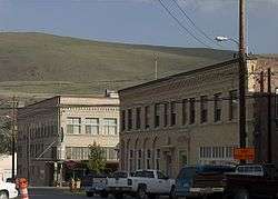
Skyline of downtown Okanogan | ||
| ||
| Motto: 100 Years of Community Pride | ||
 Location of Okanogan in Okanogan County, Washington | ||
 Okanogan Location in the United States | ||
| Coordinates: 48°22′0″N 119°34′52″W / 48.36667°N 119.58111°WCoordinates: 48°22′0″N 119°34′52″W / 48.36667°N 119.58111°W | ||
| Country | United States | |
| State | Washington | |
| County | Okanogan | |
| Established | 1888 | |
| Incorporated | October 29, 1907 | |
| Government | ||
| • Type | Mayor–council | |
| • Mayor | Jon K. Culp | |
| • Council | Okanogan City Council | |
| Area | ||
| • City | 2.00 sq mi (5.2 km2) | |
| • Land | 1.95 sq mi (5.1 km2) | |
| • Water | 0.05 sq mi (0.1 km2) | |
| • Urban | 4.736 sq mi (12.267 km2) | |
| Elevation | 840 ft (256 m) | |
| Population (2010)[1] | ||
| • City | 2,552 | |
| • Estimate (2015)[2] | 2,569 | |
| • Density | 1,308.7/sq mi (505.3/km2) | |
| • Urban | 8,229 | |
| • Urban density | 1,737/sq mi (670.8/km2) | |
| Time zone | PST (UTC-8) | |
| • Summer (DST) | PDT (UTC-7) | |
| ZIP codes | 98840 | |
| Area code(s) | 509 | |
| FIPS code | 53-50920[3] | |
| GNIS feature ID | 1531489[4] | |
| Website |
www | |
Okanogan (/ˌoʊkəˈnɒɡən/ US dict: ōk′·ə·nŏg′·ən; derived from Syilx'tsn: "rendezvous" or "meeting place") is a city in Okanogan County, Washington, United States. The population was 2,552 at the 2010 census, within the Greater Omak Area.[5] It is the seat of Okanogan County.
It has a small commuter airfield, Okanogan Legion Airport – (S35) with one paved runway of 2,533 ft (772 m) in length.[6]
History
Okanogan was officially incorporated on October 29, 1907.
Geography
Okanogan is located at 48°22′0″N 119°34′52″W / 48.36667°N 119.58111°W (48.366694, −119.581139).[7]
According to the United States Census Bureau, the city has a total area of 2.00 square miles (5.18 km2), of which, 1.95 square miles (5.05 km2) is land and 0.05 square miles (0.13 km2) is water.[8]
The town is located along the Okanogan River.[9]
Climate
Okanogan experiences a hot-summer continental climate (Köppen Dsa).
| Climate data for Okanogan | |||||||||||||
|---|---|---|---|---|---|---|---|---|---|---|---|---|---|
| Month | Jan | Feb | Mar | Apr | May | Jun | Jul | Aug | Sep | Oct | Nov | Dec | Year |
| Record high °F (°C) | 59 (15) |
63 (17) |
76 (24) |
96 (36) |
98 (37) |
102 (39) |
109 (43) |
106 (41) |
101 (38) |
86 (30) |
70 (21) |
67 (19) |
109 (43) |
| Average high °F (°C) | 33 (1) |
40 (4) |
53 (12) |
63 (17) |
72 (22) |
80 (27) |
88 (31) |
88 (31) |
78 (26) |
62 (17) |
44 (7) |
32 (0) |
61.1 (16.3) |
| Average low °F (°C) | 21 (−6) |
24 (−4) |
31 (−1) |
37 (3) |
44 (7) |
51 (11) |
57 (14) |
57 (14) |
48 (9) |
36 (2) |
28 (−2) |
20 (−7) |
37.8 (3.3) |
| Record low °F (°C) | −22 (−30) |
−26 (−32) |
−7 (−22) |
15 (−9) |
19 (−7) |
30 (−1) |
35 (2) |
34 (1) |
20 (−7) |
8 (−13) |
−3 (−19) |
−21 (−29) |
−26 (−32) |
| Average precipitation inches (mm) | 1.69 (42.9) |
1.34 (34) |
1.17 (29.7) |
1.05 (26.7) |
1.31 (33.3) |
1.23 (31.2) |
0.81 (20.6) |
0.46 (11.7) |
0.58 (14.7) |
1.10 (27.9) |
1.81 (46) |
2.54 (64.5) |
15.09 (383.2) |
Demographics

| Historical population | |||
|---|---|---|---|
| Census | Pop. | %± | |
| 1910 | 611 | — | |
| 1920 | 1,015 | 66.1% | |
| 1930 | 1,519 | 49.7% | |
| 1940 | 1,735 | 14.2% | |
| 1950 | 2,013 | 16.0% | |
| 1960 | 2,001 | −0.6% | |
| 1970 | 2,015 | 0.7% | |
| 1980 | 2,326 | 15.4% | |
| 1990 | 2,370 | 1.9% | |
| 2000 | 2,484 | 4.8% | |
| 2010 | 2,552 | 2.7% | |
| Est. 2015 | 2,569 | [10] | 0.7% |
| U.S. Decennial Census[11] 2015 Estimate[2] | |||
2010 census
As of the census[1] of 2010, there were 2,552 people, 983 households, and 619 families residing in the city. The population density was 1,308.7 inhabitants per square mile (505.3/km2). There were 1,051 housing units at an average density of 539.0 per square mile (208.1/km2). The racial makeup of the city was 79.8% White, 0.5% African American, 7.9% Native American, 0.4% Asian, 0.2% Pacific Islander, 6.4% from other races, and 4.8% from two or more races. Hispanic or Latino of any race were 14.1% of the population.
There were 983 households of which 32.6% had children under the age of 18 living with them, 40.6% were married couples living together, 15.8% had a female householder with no husband present, 6.6% had a male householder with no wife present, and 37.0% were non-families. 30.1% of all households were made up of individuals and 11.4% had someone living alone who was 65 years of age or older. The average household size was 2.39 and the average family size was 2.91.
The median age in the city was 37.7 years. 24.2% of residents were under the age of 18; 10.1% were between the ages of 18 and 24; 24.3% were from 25 to 44; 26.6% were from 45 to 64; and 14.9% were 65 years of age or older. The gender makeup of the city was 50.7% male and 49.3% female.
2000 census
As of the census of 2000, there were 2,484 people, 909 households, and 599 families residing in the city. The population density was 1,354.8 people per square mile (524.1/km²). There were 997 housing units at an average density of 543.8 per square mile (210.4/km²). The racial makeup of the city was 80.60% White, 0.36% African American, 8.17% Native American, 0.40% Asian, 0.08% Pacific Islander, 6.64% from other races, and 3.74% from two or more races. Hispanic or Latino of any race were 10.10% of the population.
There were 909 households out of which 37.1% had children under the age of 18 living with them, 48.1% were married couples living together, 13.4% had a female householder with no husband present, and 34.0% were non-families. 28.7% of all households were made up of individuals and 10.9% had someone living alone who was 65 years of age or older. The average household size was 2.49 and the average family size was 3.06.
In the city the population was spread out with 27.7% under the age of 18, 8.9% from 18 to 24, 26.4% from 25 to 44, 21.9% from 45 to 64, and 15.1% who were 65 years of age or older. The median age was 37 years. For every 100 females there were 99.7 males. For every 100 females age 18 and over, there were 94.6 males.
The median income for a household in the city was $26,994, and the median income for a family was $33,947. Males had a median income of $31,143 versus $20,822 for females. The per capita income for the city was $13,849. About 20.2% of families and 24.3% of the population were below the poverty line, including 31.9% of those under age 18 and 16.3% of those age 65 or over.
Sister city
Okanogan has one Sister City, according to the Washington State Lt. Governor's list of Washington Sister Cities:
References
- 1 2 "American FactFinder". United States Census Bureau. Retrieved 2012-12-19.
- 1 2 "Population Estimates". United States Census Bureau. Retrieved July 12, 2016.
- ↑ "American FactFinder". United States Census Bureau. Archived from the original on September 11, 2013. Retrieved May 14, 2011.
- ↑ "Okanogan". Geographic Names Information System. United States Geological Survey.
- ↑ "Urban Cluster Reference Map" (PDF). United States Census Bureau. April 1, 2010. Retrieved May 17, 2013.
- ↑ AirNav
- ↑ "US Gazetteer files: 2010, 2000, and 1990". United States Census Bureau. 2011-02-12. Retrieved 2011-04-23.
- ↑ "US Gazetteer files 2010". United States Census Bureau. Archived from the original on January 24, 2012. Retrieved 2012-12-19.
- ↑ https://maps.google.com/maps?q=Okanogan%2C+Washington&sourceid=Mozilla-search Google Maps, Okanogan
- ↑ "Annual Estimates of the Resident Population for Incorporated Places: April 1, 2010 to July 1, 2015". Retrieved July 2, 2016.
- ↑ United States Census Bureau. "Census of Population and Housing". Archived from the original on May 11, 2015. Retrieved October 4, 2013.
External links
| Wikimedia Commons has media related to Okanogan, Washington. |
Municipalities and communities of Okanogan County, Washington, United States | ||
|---|---|---|
| Cities | 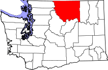 | |
| Towns | ||
| CDPs | ||
| Unincorporated communities | ||
| Indian reservation | ||
| Ghost towns | ||
| Footnotes | ‡This populated place also has portions in an adjacent county or counties | |