Munday, West Virginia
| Munday | |
|---|---|
| Unincorporated community | |
 Munday  Munday Location within the state of West Virginia | |
| Coordinates: 39°0′19″N 81°12′22″W / 39.00528°N 81.20611°WCoordinates: 39°0′19″N 81°12′22″W / 39.00528°N 81.20611°W | |
| Country | United States |
| State | West Virginia |
| County | Wirt |
| Time zone | Eastern (EST) (UTC-5) |
| • Summer (DST) | EDT (UTC-4) |
| ZIP codes | 26152[1] |
Munday is an unincorporated community in eastern Wirt County, West Virginia, United States. It lies along local roads southeast of the town of Elizabeth, the county seat of Wirt County.[2] Its elevation is 717 feet (217 m).[3] Munday had a post office, which closed on October 26, 2002.[4]
The community was named after the local Munday family.[5]
References
- ↑ United States Postal Service (2012). "USPS - Look Up a ZIP Code". Retrieved 2012-02-15.
- ↑ Rand McNally. The Road Atlas '08. Chicago: Rand McNally, 2008, p. 112.
- ↑ U.S. Geological Survey Geographic Names Information System: Munday, West Virginia, Geographic Names Information System, 1980-06-27. Accessed 2008-04-23.
- ↑ "Postmaster Finder - Post Offices by ZIP Code". United States Postal Service. Retrieved December 26, 2011.
- ↑ Kenny, Hamill (1945). West Virginia Place Names: Their Origin and Meaning, Including the Nomenclature of the Streams and Mountains. Piedmont, WV: The Place Name Press. p. 435.
Municipalities and communities of Wirt County, West Virginia, United States | ||
|---|---|---|
| Town | 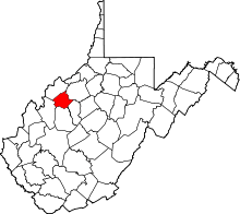 | |
| Unincorporated communities | ||
| Ghost towns | ||
This article is issued from Wikipedia - version of the 7/28/2016. The text is available under the Creative Commons Attribution/Share Alike but additional terms may apply for the media files.