McRae-Helena, Georgia
| McRae-Helena | ||
|---|---|---|
| City | ||
| City of McRae-Helena | ||
|
Downtown McRae-Helena, Georgia | ||
| ||
| Nickname(s): The Purple Heart City | ||
| Motto: The Crossroads City | ||
 McRae-Helena Location in Georgia | ||
| Coordinates: 32°04′10″N 82°54′10″W / 32.06944°N 82.90278°WCoordinates: 32°04′10″N 82°54′10″W / 32.06944°N 82.90278°W | ||
| Country | United States | |
| State | Georgia | |
| County | Telfair, Wheeler | |
| Government | ||
| • Mayor | Mike Young | |
| Population (2015) | ||
| • Total | 8,745 | |
| ZIP code | 31055 | |
| Area code(s) | 229 | |
| Website |
mcrae-helena | |


The city of McRae-Helena, in the U.S. state of Georgia, was formed on January 1, 2015, when the two cities of McRae and Helena were merged. McRae-Helena is the County seat of Telfair County, Georgia.
It is largest city in Telfair County, Georgia with an estimated population of 8,745 in 2015. This includes the population held as inmates at McRae Correctional Institution. In downtown McRae-Helena is a small replica of the Statue of Liberty, a small replica of the Liberty Bell, and a marble memorial to Telfair County residents who died in military service.
History
On January 1, 2015, McRae and the adjacent town of Helena merged to form McRae-Helena.
Geography

McRae-Helena is located in northern Telfair County at 32°3′52″N 82°53′54″W / 32.06444°N 82.89833°W (32.064508, -82.898251).
Several U.S. highways pass through McRae-Helena Area. U.S. Routes 23 and 341 pass through the city as Oak Street, leading northwest 20 miles (32 km) to Eastman and southeast 24 miles (39 km) to Hazlehurst, while U.S. Routes 280, 319, and 441 pass through as Third Avenue, crossing US 23/341 in the center of town. US 280 leads northeast 33 miles (53 km) to Vidalia and west 55 miles (89 km) to Cordele, while US 319/441 leads south 19 miles (31 km) to the small town of Jacksonville and north 35 miles (56 km) to Dublin.
According to the United States Census Bureau, the city has a total area of 4.4 square miles (11.4 km2), of which 4.3 square miles (11.2 km2) is land and 0.077 square miles (0.2 km2), or 1.77%, is water.[1] The Little Ocmulgee River flows just northeast of the city limits.
Sites of interest
Located in downtown McRae-Helena is Liberty Square, home of a Statue of Liberty replica that is one-twelfth the size of the original. It has a replica of the Liberty Bell and a marble memorial to Telfair County residents who died in military service.
On the outskirts of McRae-Helena is the Talmadge Home. This historic home was occupied by two former Georgia governors, Eugene Talmadge and Herman Eugene Talmadge. McRae-Helena was also the birthplace of Marion B. Folsom (1893–1976), a longtime executive of the Eastman Kodak Company who served as the United States Secretary of Health, Education, and Welfare during the Eisenhower administration.
Famous railfan photographer William B. Folsom is buried in McRae-Helena.
Education
Telfair County School District
The Telfair County School District holds pre-school to grade twelve, and consists of one elementary school, a middle school, and a high school.[2] The district has 112 full-time teachers and over 1,648 students.[3]
- Telfair County Elementary School
- Telfair County Middle School
- Telfair County High School
Higher education
- Heart of Georgia Technical College - McRae-Helena Campus[4]
Demographics
In 2015 it was estimated there were 8754 people included the population held as inmates at McRae Correctional Institution residing in the city.
| Historical population | |||
|---|---|---|---|
| Census | Pop. | %± | |
| Est. 2015 | 8,745 | ||
Municipalities and communities of Telfair County, Georgia, United States | ||
|---|---|---|
| Cities | 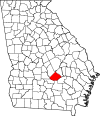 | |
| Town | ||
| Footnotes | ‡This populated place also has portions in an adjacent county or counties | |
Municipalities and communities of Wheeler County, Georgia, United States | ||
|---|---|---|
| Cities |  | |
| Footnotes | ‡This populated place also has portions in an adjacent county or counties | |
| Wikimedia Commons has media related to McRae-Helena, Georgia. |
References
- ↑
- ↑ Georgia Board of Education, Retrieved June 27, 2010.
- ↑ School Stats, Retrieved June 27, 2010.
- ↑ Heart of Georgia Technical College, retrieved June 4, 2010.