McLain, Kansas
| McLain, Kansas | |
|---|---|
| Unincorporated Community | |
 1915 Railroad Map of Harvey County | |
 McLain  McLain | |
| Coordinates: 37°59′58″N 97°15′47″W / 37.99944°N 97.26306°WCoordinates: 37°59′58″N 97°15′47″W / 37.99944°N 97.26306°W[1] | |
| Country | United States |
| State | Kansas |
| County | Harvey |
| Elevation[1] | 1,506 ft (459 m) |
| Time zone | CST (UTC-6) |
| • Summer (DST) | CDT (UTC-5) |
| Area code | 620 |
| GNIS feature ID | 0484650 [1] |
McLain is an unincorporated community in Harvey County, Kansas, United States.[1] Various maps and documents have listed the name as McLain, McLains, McLain's, and McClain. The community was located along the Missouri Pacific Railroad line between Newton and Whitewater, but the track was abandoned in 2003.[2]
McLain had a post office from 1886 until 1906.[3]
Further reading
References
- 1 2 3 4 Geographic Names Information System (GNIS) details for McLain, Kansas; United States Geological Survey (USGS); October 13, 1978.
- ↑ Railroad - Newton to Whitewater; abandonedrails.com
- ↑ "Kansas Post Offices, 1828-1961 (archived)". Kansas Historical Society. Archived from the original on October 9, 2013. Retrieved 11 June 2014.
External links
Municipalities and communities of Harvey County, Kansas, United States | ||
|---|---|---|
| Cities | 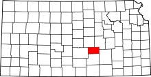 | |
| Unincorporated communities | ||
| Ghost town |
| |
| Townships | ||
| Footnotes | ‡This populated place also has portions in an adjacent county or counties | |
This article is issued from Wikipedia - version of the 7/31/2016. The text is available under the Creative Commons Attribution/Share Alike but additional terms may apply for the media files.