Masonboro, North Carolina
| Masonboro, North Carolina | |
|---|---|
| CDP | |
 Location of Masonboro, North Carolina | |
| Coordinates: 34°10′12″N 77°52′16″W / 34.17000°N 77.87111°WCoordinates: 34°10′12″N 77°52′16″W / 34.17000°N 77.87111°W | |
| Country | United States |
| State | North Carolina |
| County | New Hanover |
| Area | |
| • Total | 6.6 sq mi (17.2 km2) |
| • Land | 6.0 sq mi (15.5 km2) |
| • Water | 0.6 sq mi (1.7 km2) |
| Elevation | 23 ft (7 m) |
| Population (2000) | |
| • Total | 11,812 |
| • Density | 1,970.5/sq mi (761.4/km2) |
| Time zone | Eastern (EST) (UTC-5) |
| • Summer (DST) | EDT (UTC-4) |
| FIPS code | 37-41740[1] |
| GNIS feature ID | 1021364[2] |
| Website | Masonboro page |
Masonboro is a census-designated place (CDP) in New Hanover County, North Carolina, United States. The population was 11,812 at the 2000 census.
Masonboro is located southeast of Wilmington near the Atlantic coast. It is part of the Wilmington Metropolitan Statistical Area.
History
A post office called Masonboro operated from 1890 until 1891.[3] A large share of the early settlers being Masons caused the name to be selected.[4]
Geography
Masonboro is located at 34°10′12″N 77°52′16″W / 34.169953°N 77.871134°W.[5]
According to the United States Census Bureau, the CDP has a total area of 6.6 square miles (17 km2). 6.0 square miles (15.5 km2) of it is land and 0.6 square miles (1.6 km2) (9.65%) is water.
Demographics
At the 2000 census,[1] there were 11,812 people, 4,253 households and 3,474 families residing in the CDP. The population density was 1,970.5 per square mile (761.4/km2). There were 4,452 housing units at an average density of 742.7 per square mile (287.0/km2). The racial makeup of the CDP was 93.62% White, 3.35% African American, 0.28% Native American, 1.32% Asian, 0.02% Pacific Islander, 0.32% from other races, and 1.09% from two or more races. Hispanic or Latino of any race were 1.17% of the population.
There were 4,253 households of which 42.3% had children under the age of 18 living with them, 73.0% were married couples living together, 6.9% had a female householder with no husband present, and 18.3% were non-families. 14.3% of all households were made up of individuals and 4.6% had someone living alone who was 65 years of age or older. The average household size was 2.78 and the average family size was 3.08.
28.8% of the population were under the age of 18, 5.0% from 18 to 24, 30.3% from 25 to 44, 26.7% from 45 to 64, and 9.2% who were 65 years of age or older. The median age was 38 years. For every 100 females there were 96.0 males. For every 100 females age 18 and over, there were 92.8 males.
The median household income was $65,110 and the median family income was $68,005. Males had a median income of $51,707 compared with $34,740 for females. The per capita income for the CDP was $27,519. About 2.9% of families and 4.3% of the population were below the poverty line, including 5.8% of those under age 18 and 2.5% of those age 65 or over.
References
- 1 2 "American FactFinder". United States Census Bureau. Retrieved 2008-01-31.
- ↑ "US Board on Geographic Names". United States Geological Survey. 2007-10-25. Retrieved 2008-01-31.
- ↑ "New Hanover County". Jim Forte Postal History. Retrieved 1 November 2015.
- ↑ Proffitt, Martie (Apr 17, 1983). "Local history offers tasty tidbits". Star-News. pp. 8C. Retrieved 1 November 2015.
- ↑ "US Gazetteer files: 2010, 2000, and 1990". United States Census Bureau. 2011-02-12. Retrieved 2011-04-23.
Municipalities and communities of New Hanover County, North Carolina, United States | ||
|---|---|---|
| City | 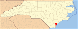 | |
| Towns | ||
| CDPs |
| |
| Unincorporated communities | ||