King, Indiana
| King, Indiana | |
|---|---|
| Unincorporated community | |
 King  King | |
| Coordinates: 38°18′15″N 87°34′34″W / 38.30417°N 87.57611°WCoordinates: 38°18′15″N 87°34′34″W / 38.30417°N 87.57611°W | |
| Country | United States |
| State | Indiana |
| County | Gibson |
| Township | Patoka |
| Elevation | 466 ft (142 m) |
| ZIP code | 47670 |
| FIPS code | 18-39780[1] |
| GNIS feature ID | 437317[2] |
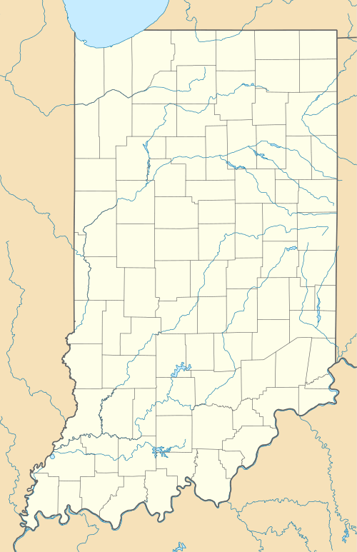
King is an unincorporated community in Patoka Township, Gibson County, Indiana, United States. It is also referred to as Kings or as King's Station.[2]
History
King had its start in the early 1850s when the Evansville & Terre Haute Railroad was extended to that point.[3] It was named for John King, a pioneer settler.[4]
A post office was established at King in 1882, and remained in operation until it was discontinued in 1908.[5]
Geography
King is located at 38°18′15″N 87°34′34″W / 38.30417°N 87.57611°W.[2]
References
- ↑ "American FactFinder". United States Census Bureau. Retrieved 2008-01-31.
- 1 2 3 "King, Indiana". Geographic Names Information System. United States Geological Survey. Retrieved 2009-10-17.
- ↑ Stormont, Gil R. (1914). History of Gibson County, Indiana: Her People, Industries and Institutions, with Biographical Sketches of Representative Citizens and Genealogical Records of Many of the Old Families. B.F.Bowen. p. 305.
- ↑ Stormont, Gil R. (1914). History of Gibson County, Indiana: Her People, Industries and Institutions, with Biographical Sketches of Representative Citizens and Genealogical Records of Many of the Old Families. B.F.Bowen. p. 527.
- ↑ "Gibson County". Jim Forte Postal History. Retrieved 11 September 2014.
Municipalities and communities of Gibson County, Indiana, United States | ||
|---|---|---|
| Cities | 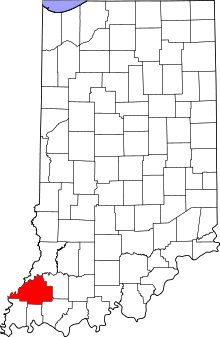 | |
| Towns | ||
| Townships | ||
| Unincorporated communities | ||
| Ghost town | ||
This article is issued from Wikipedia - version of the 12/2/2016. The text is available under the Creative Commons Attribution/Share Alike but additional terms may apply for the media files.