Kawaika-A, Arizona
| Kawaika-A, Arizona | |
|---|---|
| Populated place | |
 Kawaika-A  Kawaika-A Location within the state of Arizona | |
| Coordinates: 35°44′41″N 110°13′14″W / 35.74472°N 110.22056°WCoordinates: 35°44′41″N 110°13′14″W / 35.74472°N 110.22056°W | |
| Country | United States |
| State | Arizona |
| County | Navajo |
| Elevation[1] | 6,440 ft (1,960 m) |
| Time zone | Mountain (MST) (UTC-7) |
| • Summer (DST) | MST (UTC-7) |
| Area code(s) | 928 |
| FIPS code | 04-36940 |
| GNIS feature ID | 42872 |
Kawaika-A is a populated place situated in Navajo County, Arizona.[2] It has an estimated elevation of 6,440 feet (1,960 m) above sea level.[1]
From 1935 to 1939, the Peabody Museum of Archaeology and Ethnology of Harvard University conducted an archeological expedition of which this location was one of the primary sites, along with Awatovi. The expedition uncovered murals and wall paintings from the aboriginal American Southwest.[3] Prior to settlement by European pioneers, the location was inhabited as early as early as 1500, but was deserted for unknown reasons by 1583.[4] The name is derived from the Hopi name for the local inhabitants, the Kawaika.[5]
References
- 1 2 "Feature Detail Report for: Kawaika-A". Geographic Names Information System. United States Geological Survey.
- ↑ "Kawaika-A (in Navajo County, AZ) Populated Place Profile". AZ Hometown Locator. Retrieved December 3, 2016.
- ↑ Smith, Watson (1952). Kiva Mural Decorations at Awatovi and Kawaika-a. Boston, Massachusetts: Peabody Museum Press. pp. 38, 156. ISBN 087365126X.
- ↑ Watson, p. 29.
- ↑ Hodge, Fredrick Webb (1907). Handbook of American Indians. Smithsonian Institution. p. 666.
| Cities | 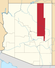 | |
|---|---|---|
| Towns | ||
| CDPs |
| |
| Unincorporated communities | ||
| Indian reservations | ||
| Ghost towns | ||
| Footnotes | ‡This populated place also has portions in an adjacent county or counties | |
This article is issued from Wikipedia - version of the 12/3/2016. The text is available under the Creative Commons Attribution/Share Alike but additional terms may apply for the media files.