Garnett, Kansas
| Garnett, Kansas | |
|---|---|
| City | |
|
Anderson County Courthouse (2009) | |
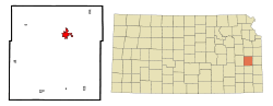 Location within Anderson County and Kansas | |
 KDOT map of Anderson County (legend) | |
| Coordinates: 38°16′58″N 95°14′27″W / 38.28278°N 95.24083°WCoordinates: 38°16′58″N 95°14′27″W / 38.28278°N 95.24083°W | |
| Country | United States |
| State | Kansas |
| County | Anderson |
| Area[1] | |
| • Total | 3.20 sq mi (8.29 km2) |
| • Land | 3.10 sq mi (8.03 km2) |
| • Water | 0.10 sq mi (0.26 km2) |
| Elevation | 1,070 ft (326 m) |
| Population (2010)[2] | |
| • Total | 3,415 |
| • Estimate (2015)[3] | 3,258 |
| • Density | 1,100/sq mi (410/km2) |
| Time zone | Central (CST) (UTC-6) |
| • Summer (DST) | CDT (UTC-5) |
| ZIP code | 66032 |
| Area code(s) | 785 |
| FIPS code | 20-25925 [4] |
| GNIS feature ID | 0477665 [5] |
| Website | GarnetKS.net |

Garnett is a city in and the county seat of Anderson County, Kansas, United States.[6] As of the 2010 census, the city population was 3,415.[7]
Geography
Garnett is located at 38°16′58″N 95°14′27″W / 38.282652°N 95.240906°W (38.282652, -95.240906).[8] According to the United States Census Bureau, the city has a total area of 3.20 square miles (8.29 km2), of which 3.10 square miles (8.03 km2) is land and 0.10 square miles (0.26 km2) is water.[1]
Garnett is famous for its fossil finds from the late Carboniferous period. The lagerstätte is about 300 million years old and contains some of the earliest reptiles on earth.
Climate
The climate in this area is characterized by hot, humid summers and generally mild to cool winters. According to the Köppen Climate Classification system, Garnett has a humid subtropical climate, abbreviated "Cfa" on climate maps.[9]
History
Garnett was platted in 1857.[10] Garnett is named for W. A. Garnett, a native of Louisville, Kentucky, and early promoter of the town of Garnett.[11][12]
The city includes three places listed on the National Register of Historic Places:[13]
- Anderson County Courthouse, at 4th and Oak Streets,
- Sennett and Bertha Kirk House, at 145 W. 4th Ave, and
- Shelley-Tipton House, at 812 W. 4th St.
Demographics
| Historical population | |||
|---|---|---|---|
| Census | Pop. | %± | |
| 1870 | 1,219 | — | |
| 1880 | 1,389 | 13.9% | |
| 1890 | 2,191 | 57.7% | |
| 1900 | 2,078 | −5.2% | |
| 1910 | 2,334 | 12.3% | |
| 1920 | 2,329 | −0.2% | |
| 1930 | 2,768 | 18.8% | |
| 1940 | 2,607 | −5.8% | |
| 1950 | 2,693 | 3.3% | |
| 1960 | 3,034 | 12.7% | |
| 1970 | 3,169 | 4.4% | |
| 1980 | 3,310 | 4.4% | |
| 1990 | 3,210 | −3.0% | |
| 2000 | 3,368 | 4.9% | |
| 2010 | 3,415 | 1.4% | |
| Est. 2015 | 3,258 | [3] | −4.6% |
| U.S. Decennial Census[14] | |||
2010 census
As of the census[2] of 2010, there were 3,415 people, 1,419 households, and 862 families residing in the city. The population density was 1,101.6 inhabitants per square mile (425.3/km2). There were 1,591 housing units at an average density of 513.2 per square mile (198.1/km2). The racial makeup of the city was 96.7% White, 0.4% African American, 0.6% Native American, 0.5% Asian, 0.6% from other races, and 1.3% from two or more races. Hispanic or Latino of any race were 2.1% of the population.
There were 1,419 households of which 30.0% had children under the age of 18 living with them, 45.5% were married couples living together, 10.4% had a female householder with no husband present, 4.9% had a male householder with no wife present, and 39.3% were non-families. 34.0% of all households were made up of individuals and 19.4% had someone living alone who was 65 years of age or older. The average household size was 2.33 and the average family size was 2.98.
The median age in the city was 40.9 years. 25.1% of residents were under the age of 18; 7.7% were between the ages of 18 and 24; 21.7% were from 25 to 44; 23% were from 45 to 64; and 22.5% were 65 years of age or older. The gender makeup of the city was 47.9% male and 52.1% female.
2000 census
As of the census[4] of 2000, there were 3,368 people, 1,439 households, and 886 families residing in the city. The population density was 1,124.6 people per square mile (434.9/km2). There were 1,597 housing units at an average density of 533.2 per square mile (206.2/km2). The racial makeup of the city was 96.97% White, 0.39% African American, 1.04% Native American, 0.27% Asian, 0.06% Pacific Islander, 0.53% from other races, and 0.74% from two or more races. Hispanic or Latino of any race were 1.45% of the population.
There were 1,439 households out of which 28.8% had children under the age of 18 living with them, 50.2% were married couples living together, 8.5% had a female householder with no husband present, and 38.4% were non-families. 34.7% of all households were made up of individuals and 21.1% had someone living alone who was 65 years of age or older. The average household size was 2.25 and the average family size was 2.91.
In the city the population was spread out with 24.4% under the age of 18, 7.5% from 18 to 24, 23.3% from 25 to 44, 20.7% from 45 to 64, and 24.1% who were 65 years of age or older. The median age was 41 years. For every 100 females there were 88.2 males. For every 100 females age 18 and over, there were 82.1 males.
The median income for a household in the city was $31,518, and the median income for a family was $38,095. Males had a median income of $31,175 versus $19,858 for females. The per capita income for the city was $16,265. About 9.2% of families and 13.0% of the population were below the poverty line, including 18.6% of those under age 18 and 9.9% of those age 65 or over.
Transportation
Rail
The area has one railroad, six freight lines and six interstate carriers.
Roads
Garnett is at the crossroads of U.S. Route 59, U.S. Route 169 and K-31. Interstate 35 is located 19 miles north of here and Interstate 70 is approximately 50 miles away.
Air
The Garnett Industrial Airport is located along U.S. 169. The nearest international air service is at the Kansas City International Airport, 90 miles away.
Bike
There is a bike path at Prairie Spirit Trail State Park.
Education
Unified School District No. 365 operates Garnett Elementary School and Anderson County Junior-Senior High School in Garnett.[15]
Notable people
- Arthur Capper, former Governor of Kansas and US Senator.
- Edgar Lee Masters, poet, lawyer and playwright
See also
- National Register of Historic Places listings in Anderson County, Kansas
- Anderson County High School
Further reading
- Anderson County
- The History Of Anderson County, Kansas, From Its First Settlement To The Fourth Of July, 1876; W.A. Johnson; Kauffman & Iler; 1877.[16]
- Plat Book Of Anderson County, Kansas, Compiled From County Records And Actual Survey; Northwest Publishing Co; 1901.[17]
- Kansas
- Kansas: A Cyclopedia Of State History, Embracing Events, Institutions, Industries, Counties, Cities, Towns, Prominent Persons, Etc; Frank W. Blackmar; Standard Publishing Co; 1912.[18][19][20]
- History Of The State of Kansas; William G. Cutler; A.T. Andreas Publisher; 1883.[21]
References
- 1 2 "US Gazetteer files 2010". United States Census Bureau. Retrieved 2012-07-06.
- 1 2 "American FactFinder". United States Census Bureau. Retrieved 2012-07-06.
- 1 2 "Annual Estimates of the Resident Population for Incorporated Places: April 1, 2010 to July 1, 2015". Retrieved July 2, 2016.
- 1 2 "American FactFinder". United States Census Bureau. Retrieved 2008-01-31.
- ↑ "US Board on Geographic Names". United States Geological Survey. 2007-10-25. Retrieved 2008-01-31.
- ↑ "Find a County". National Association of Counties. Retrieved 2011-06-07.
- ↑ "2010 City Population and Housing Occupancy Status". U.S. Census Bureau. Retrieved March 6, 2011.
- ↑ "US Gazetteer files: 2010, 2000, and 1990". United States Census Bureau. 2011-02-12. Retrieved 2011-04-23.
- ↑ Climate Summary for Garnett, Kansas
- ↑ Blackmar, Frank Wilson (1912). Kansas: A Cyclopedia of State History, Embracing Events, Institutions, Industries, Counties, Cities, Towns, Prominent Persons, Etc. Standard Publishing Company. p. 712.
- ↑ Gannett, Henry (1905). The Origin of Certain Place Names in the United States. Govt. Print. Off. p. 135.
- ↑ "Profile for Garnett, Kansas". ePodunk. Retrieved 29 June 2014.
- ↑ National Park Service (2009-03-13). "National Register Information System". National Register of Historic Places. National Park Service.
- ↑ United States Census Bureau. "Census of Population and Housing". Retrieved September 4, 2014.
- ↑ "School Campuses." Unified School District No. 365. Retrieved on November 8, 2013.
- ↑ The History Of Anderson County, Kansas, From Its First Settlement To The Fourth Of July, 1876; 1877.
- ↑ Plat Book Of Anderson County, Kansas, Compiled From County Records And Actual Survey; 1901.
- ↑ Kansas: A Cyclopedia Of State History, Embracing Events, Institutions, Industries, Counties, Cities, Towns, Prominent Persons, Etc - Vol 1; 1912.
- ↑ Kansas: A Cyclopedia Of State History, Embracing Events, Institutions, Industries, Counties, Cities, Towns, Prominent Persons, Etc - Vol 2; 1912.
- ↑ Kansas: A Cyclopedia Of State History, Embracing Events, Institutions, Industries, Counties, Cities, Towns, Prominent Persons, Etc - Vol 3; 1912.
- ↑ History Of The State of Kansas; 1883.
External links
| Wikimedia Commons has media related to Garnett, Kansas. |
- City
- Schools
- USD 365, local school district
- Historical
- Numerous Anderson County documents and photos
- Poster from Ninth Annual Anderson County Fair from September 25-28, 1891
- Maps
- Garnett City Map, KDOT
Municipalities and communities of Anderson County, Kansas, United States | ||
|---|---|---|
| Cities | 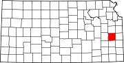 | |
| CDPs | ||
| Unincorporated communities | ||
| Ghost town | ||
| Townships | ||