East Hope, Idaho
| East Hope, Idaho | |
|---|---|
| City | |
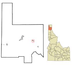 Location in Bonner County and the state of Idaho | |
| Coordinates: 48°14′31″N 116°17′42″W / 48.24194°N 116.29500°WCoordinates: 48°14′31″N 116°17′42″W / 48.24194°N 116.29500°W | |
| Country | United States |
| State | Idaho |
| County | Bonner |
| Area[1] | |
| • Total | 0.46 sq mi (1.19 km2) |
| • Land | 0.40 sq mi (1.04 km2) |
| • Water | 0.06 sq mi (0.16 km2) |
| Elevation | 2,175 ft (663 m) |
| Population (2010)[2] | |
| • Total | 210 |
| • Estimate (2012[3]) | 209 |
| • Density | 525.0/sq mi (202.7/km2) |
| Time zone | Pacific (PST) (UTC-8) |
| • Summer (DST) | PDT (UTC-7) |
| ZIP code | 83836 |
| Area code(s) | 208 |
| FIPS code | 16-23680 |
| GNIS feature ID | 0396435 |
East Hope is a city in Bonner County, Idaho. The population was 210 at the 2010 census.
Geography
East Hope is located at 48°14′31″N 116°17′42″W / 48.24194°N 116.29500°W (48.241882, -116.294925).[4]
According to the United States Census Bureau, the city has a total area of 0.46 square miles (1.19 km2), of which, 0.40 square miles (1.04 km2) is land and 0.06 square miles (0.16 km2) is water.[1]
Demographics
| Historical population | |||
|---|---|---|---|
| Census | Pop. | %± | |
| 1920 | 223 | — | |
| 1930 | 115 | −48.4% | |
| 1940 | 115 | 0.0% | |
| 1950 | 149 | 29.6% | |
| 1960 | 154 | 3.4% | |
| 1970 | 175 | 13.6% | |
| 1980 | 258 | 47.4% | |
| 1990 | 215 | −16.7% | |
| 2000 | 200 | −7.0% | |
| 2010 | 210 | 5.0% | |
| Est. 2015 | 216 | [5] | 2.9% |
2010 census
As of the census[2] of 2010, there were 210 people, 109 households, and 64 families residing in the city. The population density was 525.0 inhabitants per square mile (202.7/km2). There were 181 housing units at an average density of 452.5 per square mile (174.7/km2). The racial makeup of the city was 98.1% White, 0.5% Native American, 0.5% Asian, 0.5% Pacific Islander, and 0.5% from other races. Hispanic or Latino of any race were 2.4% of the population.
There were 109 households of which 13.8% had children under the age of 18 living with them, 55.0% were married couples living together, 3.7% had a female householder with no husband present, and 41.3% were non-families. 34.9% of all households were made up of individuals and 21.1% had someone living alone who was 65 years of age or older. The average household size was 1.93 and the average family size was 2.42.
The median age in the city was 58.5 years. 12.4% of residents were under the age of 18; 1.8% were between the ages of 18 and 24; 16.2% were from 25 to 44; 39.6% were from 45 to 64; and 30% were 65 years of age or older. The gender makeup of the city was 48.1% male and 51.9% female.
2000 census
As of the census[7] of 2000, there were 200 people, 104 households, and 68 families residing in the city. The population density was 364.2 people per square mile (140.4/km²). There were 150 housing units at an average density of 273.1 per square mile (105.3/km²). The racial makeup of the city was 98.50% White, 0.50% Native American, 0.50% Asian, and 0.50% from two or more races. Hispanic or Latino of any race were 0.50% of the population.
There were 104 households out of which 9.6% had children under the age of 18 living with them, 63.5% were married couples living together, 2.9% had a female householder with no husband present, and 33.7% were non-families. 29.8% of all households were made up of individuals and 11.5% had someone living alone who was 65 years of age or older. The average household size was 1.92 and the average family size was 2.33.
In the city the population was spread out with 10.5% under the age of 18, 2.5% from 18 to 24, 14.0% from 25 to 44, 31.0% from 45 to 64, and 42.0% who were 65 years of age or older. The median age was 58 years. For every 100 females there were 112.8 males. For every 100 females age 18 and over, there were 105.7 males.
The median income for a household in the city was $30,417, and the median income for a family was $37,500. Males had a median income of $35,938 versus $21,667 for females. The per capita income for the city was $18,184. About 3.2% of families and 7.1% of the population were below the poverty line, including none of those under the age of eighteen and 12.3% of those sixty five or over.
References
- 1 2 "US Gazetteer files 2010". United States Census Bureau. Retrieved 2012-12-18.
- 1 2 "American FactFinder". United States Census Bureau. Retrieved 2012-12-18.
- ↑ "Population Estimates". United States Census Bureau. Retrieved 2013-06-03.
- ↑ "US Gazetteer files: 2010, 2000, and 1990". United States Census Bureau. 2011-02-12. Retrieved 2011-04-23.
- ↑ "Annual Estimates of the Resident Population for Incorporated Places: April 1, 2010 to July 1, 2015". Retrieved July 2, 2016.
- ↑ "Census of Population and Housing". Census.gov. Retrieved June 4, 2015.
- ↑ "American FactFinder". United States Census Bureau. Retrieved 2008-01-31.
Municipalities and communities of Bonner County, Idaho, United States | ||
|---|---|---|
| Cities | ||
| CDP | ||
| Unincorporated communities | ||