Coal Hill, Arkansas
| Coal Hill, Arkansas | |
|---|---|
| City | |
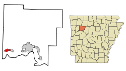 Location in Johnson County and the state of Arkansas | |
| Coordinates: 35°26′13″N 93°40′20″W / 35.43694°N 93.67222°WCoordinates: 35°26′13″N 93°40′20″W / 35.43694°N 93.67222°W | |
| Country | United States |
| State | Arkansas |
| County | Johnson |
| Area | |
| • Total | 2.7 sq mi (7 km2) |
| • Land | 2.7 sq mi (7 km2) |
| • Water | 0 sq mi (0 km2) |
| Elevation | 472 ft (144 m) |
| Population (2000) | |
| • Total | 1,001 |
| • Density | 370.7/sq mi (143/km2) |
| Time zone | Central (CST) (UTC-6) |
| • Summer (DST) | CDT (UTC-5) |
| ZIP code | 72832 |
| Area code(s) | 479 |
| FIPS code | 05-14500 |
| GNIS feature ID | 0076645 |
Coal Hill is a city in Johnson County, Arkansas, United States. The population was 1,001 at the 2000 census.
History
Coal mining gave the town its name.[1]
Geography
Coal Hill is located at 35°26′13″N 93°40′20″W / 35.43694°N 93.67222°W (35.436998, -93.672307).[2]
According to the United States Census Bureau, the city has a total area of 2.7 square miles (7.0 km2), all of it land.
Demographics
| Historical population | |||
|---|---|---|---|
| Census | Pop. | %± | |
| 1880 | 200 | — | |
| 1890 | 802 | 301.0% | |
| 1900 | 1,341 | 67.2% | |
| 1910 | 1,229 | −8.4% | |
| 1920 | 1,057 | −14.0% | |
| 1930 | 1,169 | 10.6% | |
| 1940 | 1,040 | −11.0% | |
| 1950 | 873 | −16.1% | |
| 1960 | 704 | −19.4% | |
| 1970 | 733 | 4.1% | |
| 1980 | 859 | 17.2% | |
| 1990 | 912 | 6.2% | |
| 2000 | 1,001 | 9.8% | |
| 2010 | 1,012 | 1.1% | |
| Est. 2015 | 1,025 | [3] | 1.3% |
2014 Estimate[5] | |||
As of the census[6] of 2000, there were 1,001 people, 411 households, and 274 families residing in the city. The population density was 370.9 people per square mile (143.1/km²). There were 474 housing units at an average density of 175.6/sq mi (67.8/km²). The racial makeup of the city was 95.50% White, 0.40% Native American, 1.90% from other races, and 2.20% from two or more races. 2.70% of the population were Hispanic or Latino of any race.
There were 411 households out of which 29.4% had children under the age of 18 living with them, 49.6% were married couples living together, 12.7% had a female householder with no husband present, and 33.3% were non-families. 29.9% of all households were made up of individuals and 14.6% had someone living alone who was 65 years of age or older. The average household size was 2.44 and the average family size was 2.99.
In the city the population was spread out with 24.6% under the age of 18, 9.7% from 18 to 24, 28.0% from 25 to 44, 21.6% from 45 to 64, and 16.2% who were 65 years of age or older. The median age was 36 years. For every 100 females there were 95.5 males. For every 100 females age 18 and over, there were 92.1 males.
The median income for a household in the city was $23,490, and the median income for a family was $34,250. Males had a median income of $23,077 versus $16,544 for females. The per capita income for the city was $13,540. About 16.6% of families and 21.1% of the population were below the poverty line, including 23.5% of those under age 18 and 22.9% of those age 65 or over.
Notable residents
- Marshall Chrisman, businessman and politician, born in Coal Hill in 1933
- Boss Schmidt, born in Coal Hill, major league baseball player[7]
References
- ↑ "Colorful Names". Arkansas Department of Parks & Tourism. Archived from the original on November 24, 2013. Retrieved 14 July 2014.
- ↑ "US Gazetteer files: 2010, 2000, and 1990". United States Census Bureau. 2011-02-12. Retrieved 2011-04-23.
- ↑ "Annual Estimates of the Resident Population for Incorporated Places: April 1, 2010 to July 1, 2015". Retrieved July 2, 2016.
- ↑ "Census of Population and Housing". Census.gov. Archived from the original on May 11, 2015. Retrieved June 4, 2015.
- ↑ "Annual Estimates of the Resident Population for Incorporated Places: April 1, 2010 to July 1, 2014". Retrieved June 4, 2015.
- ↑ "American FactFinder". United States Census Bureau. Archived from the original on 2013-09-11. Retrieved 2008-01-31.
- ↑ Reichler, Joseph L., ed. (1979) [1969]. The Baseball Encyclopedia (4th ed.). New York: Macmillan Publishing. ISBN 0-02-578970-8.
Municipalities and communities of Johnson County, Arkansas, United States | ||
|---|---|---|
| Cities | 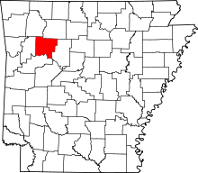 | |
| Town | ||
| CDP | ||
| Unincorporated communities | ||