Center Point, Louisiana
| Center Point, Louisiana | |
|---|---|
| Census-designated place | |
 Center Point Location within the state of Louisiana | |
| Coordinates: 31°14′53″N 92°12′35″W / 31.24806°N 92.20972°WCoordinates: 31°14′53″N 92°12′35″W / 31.24806°N 92.20972°W | |
| Country | United States |
| State | Louisiana |
| Parishes | Avoyelles |
| Area | |
| • Total | 4.7 sq mi (12.2 km2) |
| • Land | 4.7 sq mi (12.2 km2) |
| • Water | 0 sq mi (0 km2) |
| Elevation | 85 ft (26 m) |
| Population (2010) | |
| • Total | 492 |
| • Density | 104/sq mi (40.2/km2) |
| Time zone | Central (CST) (UTC-6) |
| • Summer (DST) | CST (UTC-5) |
| ZIP code | 71323 |
| FIPS code | 22-13855 |
Center Point is an unincorporated community and census-designated place in Avoyelles Parish, Louisiana, United States. As of the 2010 census, it had a population of 492.[1]
Center Point is located along Louisiana Highway 107, 13 miles (21 km) northwest of Marksville, the parish seat, and 16 miles (26 km) east of Alexandria.
References
- ↑ "Geographic Identifiers: 2010 Demographic Profile Data (G001): Center Point CDP, Louisiana". U.S. Census Bureau, American Factfinder. Retrieved May 21, 2013.
Municipalities and communities of Avoyelles Parish, Louisiana, United States | ||
|---|---|---|
| Cities | 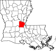 | |
| Towns | ||
| Villages | ||
| CDPs | ||
| Other Unincorporated communities | ||
This article is issued from Wikipedia - version of the 2/21/2016. The text is available under the Creative Commons Attribution/Share Alike but additional terms may apply for the media files.