Barwick, Georgia
| Barwick, Georgia | |
|---|---|
| City | |
|
Barwick City Hall | |
 Location in Thomas County and the state of Georgia | |
| Coordinates: 30°54′N 83°44′W / 30.900°N 83.733°WCoordinates: 30°54′N 83°44′W / 30.900°N 83.733°W | |
| Country | United States |
| State | Georgia |
| Counties | Thomas, Brooks |
| Area | |
| • Total | 0.75 sq mi (1.94 km2) |
| • Land | 0.72 sq mi (1.86 km2) |
| • Water | 0.03 sq mi (0.08 km2) |
| Elevation | 266 ft (81 m) |
| Population (2010) | |
| • Total | 386 |
| • Density | 538/sq mi (207.6/km2) |
| Time zone | Eastern (EST) (UTC-5) |
| • Summer (DST) | EDT (UTC-4) |
| ZIP code | 31720 |
| Area code(s) | 229 |
| FIPS code | 13-05708[1] |
| GNIS feature ID | 0310835[2] |
| Website |
www |

Barwick is a city divided by the county line between Brooks County and Thomas County, Georgia, United States. It is part of the Valdosta, Georgia Metropolitan Statistical Area. As of the 2010 census, the city had a population of 386.[3]
Geography
Barwick is located at 30°54′N 83°44′W / 30.900°N 83.733°W (30.8921, -83.7384).[4]
According to the United States Census Bureau, the city has a total area of 0.73 square miles (1.9 km2), of which 0.031 square miles (0.08 km2), or 4.16%, is water.[5]
Demographics
| Historical population | |||
|---|---|---|---|
| Census | Pop. | %± | |
| 1910 | 381 | — | |
| 1920 | 422 | 10.8% | |
| 1930 | 499 | 18.2% | |
| 1940 | 409 | −18.0% | |
| 1950 | 436 | 6.6% | |
| 1960 | 400 | −8.3% | |
| 1970 | 432 | 8.0% | |
| 1980 | 413 | −4.4% | |
| 1990 | 385 | −6.8% | |
| 2000 | 444 | 15.3% | |
| 2010 | 386 | −13.1% | |
| Est. 2015 | 379 | [6] | −1.8% |
As of the census[1] of 2000, there were 444 people, 181 households, and 110 families residing in the town. The population density was 591.1 people per square mile (228.6/km²). There were 205 housing units at an average density of 272.9 per square mile (105.5/km²). The racial makeup of the town was 47.07% White, 49.77% African American, 0.90% Asian, 1.80% from other races, and 0.45% from two or more races. Hispanic or Latino of any race were 3.38% of the population.
There were 181 households out of which 24.9% had children under the age of 18 living with them, 40.9% were married couples living together, 16.0% had a female householder with no husband present, and 39.2% were non-families. 35.9% of all households were made up of individuals and 19.9% had someone living alone who was 65 years of age or older. The average household size was 2.45 and the average family size was 3.25.
In the town the population was spread out with 29.3% under the age of 18, 8.8% from 18 to 24, 22.3% from 25 to 44, 22.7% from 45 to 64, and 16.9% who were 65 years of age or older. The median age was 35 years. For every 100 females there were 90.6 males. For every 100 females age 18 and over, there were 81.5 males.
The median income for a household in the town was $19,000, and the median income for a family was $21,250. Males had a median income of $26,806 versus $20,000 for females. The per capita income for the town was $11,091. About 41.7% of families and 42.3% of the population were below the poverty line, including 63.0% of those under age 18 and 24.6% of those age 65 or over.
References
- 1 2 "American FactFinder". United States Census Bureau. Archived from the original on 2013-09-11. Retrieved 2008-01-31.
- ↑ "US Board on Geographic Names". United States Geological Survey. 2007-10-25. Retrieved 2008-01-31.
- ↑ http://factfinder2.census.gov/faces/tableservices/jsf/pages/productview.xhtml?pid=DEC_10_SF1_GCTP2.ST13&prodType=table
- ↑ "US Gazetteer files: 2010, 2000, and 1990". United States Census Bureau. 2011-02-12. Retrieved 2011-04-23.
- ↑ "Geographic Identifiers: 2010 Demographic Profile Data (G001): Barwick city, Georgia". U.S. Census Bureau, American Factfinder. Retrieved November 7, 2013.
- ↑ "Annual Estimates of the Resident Population for Incorporated Places: April 1, 2010 to July 1, 2015". Retrieved July 2, 2016.
- ↑ "Census of Population and Housing". Census.gov. Archived from the original on May 11, 2015. Retrieved June 4, 2015.
External links
Municipalities and communities of Brooks County, Georgia, United States | ||
|---|---|---|
| Cities |  | |
| Communities | ||
| Footnotes | ‡This populated place also has portions in an adjacent county or counties | |
Municipalities and communities of Thomas County, Georgia, United States | ||
|---|---|---|
| Cities | 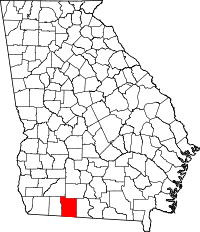 | |
| Town | ||
| Unincorporated community | ||
| Footnotes | ‡This populated place also has portions in an adjacent county or counties | |