Artesia Township, Iroquois County, Illinois
| Artesia Township | |
|---|---|
| Township | |
 Location in Iroquois County | |
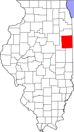 Iroquois County's location in Illinois | |
| Coordinates: 40°36′26″N 88°01′03″W / 40.60722°N 88.01750°WCoordinates: 40°36′26″N 88°01′03″W / 40.60722°N 88.01750°W | |
| Country | United States |
| State | Illinois |
| County | Iroquois |
| Established | Before 1921 |
| Area | |
| • Total | 57.42 sq mi (148.7 km2) |
| • Land | 57.36 sq mi (148.6 km2) |
| • Water | 0.06 sq mi (0.2 km2) 0.10% |
| Elevation | 682 ft (208 m) |
| Population (2010) | |
| • Total | 945 |
| • Density | 16.5/sq mi (6.4/km2) |
| Time zone | CST (UTC-6) |
| • Summer (DST) | CDT (UTC-5) |
| ZIP codes | 60918, 60924, 60955, 60968 |
| GNIS feature ID | 0428603 |
Artesia Township is one of twenty-six townships in Iroquois County, Illinois, USA. As of the 2010 census, its population was 945 and it contained 428 housing units.[1] Artesia Township formed from portions of Ash Grove and Loda townships sometime prior to 1921.
Geography
According to the 2010 census, the township has a total area of 57.42 square miles (148.7 km2), of which 57.36 square miles (148.6 km2) (or 99.90%) is land and 0.06 square miles (0.16 km2) (or 0.10%) is water.[1]
Cities, towns, villages
Cemeteries
The township contains these two cemeteries: Lisk and Saint John's Lutheran.
Major highways
School districts
- Cissna Park Community Unit School District 6
- Iroquois West Community Unit School District 10
- Paxton-Buckley-Loda Community Unit School District 10
Political districts
- Illinois' 15th congressional district
- State House District 105
- State Senate District 53
References
- "Artesia Township, Iroquois County, Illinois". Geographic Names Information System. United States Geological Survey. Retrieved 2010-01-17.
- United States Census Bureau 2007 TIGER/Line Shapefiles
- United States National Atlas
- 1 2 "Population, Housing Units, Area, and Density: 2010 - County -- County Subdivision and Place -- 2010 Census Summary File 1". United States Census. Retrieved 2013-05-28.
External links
 |
Ridgeland Township | |
Onarga Township | |
| Lyman Township, Ford County | |
Ash Grove Township | ||
| ||||
| | ||||
| Loda Township Wall Township, Ford County |
|
Pigeon Grove Township |
Municipalities and communities of Iroquois County, Illinois, United States | ||
|---|---|---|
| Cities | ||
| Villages | ||
| Townships | ||
| Unincorporated communities |
| |
| Footnotes | ‡This populated place also has portions in an adjacent county or counties | |
This article is issued from Wikipedia - version of the 10/18/2016. The text is available under the Creative Commons Attribution/Share Alike but additional terms may apply for the media files.