Arkoe, Missouri
| Arkoe, Missouri | |
|---|---|
| Village | |
 Location of Arkoe, Missouri | |
| Coordinates: 40°15′33″N 94°49′39″W / 40.25917°N 94.82750°WCoordinates: 40°15′33″N 94°49′39″W / 40.25917°N 94.82750°W | |
| Country | United States |
| State | Missouri |
| County | Nodaway |
| Area[1] | |
| • Total | 0.14 sq mi (0.36 km2) |
| • Land | 0.14 sq mi (0.36 km2) |
| • Water | 0 sq mi (0 km2) |
| Elevation | 974 ft (297 m) |
| Population (2010)[2] | |
| • Total | 68 |
| • Estimate (2012[3]) | 68 |
| • Density | 485.7/sq mi (187.5/km2) |
| Time zone | Central (CST) (UTC-6) |
| • Summer (DST) | CDT (UTC-5) |
| FIPS code | 29-01864[4] |
| GNIS feature ID | 0713384[5] |
Arkoe is a village in Nodaway County, Missouri, United States. The population was 68 at the 2010 census.
Geography
Arkoe is located at 40°15′33″N 94°49′39″W / 40.25917°N 94.82750°W (40.259248, -94.827502).[6]
According to the United States Census Bureau, the village has a total area of 0.14 square miles (0.36 km2), all of it land.[1]
History
Arkoe was platted in 1874 by Dr. P. H. Talbott.[7] The origin of the name "Arkoe" is obscure.[7] An early variant name was "Bridgewater".[7] A post office called Bridgewater was established in Bridgewater was established in 1871, the name was changed to Arkoe in 1877, and the post office closed in 1953.[8]
On September 18, 1880, first settler Dr. Talbott was shot and killed at his home.[9] His wife, Belle, and his sons Charles Edward and Albert Perry, were initially suspected and arrested for his murder. Eventually, Belle was released and the sons were tried for their father's murder. Both were convicted and sentenced to hang. They were executed in the Beal Pasture (today Beal Park), on the east side of Maryville, on July 22, 1881. News accounts estimated the number of people present at the hanging at over 10,000. The Talbott brothers' hanging is said to have been the first "legal" hanging in Nodaway County. The Talbott brothers are buried in a private family cemetery a half mile west of Arkoe.[10][11] The tombstone marking their burial site reads, "We died inocent," with the word "innocent" misspelled on the headstone. Also carved into the stone are two hands clasped together as in a handshake.
Demographics
2010 census
As of the census[2] of 2010, there were 68 people, 23 households, and 16 families residing in the village. The population density was 485.7 inhabitants per square mile (187.5/km2). There were 27 housing units at an average density of 192.9 per square mile (74.5/km2). The racial makeup of the village was 100.0% White.
There were 23 households of which 52.2% had children under the age of 18 living with them, 56.5% were married couples living together, 8.7% had a female householder with no husband present, 4.3% had a male householder with no wife present, and 30.4% were non-families. 26.1% of all households were made up of individuals and 17.3% had someone living alone who was 65 years of age or older. The average household size was 2.96 and the average family size was 3.50.
The median age in the village was 31.5 years. 39.7% of residents were under the age of 18; 2.9% were between the ages of 18 and 24; 26.5% were from 25 to 44; 23.6% were from 45 to 64; and 7.4% were 65 years of age or older. The gender makeup of the village was 50.0% male and 50.0% female.
2000 census
As of the census[4] of 2000, there were 58 people, 24 households, and 13 families residing in the town. The population density was 425.4 people per square mile (160.0/km²). There were 24 housing units at an average density of 176.0 per square mile (66.2/km²). The racial makeup of the town was 96.55% White, and 3.45% from two or more races.
There were 24 households out of which 33.3% had children under the age of 18 living with them, 45.8% were married couples living together, 4.2% had a female householder with no husband present, and 41.7% were non-families. 33.3% of all households were made up of individuals and 16.7% had someone living alone who was 65 years of age or older. The average household size was 2.42 and the average family size was 3.21.
In the town the population was spread out with 27.6% under the age of 18, 5.2% from 18 to 24, 34.5% from 25 to 44, 17.2% from 45 to 64, and 15.5% who were 65 years of age or older. The median age was 38 years. For every 100 females there were 152.2 males. For every 100 females age 18 and over, there were 147.1 males.
The median income for a household in the town was $40,000, and the median income for a family was $51,250. Males had a median income of $27,500 versus $21,250 for females. The per capita income for the town was $13,725. There were 14.3% of families and 14.3% of the population living below the poverty line, including 23.5% of under eighteens and none of those over 64.
References
- 1 2 "US Gazetteer files 2010". United States Census Bureau. Retrieved 2012-07-08.
- 1 2 "American FactFinder". United States Census Bureau. Retrieved 2012-07-08.
- ↑ "Population Estimates". United States Census Bureau. Retrieved 2013-05-30.
- 1 2 "American FactFinder". United States Census Bureau. Retrieved 2008-01-31.
- ↑ "US Board on Geographic Names". United States Geological Survey. 2007-10-25. Retrieved 2008-01-31.
- ↑ "US Gazetteer files: 2010, 2000, and 1990". United States Census Bureau. 2011-02-12. Retrieved 2011-04-23.
- 1 2 3 "Nodaway County Place Names, 1928–1945". The State Historical Society of Missouri. Archived from the original on June 24, 2016. Retrieved November 24, 2016.
- ↑ "Post Offices". Jim Forte Postal History. Retrieved 24 November 2016.
- ↑ "The Talbotts". Murder by Gaslight. Retrieved 2013-06-15.
- ↑ "Charles Edward Talbott". Find A Grave. Retrieved 2013-06-15.
- ↑ "Albert Perry Talbott". Find A Grave. Retrieved 2013-06-15.
External links
Municipalities and communities of Nodaway County, Missouri, United States | ||
|---|---|---|
| Cities | 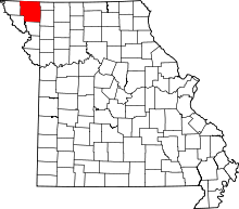 | |
| Villages | ||
| Townships | ||
| CDPs | ||
| Unincorporated communities | ||
| Ghost town | ||