Waukena, California
| Waukena | |
|---|---|
| census-designated place | |
 Waukena | |
| Coordinates: 36°08′19″N 119°30′34″W / 36.13861°N 119.50944°WCoordinates: 36°08′19″N 119°30′34″W / 36.13861°N 119.50944°W | |
| Country |
|
| State |
|
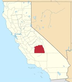
| County | Tulare |
| Area[1] | |
| • Total | 0.942 sq mi (2.441 km2) |
| • Land | 0.942 sq mi (2.441 km2) |
| • Water | 0 sq mi (0 km2) 0% |
| Elevation | 226 ft (69 m) |
| Population (2010) | |
| • Total | 108 |
| • Density | 110/sq mi (44/km2) |
| Time zone | Pacific (PST) (UTC-8) |
| • Summer (DST) | PDT (UTC-7) |
| ZIP code | 93282 |
| Area code(s) | 559 |
| GNIS feature IDa | 251266; 2585463 |
| U.S. Geological Survey Geographic Names Information System: Waukena, California; U.S. Geological Survey Geographic Names Information System: Waukena, California | |
Waukena is a census-designated place in Tulare County, California, United States.[2] Waukena is located on California State Route 137 4 miles (6.4 km) northeast of Corcoran. Waukena has a post office with ZIP code 93282.[3] The population was 108 at the 2010 census.
Geography
According to the United States Census Bureau, the CDP covers an area of 0.9 square miles (2.4 km²), all of it land.
Climate
According to the Köppen Climate Classification system, Waukena has a semi-arid climate, abbreviated "BSk" on climate maps.[4]
Demographics
The 2010 United States Census[5] reported that Waukena had a population of 108. The population density was 114.6 people per square mile (44.3/km²). The racial makeup of Waukena was 86 (79.6%) White, 0 (0.0%) African American, 3 (2.8%) Native American, 0 (0.0%) Asian, 0 (0.0%) Pacific Islander, 19 (17.6%) from other races, and 0 (0.0%) from two or more races. Hispanic or Latino of any race were 45 persons (41.7%).
The Census reported that 108 people (100% of the population) lived in households, 0 (0%) lived in non-institutionalized group quarters, and 0 (0%) were institutionalized.
There were 37 households, out of which 17 (45.9%) had children under the age of 18 living in them, 18 (48.6%) were opposite-sex married couples living together, 4 (10.8%) had a female householder with no husband present, 3 (8.1%) had a male householder with no wife present. There were 6 (16.2%) unmarried opposite-sex partnerships, and 1 (2.7%) same-sex married couples or partnerships. 8 households (21.6%) were made up of individuals and 4 (10.8%) had someone living alone who was 65 years of age or older. The average household size was 2.92. There were 25 families (67.6% of all households); the average family size was 3.32.
The population was spread out with 34 people (31.5%) under the age of 18, 14 people (13.0%) aged 18 to 24, 26 people (24.1%) aged 25 to 44, 27 people (25.0%) aged 45 to 64, and 7 people (6.5%) who were 65 years of age or older. The median age was 30.3 years. For every 100 females there were 125.0 males. For every 100 females age 18 and over, there were 89.7 males.
There were 45 housing units at an average density of 47.8 per square mile (18.4/km²), of which 15 (40.5%) were owner-occupied, and 22 (59.5%) were occupied by renters. The homeowner vacancy rate was 0%; the rental vacancy rate was 8.3%. 39 people (36.1% of the population) lived in owner-occupied housing units and 69 people (63.9%) lived in rental housing units.