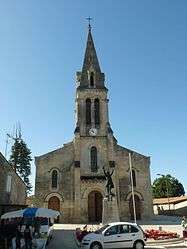
Saint-Savin, Gironde
| Saint-Savin | |
|---|---|
 | |
 Saint-Savin | |
|
Location within Nouvelle-Aquitaine region  Saint-Savin | |
| Coordinates: 45°08′22″N 0°26′51″W / 45.1394°N 0.4475°WCoordinates: 45°08′22″N 0°26′51″W / 45.1394°N 0.4475°W | |
| Country | France |
| Region | Nouvelle-Aquitaine |
| Department | Gironde |
| Arrondissement | Blaye |
| Canton | Saint-Savin |
| Intercommunality | Canton of Saint-Savin |
| Government | |
| • Mayor (2008–2014) | Jean-Claude Recappe |
| Area1 | 33.87 km2 (13.08 sq mi) |
| Population (2008)2 | 2,684 |
| • Density | 79/km2 (210/sq mi) |
| Time zone | CET (UTC+1) |
| • Summer (DST) | CEST (UTC+2) |
| INSEE/Postal code | 33473 / 33920 |
| Elevation |
19–93 m (62–305 ft) (avg. 95 m or 312 ft) |
|
1 French Land Register data, which excludes lakes, ponds, glaciers > 1 km² (0.386 sq mi or 247 acres) and river estuaries. 2 Population without double counting: residents of multiple communes (e.g., students and military personnel) only counted once. | |
Saint-Savin is a commune in the Gironde department in Nouvelle-Aquitaine in southwestern France.
Population
| Historical population | ||
|---|---|---|
| Year | Pop. | ±% |
| 1793 | 1,590 | — |
| 1800 | 1,850 | +16.4% |
| 1806 | 1,784 | −3.6% |
| 1821 | 2,059 | +15.4% |
| 1831 | 2,075 | +0.8% |
| 1836 | 1,982 | −4.5% |
| 1841 | 1,926 | −2.8% |
| 1846 | 2,046 | +6.2% |
| 1851 | 2,034 | −0.6% |
| 1856 | 2,019 | −0.7% |
| 1861 | 2,034 | +0.7% |
| 1866 | 2,145 | +5.5% |
| 1872 | 2,205 | +2.8% |
| 1876 | 2,126 | −3.6% |
| 1881 | 2,210 | +4.0% |
| 1886 | 2,186 | −1.1% |
| 1891 | 1,627 | −25.6% |
| 1896 | 1,769 | +8.7% |
| 1901 | 1,772 | +0.2% |
| 1906 | 1,804 | +1.8% |
| 1911 | 1,722 | −4.5% |
| 1921 | 1,642 | −4.6% |
| 1926 | 1,639 | −0.2% |
| 1931 | 1,735 | +5.9% |
| 1936 | 1,645 | −5.2% |
| 1946 | 1,503 | −8.6% |
| 1954 | 1,655 | +10.1% |
| 1962 | 1,672 | +1.0% |
| 1968 | 1,640 | −1.9% |
| 1975 | 1,655 | +0.9% |
| 1982 | 1,757 | +6.2% |
| 1990 | 1,886 | +7.3% |
| 1999 | 2,080 | +10.3% |
| 2008 | 2,684 | +29.0% |
See also
References
| Wikimedia Commons has media related to Saint-Savin (Gironde). |
This article is issued from Wikipedia - version of the 11/9/2016. The text is available under the Creative Commons Attribution/Share Alike but additional terms may apply for the media files.