Reading, Vermont
| Reading, Vermont | |
|---|---|
| Town | |
|
| |
 Location in Windsor County and the state of Vermont. | |
 Reading, Vermont Location in the United States | |
| Coordinates: 43°29′39″N 72°35′47″W / 43.49417°N 72.59639°WCoordinates: 43°29′39″N 72°35′47″W / 43.49417°N 72.59639°W | |
| Country | United States |
| State | Vermont |
| County | Windsor |
| Area | |
| • Total | 41.7 sq mi (107.9 km2) |
| • Land | 41.5 sq mi (107.5 km2) |
| • Water | 0.2 sq mi (0.4 km2) |
| Elevation | 1,870 ft (570 m) |
| Population (2010) | |
| • Total | 667 |
| • Density | 16/sq mi (6.2/km2) |
| Time zone | Eastern (EST) (UTC-5) |
| • Summer (DST) | EDT (UTC-4) |
| ZIP code | 05062 |
| Area code(s) | 802 |
| FIPS code | 50-58375[1] |
| GNIS feature ID | 1462183[2] |
| Website |
www |

Reading is a town in Windsor County, Vermont, United States. The population was 666 at the 2010 census.[3]
History
On August 30, 1754, after being captured by Abenakis at Fort at Number 4, Charlestown, New Hampshire, and being force-marched to Montreal, Susannah Willard Johnson gave birth to a daughter about .5 miles (0.80 km) up Knapp Brook. A marker beside Vermont Route 106 commemorates this event.[4]
Geography
According to the United States Census Bureau, the town has a total area of 41.7 square miles (107.9 km2), of which 41.5 square miles (107.5 km2) is land and 0.2 square mile (0.4 km2) (0.41%) is water.
Landmarks
Reading is the home of Jenne Farm, a tourist attraction that draws in many photographers and other visitors, especially in the autumn.
Demographics
| Historical population | |||
|---|---|---|---|
| Census | Pop. | %± | |
| 1790 | 747 | — | |
| 1800 | 1,120 | 49.9% | |
| 1810 | 1,565 | 39.7% | |
| 1820 | 1,603 | 2.4% | |
| 1830 | 1,409 | −12.1% | |
| 1840 | 1,363 | −3.3% | |
| 1850 | 1,171 | −14.1% | |
| 1860 | 1,159 | −1.0% | |
| 1870 | 1,012 | −12.7% | |
| 1880 | 953 | −5.8% | |
| 1890 | 749 | −21.4% | |
| 1900 | 649 | −13.4% | |
| 1910 | 530 | −18.3% | |
| 1920 | 463 | −12.6% | |
| 1930 | 474 | 2.4% | |
| 1940 | 437 | −7.8% | |
| 1950 | 470 | 7.6% | |
| 1960 | 472 | 0.4% | |
| 1970 | 564 | 19.5% | |
| 1980 | 647 | 14.7% | |
| 1990 | 614 | −5.1% | |
| 2000 | 707 | 15.1% | |
| 2010 | 666 | −5.8% | |
| Est. 2014 | 656 | [5] | −1.5% |
| U.S. Decennial Census[6] | |||
As of the census[1] of 2000, there were 707 people, 286 households, and 203 families residing in the town. The population density was 17.0 people per square mile (6.6/km2). There were 407 housing units at an average density of 9.8 per square mile (3.8/km2). The racial makeup of the town was 98.44% White, 0.42% African American, 0.14% Asian, and 0.99% from two or more races. Hispanic or Latino of any race were 0.99% of the population.
There were 286 households out of which 29.4% had children under the age of 18 living with them, 59.4% were married couples living together, 8.7% had a female householder with no husband present, and 28.7% were non-families. 22.0% of all households were made up of individuals and 9.1% had someone living alone who was 65 years of age or older. The average household size was 2.47 and the average family size was 2.87.
In the town the population was spread out with 24.0% under the age of 18, 4.5% from 18 to 24, 28.1% from 25 to 44, 28.4% from 45 to 64, and 14.9% who were 65 years of age or older. The median age was 41 years. For every 100 females there were 89.5 males. For every 100 females age 18 and over, there were 92.5 males.
The median income for a household in the town was $44,306, and the median income for a family was $48,636. Males had a median income of $32,202 versus $25,000 for females. The per capita income for the town was $20,504. About 6.2% of families and 8.1% of the population were below the poverty line, including 5.4% of those under age 18 and 6.2% of those age 65 or over.
Education

Reading is served by Reading Elementary School for Grades Pre-K – 6. In 2015-16, there were a total of 53 students.[7] Student attend grades 7-12 at Woodstock Union High and Middle School. This school is part of the Windsor Central Supervisory Union.
Notable people
- Titus Brown, US congressman[8]
References
- 1 2 "American FactFinder". United States Census Bureau. Retrieved 2008-01-31.
- ↑ "US Board on Geographic Names". United States Geological Survey. 2007-10-25. Retrieved 2008-01-31.
- ↑ "Profile of General Population and Housing Characteristics: 2010 Demographic Profile Data (DP-1): Reading town, Windsor County, Vermont". U.S. Census Bureau, American Factfinder. Retrieved July 31, 2012.
- ↑ "VERMONT'S HISTORIC ROADSIDE MARKERS". Vermont State Historic Sites. historicvermont.org. 2010-08-26.
- ↑ "Annual Estimates of the Resident Population for Incorporated Places: April 1, 2010 to July 1, 2014". Retrieved June 4, 2015.
- ↑ "U.S. Decennial Census". United States Census Bureau. Retrieved May 16, 2015.
- ↑ AOE - http://education.vermont.gov/data-and-reporting/school-reports/
- ↑ "BROWN, Titus, (1786 - 1849)". Biographical Directory of the United States Congress. Retrieved December 10, 2013.
External links
![]() Media related to Reading, Vermont at Wikimedia Commons
Media related to Reading, Vermont at Wikimedia Commons
Woodstock Union High School and Middle School
Municipalities and communities of Windsor County, Vermont, United States | ||
|---|---|---|
| Towns | 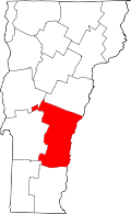 | |
| Villages | ||
| CDPs | ||
| Other communities | ||