Radcliffe, Lexington
| Radcliffe | |
|---|---|
| Neighborhood of Lexington, Kentucky | |
| Country | United States |
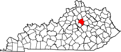
| State | Kentucky |
| County | Fayette |
| City | Lexington |
| Area | |
| • Total | 0.526 sq mi (1.36 km2) |
| Population (2000) | |
| • Total | 1,853 |
| • Density | 3,522/sq mi (1,362/km2) |
| Time zone | Eastern (EST) (UTC-5) |
| • Summer (DST) | EDT (UTC-4) |
| ZIP code | 40505 |
| Area code(s) | 859 |
Radcliffe is a neighborhood in northern Lexington, Kentucky, United States. It is alternatively called Marlboro. Its boundaries are Dover Road to the south, Paris Pike to the east, Russell Cave Road to the west, and I-75/ I-64 to the north.[1]
Neighborhood statistics
- Area: 0.526 square miles (1.36 km2)
- Population: 1,853
- Population density: 3,522 people per square mile (1,362.5/km²)
- Median household income: $57,218[1]
References
- 1 2 Radcliffe Neighborhood Profile city data.com. Retrieved on 2011-01-01


This article is issued from Wikipedia - version of the 8/1/2013. The text is available under the Creative Commons Attribution/Share Alike but additional terms may apply for the media files.