Monida, Montana
| Monida, Montana | |
|---|---|
| Unincorporated community | |
|
American Orient Express in Monida | |
 Monida, Montana  Monida, Montana | |
| Coordinates: 44°33′43″N 112°18′49″W / 44.56194°N 112.31361°WCoordinates: 44°33′43″N 112°18′49″W / 44.56194°N 112.31361°W | |
| Country | United States |
| State | Montana |
| County | Beaverhead |
| Elevation | 6,788 ft (2,069 m) |
| Time zone | Mountain (MST) (UTC-7) |
| • Summer (DST) | MDT (UTC-6) |
| Area code(s) | 406 |
| GNIS feature ID | 787554[1] |

Monida is an unincorporated community in Beaverhead County, Montana, United States. Monida is located on Interstate 15 at the top of Monida Pass, 14.7 miles (23.7 km) east-southeast of Lima. The community is situated on the Continental Divide at the Idaho state line. It has a permanent population of two.
References
Municipalities and communities of Beaverhead County, Montana, United States | ||
|---|---|---|
| City | 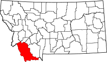 | |
| Town | ||
| CDP | ||
| Ghost towns | ||
| Unincorporated communities | ||
This article is issued from Wikipedia - version of the 8/8/2016. The text is available under the Creative Commons Attribution/Share Alike but additional terms may apply for the media files.