Hobba
| Hobba | |
|---|---|
| Village | |
 Hobba | |
| Coordinates: DZ 33°36′21″N 6°45′9″E / 33.60583°N 6.75250°ECoordinates: DZ 33°36′21″N 6°45′9″E / 33.60583°N 6.75250°E | |
| Country |
|
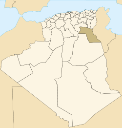
| Province | El Oued Province |
| District | Reguiba District |
| Commune | Reguiba[1] |
| Elevation | 44 m (144 ft) |
| Time zone | CET (UTC+1) |
Hobba is a village in the commune of Reguiba,[1] in Reguiba District, El Oued Province, Algeria. The village is located on the N48 highway at the junction with a local road leading to Reguiba, 29 kilometres (18 mi) northwest of El Oued.[2]
References
- 1 2 "Décret n° 84-365, fixant la composition, la consistance et les limites territoriale des communes. Wilaya d'El Oued" (PDF) (in French). Journal officiel de la République Algérienne,. 19 December 1984. p. 1565. Archived from the original (PDF) on 2 March 2013 or before. Retrieved 2 March 2013. Check date values in:
|archive-date=(help) - ↑ "Hobba Station, N48, El Oued, Algeria". Google Maps. Retrieved 25 April 2013.
Neighbouring towns and cities
 |
Hamraia Sif El Menadi |
Ben Guecha | | |
| Djamaa | |
Magrane | ||
| ||||
| | ||||
| Reguiba | Ghamra Guemar El Oued |
Sidi Aoun |
This article is issued from Wikipedia - version of the 4/25/2013. The text is available under the Creative Commons Attribution/Share Alike but additional terms may apply for the media files.