Historical United States Census totals for Oxford County, Maine
This article shows U.S. Census totals for Oxford County, Maine, broken down by municipality, from 1900 to 2000.
There are two types of incorporated municipalities in Maine, towns and cities. The tables in the New England Historical U.S. Census Totals series differentiate between towns and cities; however, there have never been any cities in Oxford County.
Most areas of New England are entirely divided into incorporated municipalities, with no unincorporated territory. In the three northern New England states, however, some unincorporated territory does exist, generally in areas that are very sparsely populated. Maine contains significantly more unincorporated territory than the other states, with the bulk of it in interior and northern counties, including Oxford County.
Some unincorporated territory in Maine is organized into a third type of town-level municipality unique to Maine, called a plantation (considered to be “organized”, but not incorporated), while some is entirely unorganized. Due to the large extent of unincorporated territory in Oxford County, separate sections with detailed historical census totals for such areas follow the main tables below. For any census, adding up the totals for each town-level municipality, including any plantations or unorganized entities, should yield the county total.
For more information on the New England municipal system, see New England town.
Corporate changes since 1900
- 1919 – Grafton disincorporated and reverted to unorganized territory
- 1935 – Mason disincorporated and reverted to unorganized territory
- 1937 – Albany disincorporated and reverted to unorganized territory
- 1957 – New town of West Paris formed from Paris
- 1978 – Otisfield, formerly a part of Cumberland County, joined Oxford County
1900
County Total: 32,238
- Rumford 3,770
- Paris 3,225
- Norway 2,902
- Bethel 1,835
- Fryeburg 1,376
- Oxford 1,331
- Buckfield 1,139
- Dixfield 1,052
- Brownfield 1,019
- Hiram 1,015
- Canton 946
- Waterford 917
- Porter 886
- Mexico 816
- Woodstock 816
- Sumner 802
- Peru 773
- Greenwood 741
- Andover 727
- Lovell 693
- Hartford 660
- Denmark 634
- Albany 538
- Hebron 494
- Gilead 340
- Newry 286
- Stoneham 284
- Sweden 282
- Stow 270
- Upton 242
- Roxbury 238
- Hanover 214
- Byron 204
- Grafton 81
- Mason 67
Unincorporated territory reported 623 residents. This consisted of 352 residents in organized plantations, and 271 residents in unorganized territory.
1910
County Total: 36,256
- Rumford 6,777
- Paris 3,436
- Norway 3,002
- Mexico 2,065
- Bethel 1,930
- Fryeburg 1,282
- Oxford 1,221
- Buckfield 1,087
- Dixfield 1,056
- Canton 1,013
- Hiram 945
- Waterford 934
- Brownfield 933
- Porter 864
- Woodstock 808
- Sumner 762
- Andover 757
- Peru 746
- Lovell 668
- Greenwood 664
- Hebron 603
- Denmark 596
- Hartford 592
- Albany 410
- Roxbury 311
- Upton 306
- Newry 271
- Sweden 266
- Stoneham 253
- Gilead 233
- Stow 224
- Hanover 196
- Byron 187
- Grafton 64
- Mason 60
Unincorporated territory reported 734 residents. This consisted of 608 residents in organized plantations, and 126 residents in unorganized territory.
1920
County Total: 37,700
- Rumford 8,576
- Paris 3,656
- Mexico 3,242
- Norway 2,969
- Bethel 1,792
- Fryeburg 1,283
- Dixfield 1,134
- Oxford 1,097
- Buckfield 957
- Hiram 921
- Brownfield 835
- Porter 820
- Andover 767
- Waterford 765
- Woodstock 765
- Canton 750
- Peru 738
- Sumner 670
- Hebron 652
- Greenwood 605
- Denmark 576
- Lovell 575
- Hartford 525
- Albany 360
- Roxbury 276
- Newry 254
- Sweden 225
- Byron 217
- Stow 199
- Gilead 196
- Stoneham 196
- Hanover 165
- Upton 123
- Mason 54
Unincorporated territory reported 765 residents. This consisted of 314 residents in organized plantations, and 451 residents in unorganized territory.
1930
County Total: 41,483
- Rumford 10,340
- Mexico 4,767
- Paris 3,761
- Norway 3,145
- Bethel 2,025
- Fryeburg 1,592
- Dixfield 1,521
- Oxford 1,125
- Buckfield 972
- Porter 883
- Woodstock 848
- Peru 826
- Hiram 813
- Hebron 791
- Andover 788
- Canton 767
- Waterford 743
- Brownfield 689
- Lovell 645
- Sumner 567
- Greenwood 548
- Denmark 474
- Hartford 432
- Roxbury 314
- Albany 309
- Gilead 220
- Sweden 189
- Newry 188
- Hanover 170
- Upton 166
- Stoneham 164
- Stow 161
- Byron 96
- Mason 61
Unincorporated territory reported 383 residents. This consisted of 284 residents in organized plantations, and 99 residents in unorganized territory.
1940
County Total: 42,662
- Rumford 10,230
- Mexico 4,431
- Paris 4,094
- Norway 3,649
- Bethel 2,034
- Dixfield 1,790
- Fryeburg 1,726
- Oxford 1,316
- Peru 965
- Woodstock 913
- Buckfield 903
- Porter 892
- Waterford 836
- Hiram 787
- Andover 757
- Brownfield 741
- Canton 706
- Hebron 678
- Lovell 647
- Greenwood 564
- Sumner 541
- Denmark 532
- Hartford 430
- Roxbury 346
- Stoneham 238
- Sweden 225
- Hanover 178
- Upton 174
- Newry 167
- Gilead 160
- Stow 153
- Byron 125
Unincorporated territory reported 734 residents. This consisted of 300 residents in organized plantations, and 434 residents in unorganized territory.
1950
County Total: 44,221
- Rumford 9,954
- Mexico 4,762
- Paris 4,358
- Norway 3,811
- Bethel 2,367
- Dixfield 2,022
- Fryeburg 1,926
- Oxford 1,569
- Peru 1,080
- Porter 1,052
- Woodstock 971
- Buckfield 899
- Hebron 829
- Waterford 828
- Hiram 804
- Andover 756
- Canton 746
- Lovell 640
- Brownfield 612
- Greenwood 604
- Sumner 526
- Denmark 447
- Hartford 381
- Roxbury 348
- Stoneham 216
- Sweden 212
- Hanover 211
- Newry 188
- Stow 147
- Gilead 140
- Upton 105
- Byron 96
Unincorporated territory reported 614 residents. This consisted of 154 residents in organized plantations, and 460 residents in unorganized territory.
1960
County Total: 44,345
- Rumford 10,005
- Mexico 5,043
- Norway 3,733
- Paris 3,601
- Bethel 2,408
- Dixfield 2,323
- Fryeburg 1,874
- Oxford 1,658
- Peru 1,229
- West Paris 1,050
- Buckfield 982
- Porter 975
- Woodstock 930
- Waterford 834
- Andover 762
- Canton 728
- Hiram 699
- Greenwood 601
- Lovell 588
- Brownfield 538
- Sumner 481
- Hebron 465
- Denmark 376
- Roxbury 344
- Hartford 325
- Newry 260
- Hanover 240
- Stoneham 182
- Gilead 136
- Sweden 119
- Byron 108
- Stow 108
- Upton 35
Unincorporated territory reported 769 residents. This consisted of 149 residents in organized plantations, and 620 residents in unorganized territory.
1970
County Total: 43,457
- Rumford 9,363
- Mexico 4,309
- Paris 3,739
- Norway 3,595
- Bethel 2,220
- Fryeburg 2,208
- Dixfield 2,188
- Oxford 1,892
- Peru 1,345
- West Paris 1,171
- Porter 1,115
- Woodstock 1,005
- Buckfield 929
- Andover 791
- Waterford 760
- Canton 742
- Hiram 686
- Greenwood 610
- Lovell 607
- Hebron 532
- Sumner 525
- Brownfield 478
- Denmark 397
- Hartford 312
- Hanover 275
- Roxbury 271
- Newry 208
- Stoneham 160
- Gilead 153
- Byron 132
- Sweden 110
- Stow 109
- Upton 54
Unincorporated territory reported 466 residents. This consisted of 135 residents in organized plantations, and 331 residents in unorganized territory.
1980
County Total: 49,043
- Rumford 8,240
- Paris 4,168
- Norway 4,042
- Mexico 3,698
- Oxford 3,143
- Fryeburg 2,715
- Dixfield 2,389
- Bethel 2,340
- Peru 1,564
- West Paris 1,390
- Buckfield 1,333
- Porter 1,222
- Woodstock 1,087
- Hiram 1,067
- Waterford 1,026
- Otisfield 897
- Andover 850
- Canton 831
- Brownfield 767
- Lovell 767
- Denmark 672
- Hebron 665
- Greenwood 653
- Sumner 613
- Hartford 480
- Roxbury 373
- Hanover 256
- Newry 235
- Stoneham 204
- Gilead 191
- Stow 186
- Sweden 163
- Byron 114
- Upton 65
Unincorporated territory reported 637 residents. This consisted of 129 residents in organized plantations, and 508 residents in unorganized territory.
1990
County Total: 52,602
- Rumford 7,078
- Norway 4,754
- Paris 4,492
- Oxford 3,705
- Mexico 3,344
- Fryeburg 2,968
- Dixfield 2,574
- Bethel 2,329
- Buckfield 1,566
- Peru 1,541
- West Paris 1,514
- Porter 1,301
- Waterford 1,299
- Hiram 1,260
- Woodstock 1,194
- Otisfield 1,136
- Brownfield 1,034
- Andover 953
- Canton 951
- Lovell 888
- Hebron 878
- Denmark 855
- Sumner 761
- Hartford 722
- Greenwood 689
- Roxbury 437
- Newry 316
- Stow 283
- Hanover 272
- Stoneham 224
- Sweden 222
- Gilead 204
- Byron 111
- Upton 70
Unincorporated territory reported 677 residents. This consisted of 83 residents in organized plantations, and 594 residents in unorganized territory.
2000
County Total: 54,755
- Rumford 6,472
- Paris 4,793
- Norway 4,611
- Oxford 3,960
- Fryeburg 3,083
- Mexico 2,959
- Dixfield 2,514
- Bethel 2,411
- Buckfield 1,723
- West Paris 1,722
- Otisfield 1,560
- Peru 1,515
- Waterford 1,455
- Porter 1,438
- Hiram 1,423
- Woodstock 1,307
- Brownfield 1,251
- Canton 1,121
- Hebron 1,053
- Denmark 1,004
- Lovell 974
- Hartford 963
- Andover 864
- Sumner 854
- Greenwood 802
- Roxbury 384
- Newry 344
- Sweden 324
- Stow 288
- Stoneham 255
- Hanover 251
- Gilead 156
- Byron 121
- Upton 62
Unincorporated territory reported 738 residents. This consisted of 83 residents in organized plantations, and 655 residents in unorganized territory.
Plantations
As of 1900, Oxford County contained three plantations: Lincoln, Magalloway and Milton. Milton, originally formed from a gore, surrendered its organization and reverted to unorganized territory in 1944. Lincoln and Magalloway, which are both in the northern part of the county, still exist today.
Lincoln Plantation is not to be confused with the unrelated town of Lincoln, in Penobscot County. Because plantations are organized at the county level, they are allowed to duplicate the names of incorporated towns.
1900
- Milton 202
- Magalloway 77
- Lincoln 73
1910
- Lincoln 307
- Milton 204
- Magalloway 97
1920
- Milton 148
- Magalloway 86
- Lincoln 80
1930
- Milton 111
- Lincoln 90
- Magalloway 83
1940
- Milton 127
- Lincoln 89
- Magalloway 84
1950
- Magalloway 83
- Lincoln 71
1960
- Lincoln 99
- Magalloway 50
1970
- Magalloway 75
- Lincoln 60
1980
- Magalloway 79
- Lincoln 50
1990
- Magalloway 45
- Lincoln 38
2000
- Lincoln 46
- Magalloway 37
Unorganized Territory
Like all of Maine's interior counties, Oxford County contains a significant amount of unorganized territory. Most of it is in the northern part of the county, in areas which are very sparsely populated:
- The entire area of the county north of Upton, Grafton, Newry and Andover has never been incorporated. Lincoln Plantation and Magalloway Plantation, which lie directly north of Upton along the New Hampshire border, are the only areas in this region which have even been formally organized into plantations. The rest of the area is for the most part quite remote, and has never had any significant population on more than a transitory basis. Most of it is divided among ten unorganized townships. There is also a cluster of three gore-like entities just to the northwest of Andover.
- The central part of the county has historically been almost entirely incorporated, but there is one area that has never been—Riley Township, which lies in between Grafton and Gilead, along the New Hampshire line. In addition, while Grafton was once an incorporated town, it disincorporated in 1919 and reverted to the status of an unorganized township.
- The southern part of the county was also historically almost entirely divided into incorporated towns, but there are a few gore-sized areas that were never incorporated. One gore was eventually organized as Milton Plantation, though it never incorporated as a town. Another is Batchelders Grant, which lies along the New Hampshire line in between Gilead and Stow. Batchelders Grant was once larger and has had portions included in the formation of or annexed by adjacent towns on a number of occasions over the years, but the portion that remains has never been incorporated. There was also once a Fryeburg Academy Grant in the vicinity of Batchelders Grant. After gradually losing territory to adjacent towns, it completely ceased to exist in 1913, when its remaining territory was annexed by the town of Mason.
Between 1935 and 1945, a large number of municipalities in Maine dissolved and reverted to unorganized townships. In Oxford County, this included two towns (Albany and Mason) and one plantation (Milton), all in the southern part of the county.
The areas of Oxford County that are entirely unorganized cover about 620 square miles (1,600 km2), with a population of about 650 people. This covers about 30% of the county’s land area, but includes only about 1.2% of its population. The bulk of this population appears to live in areas that were formerly organized municipalities. Albany had nearly 300 residents at the time it disincorporated, and it appears to have maintained a population level of some significance down to the present time. Albany Township and Milton Township each currently maintain a registrar and clerk, although they do not have true organized municipal governments.
Over the years, the U.S. Census Bureau has used different methods to compile data compilation for unorganized territory in Maine. From 1900 to 1950, data was tabulated for each individual unorganized entity. In 1960, a single catch-all “Unorganized Territory” listing was provided for each Maine County, generally with no further breakdown. Since 1970, the Census has grouped contiguous areas in each county into one or more “unorganized territories”. Three such areas are recognized within Oxford County:
- North Oxford Unorganized Territory: includes the areas in the northern part of the county which have never been organized, as well as the former town of Grafton, and Riley Township.
- South Oxford Unorganized Territory: includes Batchelders Grant, and the former towns of Albany and Mason.
- Milton Unorganized Territory: includes the former Milton Plantation. (Milton is its own unorganized territory because it does not border any other unorganized territory.)
The listings below provide population figures for 1) all unincorporated territory, including plantations; 2) organized plantations, for which breakouts are available in the main tables above; and 3) unorganized territory, with any available breakouts provided.
1900
All unincorporated territory 623
Organized plantations 352
Unorganized territory 271
- Batchelders Grant 173
- Andover North & West Surplus 22
- Richardsontown Twp. (T4R1) 21
- Fryeburg Academy Grant 15
- Riley Twp. (TAR1) 13
- Adamstown Twp. (T4R2) 12
- Lynchtown Twp. (T5R4) 8
- Township C 7
1910
All unincorporated territory 734
Organized plantations 608
Unorganized territory 126
- Batchelders Grant 49
- Andover North Surplus 21
- Fryeburg Academy Grant 14
- Richardsontown Twp. (T4R1) 11
- Riley Twp. (TAR1) 10
- Bowmantown Twp. (T4R6) 6
- Township C 5
- Adamstown Twp. (T4R2) 4
- Lynchtown Twp. (T5R4) 3
- Parkertown Twp. (T5R3) 3
1920
All unincorporated territory 765
Organized plantations 314
Unorganized territory 451
- Lynchtown Twp. (T5R4) 168
- Upper Cupsuptic Twp. (T4R4) 78
- Parmachenee Twp. (T5R5) 47
- Richardsontown Twp. (T4R1) 42
- Lower Cupsuptic Twp. (T4R3) 27
- Parkertown Twp. (T5R3) 27
- Adamstown Twp. (T4R2) 20
- Riley Twp. (TAR1) 16
- Grafton Twp. (TAR2) 15
- Township C 5
- Bowmantown Twp. (T4R6) 4
- Oxbow Twp. (T4R5) 1
- Batchelders Grant 1
1930
All unincorporated territory 383
Organized plantations 284
Unorganized territory 99
- C Surplus 39
- Richardsontown Twp. (T4R1) 21
- Adamstown Twp. (T4R2) 19
- Township C 9
- Lynchtown Twp. (T5R4) 6
- Grafton Twp. (TAR2) 5
1940
All unincorporated territory 734
Organized plantations 300
Unorganized territory 434
- Albany Twp. 288
- Mason Twp. 43
- Adamstown Twp. (T4R2) 40
- Grafton Twp. (TAR2) 26
- Riley Twp. (TAR1) 22
- Richardsontown Twp. (T4R1) 6
- Lynchtown Twp. (T5R4) 4
- Township C 3
- C Surplus 2
1950
All unincorporated territory 614
Organized plantations 154
Unorganized territory 460
- Albany Twp. 242
- Milton Twp. 159
- Mason Twp. 35
- Grafton Twp. (TAR2) 11
- Township C 8
- Adamstown Twp. (T4R2) 3
- Richardsontown Twp. (T4R1) 2
1960
All unincorporated territory 769
Organized plantations 149
Unorganized territory 620
The 1960 Census reported all unorganized territory in Oxford County under a single catch-all listing. No breakdown is available.
1970
All unincorporated territory 466
Organized plantations 135
Unorganized territory 331
Starting with 1970 Census, the unorganized territory in Oxford County was broken into three groups of contiguous territory (the former Milton Plantation got its own listing because it does not border any other unorganized territory).
- South Oxford Unorganized Territory 184
- Milton Unorganized Territory 138
- North Oxford Unorganized Territory 9
1980
All unincorporated territory 637
Organized plantations 129
Unorganized territory 508
- South Oxford Unorganized Territory 348
- Milton Unorganized Territory 123
- North Oxford Unincorporated Territory 37
1990
All unincorporated territory 677
Organized plantations 83
Unorganized territory 594
- South Oxford Unorganized Territory 455
- Milton Unorganized Territory 128
- North Oxford Unorganized Territory 11
2000
All unincorporated territory 738
Organized plantations 83
Unorganized territory 655
- South Oxford Unorganized Territory 515
- Milton Unorganized Territory 123
- North Oxford Unorganized Territory 17
Note: the unorganized townships in the northern part of Oxford County are on the WBKP (West of Bingham's Kennebec Purchase) grid. The rows of townships on this grid are numbered east to west, with the first three rows within the modern borders of Franklin County, and rows 4 and 5 in Oxford County, ending at the New Hampshire border. Magalloway Plantation and Richardsontown Twp. are in range 1 of the grid, with range numbers increasing as one goes north.
To the immediate south of the above grid, there were originally a series of lettered townships, starting with "A" at the New Hampshire border and continuing eastward into Franklin County, to at least "E". "A" (two ranges, Grafton and Riley townships), "B" (Upton) and "C" are within the modern borders of Oxford County.
Notes
1960 Census
The Census Bureau made a number of revisions to 1960 census totals subsequent to their initial release. When it did so, however, it appears to have updated municipal totals only, not overall county totals or state totals, even though in most cases changing municipal totals should have caused county and state totals to change. The 1960 total for Oxford County was originally reported as 44,345; and for the town of Stoneham, 18. The total for Stoneham was later revised to that shown in the list above (182; the original total would seem likely to have been a typo). This should have caused the county total to change as well (to 44,509), but subsequent census publications have continued to list the county total as it was originally reported (44,345). As a result, in the list above, the municipal totals for 1960 do not add to the county total. The 1960 state total for Maine that appears in various Census materials (969,265) likewise reflects the original 1960 total for Oxford County, and does not take into account the revision made to the population of Stoneham.
See also
- Oxford County, Maine topics
- United States Census
Historical U.S. census figures for Maine | ||
|---|---|---|
 | ||
Municipalities and communities of Oxford County, Maine, United States | ||
|---|---|---|
| Towns | 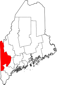 | |
| Plantations | ||
| Unorganized territories | ||
| CDPs | ||
| Other villages | ||