Charleston Township, Coles County, Illinois
| Charleston Township | |
|---|---|
| Township | |
 Location in Coles County | |
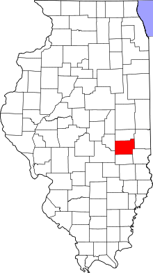 Coles County's location in Illinois | |
| Coordinates: 39°29′N 88°11′W / 39.483°N 88.183°WCoordinates: 39°29′N 88°11′W / 39.483°N 88.183°W | |
| Country | United States |
| State | Illinois |
| County | Coles |
| Established | November 8, 1859 |
| Area | |
| • Total | 37.91 sq mi (98.2 km2) |
| • Land | 37.19 sq mi (96.3 km2) |
| • Water | 0.72 sq mi (1.9 km2) 1.90% |
| Elevation | 686 ft (209 m) |
| Population (2010) | |
| • Total | 23,916 |
| • Density | 643.1/sq mi (248.3/km2) |
| Time zone | CST (UTC-6) |
| • Summer (DST) | CDT (UTC-5) |
| ZIP codes | 61912, 61920 62440 |
| GNIS feature ID | 0428790 |
Charleston Township is one of twelve townships in Coles County, Illinois, USA. As of the 2010 census, its population was 23,916 and it contained 9,497 housing units.[1] Eastern Illinois University is located in this township.
History
Charleston Township was named for one of its founders, Charles Morton.[2]
Geography
According to the 2010 census, the township has a total area of 37.91 square miles (98.2 km2), of which 37.19 square miles (96.3 km2) (or 98.10%) is land and 0.72 square miles (1.9 km2) (or 1.90%) is water.[1]
Cities, towns, villages
- Charleston (west three-quarters)
Cemeteries
The township contains fourteen cemeteries: Adkins, Chambers, Cossel, Fudge, Huckaba, Kickapoo, Lumbrick, Mound, Old Charleston, Roselawn, Salem, Stoner, Unity and Yocum.
Major highways
Landmarks
- Coles County Fairgrounds
- Eastern Illinois University
- Horse Racing Track
School districts
Political districts
- Illinois's 15th congressional district
- State House District 110
- State Senate District 55
References
- "Charleston Township, Coles County, Illinois". Geographic Names Information System. United States Geological Survey. Retrieved 2010-01-10.
- United States Census Bureau 2007 TIGER/Line Shapefiles
- United States National Atlas
- 1 2 "Population, Housing Units, Area, and Density: 2010 - County -- County Subdivision and Place -- 2010 Census Summary File 1". United States Census. Retrieved 2013-05-28.
- ↑ Gannett, Henry (1905). The Origin of Certain Place Names in the United States. Govt. Print. Off. p. 76.
External links
Adjacent townships
 |
Humboldt Township | Seven Hickory Township | Morgan Township | |
| Lafayette Township | |
Ashmore Township | ||
| ||||
| | ||||
| Pleasant Grove Township | |
Hutton Township |
Municipalities and communities of Coles County, Illinois, United States | ||
|---|---|---|
| Cities | ||
| Villages | ||
| Townships | ||
| Unincorporated communities | ||
| Extinct communities |
| |
| Footnotes | ‡This populated place also has portions in an adjacent county or counties | |
This article is issued from Wikipedia - version of the 11/20/2016. The text is available under the Creative Commons Attribution/Share Alike but additional terms may apply for the media files.