Črni Potok, Šmartno pri Litiji
| Črni Potok | |
|---|---|
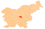
 Črni Potok Location in Slovenia | |
| Coordinates: 46°2′3.99″N 14°50′35.38″E / 46.0344417°N 14.8431611°ECoordinates: 46°2′3.99″N 14°50′35.38″E / 46.0344417°N 14.8431611°E | |
| Country |
|
| Traditional region | Lower Carniola |
| Statistical region | Central Slovenia |
| Municipality | Šmartno pri Litiji |
| Area | |
| • Total | 2.83 km2 (1.09 sq mi) |
| Elevation | 259.7 m (852.0 ft) |
| Population (2002) | |
| • Total | 130 |
| [1] | |
Črni Potok (pronounced [ˈtʃəɾni ˈpɔːtɔk]; German: Schwarzenbach[2]) is a dispersed settlement in the valley of Black Creek (Slovene: Črni potok) south of Šmartno pri Litiji in central Slovenia. The area is part of the historical region of Lower Carniola. The entire Municipality of Šmartno pri Litiji is now included in the Central Slovenia Statistical Region.[3] It includes the hamlets of Brezje (formerly Sveti Križ, German: Heiligenkreuz[2]) and Sela.[4]
The local church, built on a small hill in the southwestern hamlet of Brezje, is dedicated to the Exaltation of the Holy Cross (Slovene: Povišanje svetega Križa ) and belongs to the Parish of Šmartno. It dates to the 17th century.[5]
References
- ↑ Statistical Office of the Republic of Slovenia
- 1 2 Leksikon občin kraljestev in dežel zastopanih v državnem zboru, vol. 6: Kranjsko. 1906. Vienna: C. Kr. Dvorna in Državna Tiskarna, pp. 94–95.
- ↑ Šmartno pri Litiji municipal site
- ↑ Savnik, Roman, ed. 1971. Krajevni leksikon Slovenije, vol. 2. Ljubljana: Državna založba Slovenije, pp. 259–260.
- ↑ "EŠD 2548". Registry of Immovable Cultural Heritage (in Slovenian). Ministry of Culture of the Republic of Slovenia. Retrieved 5 September 2011.
External links
| Settlements | Administrative centre: Šmartno pri Litiji
|  |
|---|---|---|
| Landmarks |
| |
| Notable people |
| |
This article is issued from Wikipedia - version of the 12/4/2014. The text is available under the Creative Commons Attribution/Share Alike but additional terms may apply for the media files.