Ya'an
| Ya'an 雅安市 | |
|---|---|
| Prefecture-level city | |
|
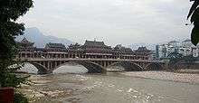
Ya'an, 2008 | |
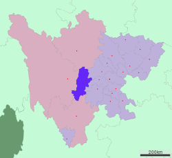 Location of Ya'an City jurisdiction in Sichuan | |
| Coordinates: 29°59′N 103°01′E / 29.983°N 103.017°ECoordinates: 29°59′N 103°01′E / 29.983°N 103.017°E | |
| Country | China |
| Province | Sichuan |
| Area | |
| • Total | 15,300 km2 (5,900 sq mi) |
| Elevation | 580 m (1,900 ft) |
| Population | |
| • Total | 1,530,000 |
| • Density | 100/km2 (260/sq mi) |
| Time zone | China Standard (UTC+8) |
| Postal code | 625000 |
| Area code(s) | 0835 |
| Licence plate prefixes | 川T |
| Website |
yaan |

Ya'an (Chinese: 雅安; pinyin: Yǎ'ān; Wade–Giles: Ya-an, Tibetan: Yak-Nga [གཡག་རྔ་]) is a prefecture-level city in the western part of Sichuan province, China, located just below the Tibetan Plateau.
History

Previously known as Yazhou-fu, the city is first mentioned during the Zhou Dynasty (1122-255 BCE). It served as a county seat during the Qin and Han Dynasties, but was subsequently taken by nomadic tribes. After being reintegrated into the Chinese Empire in the late 5th century, it was made the seat of the Ya Prefecture in 604. The modern Ya'an county was established in 1912. It became the provincial capital of Xikang province in 1951, but has been a municipality under the administration of Sichuan province since 1955, when Xikang province was merged and became a part of Sichuan province.
The first giant panda was found in Baoxing County of Ya'an; Ya'an is also the origin of artificial planting tea of the world; Mengding Mountain in Mingshan County, has been keeping seven tea trees, which are believed to be the origins of tea, for more than 1,000 years.
"The busy little town [of Yaan] was full of life, for its market is the only trading centre for the Chinese and Tibetans from Kangting. Accompanied by two coolies, I crossed the long suspension bridge which oscillates alarmingly over the Ya Ho. I got separated from my coolies in the dense crowd which swarmed along the main street, but in the end found them, and my luggage, at the Catholic mission, where two venerable fathers welcomed me with the flowery courtesy of mandarins...Yaan is the main market for a special kind of tea which is grown in this part of the country and exported in very large quantities to Tibet via Kangting and over the caravan routes through Batang (Paan) and Teko. Although the Chinese regard it as an inferior product, it is greatly esteemed by the Tibetans for its powerful flavor, which harmonizes particularly well with that of yak butter and salt which Tibetans often mix with their tea. Brick tea comprises not only what we call tea leaves, but also the coarser leaves and some of the twigs of the shrub, as well as the leaves and fruit of other plants and trees (the alder, for instance). This amalgam is steamed, weighed, and compressed into hard bricks, which are packed up in coarse matting in subunits of four. These rectangular parcels weigh between twenty-two and twenty-six pounds—the quality of the tea makes a slight difference to the weight—and are carried to Kangting by coolies. A long string of them, moving slowly under their monstrous burdens of tea, was a familiar sight along the road I followed."[2]
Panda tea is also a local speciality.
On April 20, 2013, the city was hit by a major earthquake, causing numerous casualties and heavy damage to housing and infrastructure.
Geography

Ya'an is located at the western edge of the Sichuan Basin and on the upper reaches of the Yangtze, covering the transition between the Chengdu Plain and the Tibetan Plateau. Its latitude ranges from 28° 51′ 10″ — 30° 56′ 40″ N and its longitude from 101° 56′ 26″—103° 23′ 28″ E. Neighbouring prefectures are, starting from the northeast and moving counter-clockwise, Chengdu (NE), Meishan (E), Leshan (SE), Liangshan Yi Autonomous Prefecture (S), Garzê Tibetan Autonomous Prefecture (W), and Ngawa Tibetan and Qiang Autonomous Prefecture (N). With an area of 15,300 square kilometres (5,910 sq mi) and a population of 1,530,000, [3] The city is encircled by mountains, and four rivers flow through it.
Climate
Ya'an has a monsoon-influenced humid subtropical climate (Köppen Cwa) and is largely mild and humid. The presence of the mountains to the northwest greatly affects the city's climate. In the short winters, they help shield the city from cold Siberian winds. January averages 6.3 °C (43.3 °F), and while frost may occur, snow is rare. Summers are hot and humid, with highs often reaching 30 °C (86 °F), yet extended heat waves are rare; the daily average in July and August is around 25 °C (77 °F). Rainfall is common year-round, though in winter it tends to be light, and is particularly heavy in summer, when warm, humid southerly or southeasterly winds blow against the mountains, causing orographic lift to occur, enhancing rainfall. With nearly 1,700 millimetres (67 in) of rainfall occurring on 213 days per year, Ya'an is also known as the "Rain City".[4] In addition, rain often falls at night, so fog is not a common occurrence.
| Climate data for Ya'an (1971−2000) | |||||||||||||
|---|---|---|---|---|---|---|---|---|---|---|---|---|---|
| Month | Jan | Feb | Mar | Apr | May | Jun | Jul | Aug | Sep | Oct | Nov | Dec | Year |
| Record high °C (°F) | 18.2 (64.8) |
22.1 (71.8) |
27.7 (81.9) |
33.2 (91.8) |
35.1 (95.2) |
34.9 (94.8) |
35.2 (95.4) |
35.4 (95.7) |
34.9 (94.8) |
28.7 (83.7) |
24.5 (76.1) |
19.6 (67.3) |
35.4 (95.7) |
| Average high °C (°F) | 9.4 (48.9) |
11.1 (52) |
15.6 (60.1) |
21.5 (70.7) |
25.5 (77.9) |
27.7 (81.9) |
29.6 (85.3) |
29.6 (85.3) |
24.9 (76.8) |
20.1 (68.2) |
15.5 (59.9) |
10.8 (51.4) |
20.1 (68.2) |
| Daily mean °C (°F) | 6.3 (43.3) |
7.7 (45.9) |
11.6 (52.9) |
16.8 (62.2) |
20.8 (69.4) |
23.3 (73.9) |
25.1 (77.2) |
24.9 (76.8) |
21.0 (69.8) |
16.7 (62.1) |
12.4 (54.3) |
7.8 (46) |
16.2 (61.15) |
| Average low °C (°F) | 4.1 (39.4) |
5.5 (41.9) |
8.8 (47.8) |
13.5 (56.3) |
17.5 (63.5) |
20.2 (68.4) |
22.0 (71.6) |
21.9 (71.4) |
18.5 (65.3) |
14.5 (58.1) |
10.3 (50.5) |
5.8 (42.4) |
13.6 (56.4) |
| Record low °C (°F) | −2.8 (27) |
−1.6 (29.1) |
−0.7 (30.7) |
3.2 (37.8) |
10.0 (50) |
14.3 (57.7) |
17.1 (62.8) |
16.6 (61.9) |
12.9 (55.2) |
4.8 (40.6) |
1.2 (34.2) |
−3.9 (25) |
−3.9 (25) |
| Average precipitation mm (inches) | 20.8 (0.819) |
31.9 (1.256) |
50.9 (2.004) |
93.0 (3.661) |
129.4 (5.094) |
181.0 (7.126) |
369.6 (14.551) |
433.6 (17.071) |
206.6 (8.134) |
98.3 (3.87) |
56.5 (2.224) |
20.9 (0.823) |
1,692.5 (66.633) |
| Average precipitation days (≥ 0.1 mm) | 13.3 | 16.1 | 18.6 | 17.8 | 19.1 | 19.3 | 20.1 | 18.8 | 20.8 | 20.4 | 16.3 | 12.6 | 213.2 |
| Source: Weather China[4] | |||||||||||||
Administrative Subdivisions
| Map | |||||
|---|---|---|---|---|---|
| Name | Hanzi | Hanyu Pinyin | Population (2004 est.) | Area (km²) | Density (/km²) |
| Yucheng District | 雨城区 | Yǔchéng Qū | 340,000 | 1,060 | 321 |
| Mingshan District | 名山区 | Míngshān Qū | 260,000 | 614 | 423 |
| Yingjing County | 荥经县 | Yíngjīng Xiàn | 140,000 | 1,781 | 79 |
| Hanyuan County | 汉源县 | Hànyuán Xiàn | 350,000 | 2,349 | 149 |
| Shimian County | 石棉县 | Shímián Xiàn | 120,000 | 2,678 | 45 |
| Tianquan County | 天全县 | Tiānquán Xiàn | 150,000 | 2,394 | 63 |
| Lushan County | 芦山县 | Lúshān Xiàn | 120,000 | 1,364 | 88 |
| Baoxing County | 宝兴县 | Bǎoxīng Xiàn | 60,000 | 3,114 | 19 |

Transport
Notes
- ↑ Chinese steles: pre-Buddhist and Buddhist use of a symbolic form, p. 209
- ↑ Migot, André (1955). Tibetan Marches. Translated by Peter Fleming. E. P. Dutton & Co., Inc., U.S.A., pp. 59-60.
- ↑ (Chinese) Profile of Ya'an, official website of Ya'an Government, visited on May 12, 2008.
- 1 2 雅安城市介绍 (in Chinese). Weather China. Retrieved 2011-05-30.
See also
References
- Encyclopædia Britannica, 15th ed., 2005
- Forbes, Andrew ; Henley, David (2011). China's Ancient Tea Horse Road. Chiang Mai: Cognoscenti Books. ASIN: B005DQV7Q2
External links
| Wikimedia Commons has media related to Ya'an. |
Sichuan topics | |||||||
|---|---|---|---|---|---|---|---|
| General | |||||||
| History |
| ||||||
| Geography | |||||||
| Culture |
| ||||||
| People | |||||||
| Languages |
| ||||||
| Visitor attractions | |||||||