World Trade Center station (PATH)
| ||||||||||||||||||||||||||||||||
|---|---|---|---|---|---|---|---|---|---|---|---|---|---|---|---|---|---|---|---|---|---|---|---|---|---|---|---|---|---|---|---|---|
 The WTC Transportation Hub in September 2016 | ||||||||||||||||||||||||||||||||
| Location |
World Trade Center New York City, NY, United States | |||||||||||||||||||||||||||||||
| Coordinates | 40°42′42″N 74°00′38″W / 40.711787°N 74.010525°WCoordinates: 40°42′42″N 74°00′38″W / 40.711787°N 74.010525°W | |||||||||||||||||||||||||||||||
| Owned by | Port Authority of New York and New Jersey | |||||||||||||||||||||||||||||||
| Line(s) | ||||||||||||||||||||||||||||||||
| Platforms | 4 island platforms | |||||||||||||||||||||||||||||||
| Tracks | 5 | |||||||||||||||||||||||||||||||
| Connections |
New York City Subway: | |||||||||||||||||||||||||||||||
| Construction | ||||||||||||||||||||||||||||||||
| Disabled access | Yes | |||||||||||||||||||||||||||||||
| History | ||||||||||||||||||||||||||||||||
| Opened | 1903, 2016 (as WTC transportation hub) | |||||||||||||||||||||||||||||||
| Rebuilt | 1971, 2003 (temporary station) | |||||||||||||||||||||||||||||||
| Electrified | 600V (DC) Third Rail | |||||||||||||||||||||||||||||||
| Traffic | ||||||||||||||||||||||||||||||||
| Passengers (2015) |
13,929,547[1] | |||||||||||||||||||||||||||||||
| Services | ||||||||||||||||||||||||||||||||
| ||||||||||||||||||||||||||||||||
| Rebuilding of the World Trade Center |
|---|
| One WTC |
| 2–7 WTC |
| Other elements |
World Trade Center is a terminal station in Lower Manhattan for PATH rail service. It was originally opened on July 19, 1909, as Hudson Terminal, but was torn down, rebuilt as World Trade Center, and re-opened July 6, 1971. Following the September 11, 2001 attacks, a temporary station opened in 2003. This station serves as the terminus for the Newark – World Trade Center and Hoboken – World Trade Center routes. The main station house, the Oculus, opened on March 4, 2016, and the terminal was renamed the World Trade Center Transportation Hub, or World Trade Center for short.
Station layout
| G | Street level | Entrance/Exit to Vesey Street and West Broadway/Greenwich Street |
| Entrance/Exit to the National September 11 Memorial & Museum | ||
| Escalators and elevator to mezzanine, (Shops, ATMs) | ||
| At-grade connection to Cortlandt Street subway station ( | ||
| B1 Upper Concourse[2] |
North mezzanine | Ticket machines, one-way faregates, concourse, ramps and staircases to West and East mezzanines |
| West mezzanine | Elevators and stairs to tracks 4 and 5 | |
| West Concourse to Brookfield Place | ||
| East mezzanine | Elevators, escalators, and stairs to tracks 1, 2, and 3 | |
| Cortlandt Street platforms | Transfer to New York City Subway | |
| B2 Lower Concourse[2] |
Passageways | Transfer to New York City Subway ( |
| B3[2] | Mezzanine | Transfer between platforms |
| B4 Platforms[2] | ||
| Track 1 | ← HOB–WTC toward Hoboken (Exchange Place) | |
| Island platform (Platform A) | ||
| Track 2 | No service | |
| Island platform (Platform B) | ||
| Track 3 | No service | |
| Track 4 | ← NWK–WTC toward Newark (Exchange Place) | |
| Island platform (Platform C) | ||
| Track 5 | ← NWK–WTC toward Newark (Exchange Place) | |
| Island platform (Platform D) | ||
| Track 6 | No service | |
The station currently has six tracks and four island platforms in a basement four stories underground.[3][2] The new Platform A, next to tracks 1 and 2, opened as part of the Transportation Hub on February 25, 2014.[4][5][6] Platform B between tracks 2 and 3 opened on May 7, 2015.[7] The other two platforms opened on September 8, 2016.[8]
The current station has a temporary entrance that has been open since the temporary station entered in November 2003. Due to the redevelopment of the World Trade Center site, the entrances and size of the temporary station have changed over time. The most current entrance to the station is located at Vesey Street, facing Greenwich Street and adjacent to 7 World Trade Center. The temporary entrance is a one-story building on the south side of Vesey Street with a Hudson News outlet and escalators extending into a lower level mezzanine. A connection to Brookfield Place was made available since October 27, 2013, through a permanent passageway known as the West Concourse. On August 16, 2016, the Westfield World Trade Center entrance opened.
Hudson Terminal

Hudson Terminal was built by the Hudson and Manhattan Railroad at the turn of the twentieth century and was located between Greenwich, Cortlandt, Church, and Fulton Streets. The Hudson Terminal included two 22-story office buildings located above the station.
The terminal was an architectural and engineering marvel of its time, designed with ramps to allow pedestrian traffic to flow in and out of the station quickly and easily.[9] The station was served by two single-track tubes connected by a loop to speed train movements. The loop included five tracks and 3 platforms (2 center island and one side) and was somewhat similar to the current arrangement.[10] By 1914, passenger volume at the Hudson Terminal had reached 30,535,500 annually.[9] Volume nearly doubled by 1922, with 59,221,354 passengers that year.[11]
Overall ridership on New Jersey's Hudson and Manhattan Railroad declined substantially from a high of 113 million riders in 1927 to 26 million in 1958, after new automobile tunnels and bridges opened across the Hudson River.[12] The State of New Jersey was interested in getting the Port Authority of New York and New Jersey to take over the railroad, but the Port Authority long viewed it as something unprofitable and had no interest in doing so. In the late 1950s, the Port Authority proposed to build a "world trade center" in Lower Manhattan along the East River.
As a bi-state agency, Port Authority projects required approval from both the states of New Jersey and New York. Toward the end of 1961, negotiations with outgoing New Jersey Governor Robert B. Meyner regarding the World Trade Center project reached a stalemate. In December 1961, Port Authority executive director Austin J. Tobin met with newly elected New Jersey Governor Richard J. Hughes, and made a proposal to shift the World Trade Center project to the west side, where the Hudson Terminal was located.[13]
In acquiring the Hudson & Manhattan Railroad, the Port Authority also acquired the Hudson Terminal and other buildings which were deemed obsolete.[13] On January 22, 1962, the two states reached an agreement to allow the Port Authority to take over the railroad and build the World Trade Center on Manhattan's lower west side.[14] The shift in location for the World Trade Center to a site more convenient to New Jersey, together with Port Authority acquisition of the H&M Railroad, brought New Jersey to agreement in support of the World Trade Center project.
Old PATH stations
Original PATH station


Groundbreaking on the World Trade Center took place in 1966. The site was on landfill, with bedrock located 65 metres (213 ft) below the surface.[15] A new method was used to construct a slurry wall to keep water from the Hudson River out. During excavation of the site and construction of the towers, the original Hudson Tubes remained in service as elevated tunnels. The Hudson Terminal was shut down in 1971 when a new Port Authority Trans-Hudson, or PATH Railroad station was completed.[16] The new station cost $35 million to build. At the time, it had a passenger volume of 85,000 daily.[17]
The new PATH railroad station opened on July 6, 1971, and was at a different location from the original Hudson Terminal.[18] Larger balloon loops in the PATH station platform allowed 10-car trains to be utilized, as the previous station could handle only 6-car trains due to tight loops.[16] While construction of the World Trade Center neared completion, a temporary corridor was provided to take passengers between the station and a temporary entrance on Church Street. When it opened, the station had nine high-speed escalators between the platform level and the mezzanine level.[17] The WTC PATH station was served by Newark – World Trade Center and Hoboken – World Trade Center trains. The station was connected to the World Trade Center towers via an underground concourse and a shopping center. There were also underground connections to the New York City Subway (A C E trains at World Trade Center, and N R W trains at Cortlandt Street). By 2001, the volume of passengers using the WTC PATH station was approximately 25,000 daily.[19]
The station did not sustain significant damage during the 1993 World Trade Center bombing, although a section of ceiling in the station collapsed and trapped dozens.[20][21] Within a week, the Port Authority was able to resume PATH service to the World Trade Center.[22]
On September 11, 2001, the station was shut down by the Port Authority after the first airplane hit the North Tower of the World Trade Center. A train from Newark that came into the terminal at 8:55 am stopped only to pick up passengers. A second train, from Hoboken, came through at 9:00 am but did not stop and returned to New Jersey. An empty train was sent to the station at 9:10 am to pick up a dozen PATH employees and a homeless individual, leaving the station empty.[23]
Temporary PATH station


With the station destroyed, service to Lower Manhattan was suspended for over two years. Exchange Place, the next station on the Newark – World Trade Center line, also had to be closed because it could not operate as a terminal station. Instead, two uptown services (Newark – 33rd Street, red on the official PATH map; and Hoboken – 33rd Street, blue on the map) and one intrastate New Jersey service (Hoboken – Journal Square, green on the map) were put into operation.[24]
Cleanup of the Exchange Place station was needed after the attacks. In addition, the downtown Hudson tubes had been flooded, which destroyed the track infrastructure.[25] Modifications to the tracks were also required since the Exchange Place station was not a terminal station.[24] The Exchange Place station re-opened in June 2003. PATH service to Lower Manhattan was restored when a temporary station opened on November 23, 2003. The inaugural train was the same one that had been used for the evacuation.
The temporary PATH station was designed by Port Authority chief architect Robert I. Davidson[26] and constructed at a cost of $323 million.[27] The station featured a canopy entrance along Church Street and a 118-by-12 foot mosaic mural, "Iridescent Lightning," by Giulio Candussio[26] of the Scuola Mosaicisti del Friuli in Spilimbergo, Italy. The station was also adorned with opaque panel walls inscribed with inspirational quotes attesting to the greatness and resilience of New York City. These panels partially shielded the World Trade Center site from view.
In the 9/11 attacks, some sections of the station, including the floor and the signage on the northeast corner, were only lightly damaged in the collapse of the World Trade Center. These sections of the station were retained in the temporary station, and remained in the new station, where it connects with the platforms for the 2 3 A C E trains. Following its reopening and the resumption of Newark – World Trade Center and Hoboken – World Trade Center services, the station quickly reclaimed its status as the busiest station in the PATH system.
The station was also home to a Storycorps booth, which opened in 2005. Through this program, visitors could arrange to give oral recorded histories of the disaster. The booth closed in the spring of 2007 to make way for construction at the World Trade Center site.[28] In June 2007, the street entrance to the temporary station was closed and demolished as part of the site construction. A set of new staircases was constructed several feet to the south, and a "tent" structure was added to provide cover from the elements. The tent structure, by Voorsanger Architects and installed at a cost of $275,000, was designed to have an "aspiring quality," according to architect Bartholomew Voorsanger.[29] That entrance on Church Street was closed in April 2008 when the entrance was relocated once again. On April 1, 2008, the third temporary entrance to the PATH station opened for commuters. The entrance was located on Vesey Street, adjacent to 7 World Trade Center, and served until the opening of the permanent station, designed by Calatrava,[30] and also to make way for a Performing Arts Center if the proposed building finds approval.
World Trade Center Transportation Hub

The World Trade Center Transportation Hub is the Port Authority of New York and New Jersey's formal name for the new PATH station and the associated transit and retail complex that opened on March 3, 2016. The station's renaming took place when the station reopened.[31][32] It was designed by Spanish architect Santiago Calatrava and composed of a train station with a large and open mezzanine under the National September 11 Memorial plaza.[33] This mezzanine is connected to an aboveground head house structure called the Oculus—located between 2 World Trade Center and 3 World Trade Center—as well as to public concourses under the various towers in the World Trade Center complex.[32][34]

In addition, the station was designed to connect the PATH to the New York City Subway system, and to facilitate a below ground east-west passageway that connects to the various modes of transportation in Lower Manhattan, from the Fulton Center to the Battery Park City Ferry Terminal. Furthermore, to replace the lost retail space from the original mall at the World Trade Center, significant portions of the Hub are devoted to the new 365,000 square foot Westfield World Trade Center mall.[35]
Background
A large transit station was not part of the 2003 Memory Foundations master plan for the site by Daniel Libeskind, which called for a smaller station along the lines of the original subterranean station that existed beneath the World Trade Center. Libeskind's design called for the Oculus space to be left open, forming a "Wedge of Light" so that sun rays around the autumnal equinox would hit the World Trade Center footprints each September. In early 2004, the Port Authority, which owns the land, modified the Libeskind plan to include a large transportation station downtown, intended to rival Penn Station and Grand Central Terminal. In a nod to the Libeskind concept, the Oculus was built to maximize the effect of the autumnal equinox rays.
Design
.jpg)

Spanish architect Santiago Calatrava, designer of the station, said the Oculus resembles a bird being released from a child's hand. The roof was originally designed to mechanically open to increase light and ventilation to the enclosed space. Herbert Muschamp, architecture critic of The New York Times, compared the design to the Bethesda Terrace and Fountain in Central Park, and wrote in 2004:
| “ | Santiago Calatrava's design for the World Trade Center PATH station should satisfy those who believe that buildings planned for ground zero must aspire to a spiritual dimension. Over the years, many people have discerned a metaphysical element in Mr. Calatrava's work. I hope New Yorkers will detect its presence, too. With deep appreciation, I congratulate the Port Authority for commissioning Mr. Calatrava, the great Spanish architect and engineer, to design a building with the power to shape the future of New York. It is a pleasure to report, for once, that public officials are not overstating the case when they describe a design as breathtaking.[36] | ” |
Another New York Times' critic Michael Kimmelman wrote later in 2004:
| “ | The World Trade Center PATH Terminal by Santiago Calatrava, the renowned Spanish architect and engineer, is what we should have at ground zero. Not modified suburban malls with water fountains, but a major cultural contribution to our city.[37] | ” |
However, Calatrava's original soaring spike design was scaled back because of security issues. The New York Times observed in 2005:
| “ | In the name of security, Santiago Calatrava's bird has grown a beak. Its ribs have doubled in number and its wings have lost their interstices of glass.... [T]he main transit hall, between Church and Greenwich Streets, will almost certainly lose some of its delicate quality, while gaining structural expressiveness. It may now evoke a slender stegosaurus more than it does a bird.[38] | ” |
The design was further modified in 2008 to eliminate the opening and closing roof mechanism because of budget and space constraints.[39]
In 2014 The Atlantic's CityLab criticized the emphasis placed on form over function, citing design flaws driven by aesthetic choices that detract from the station's usability as a transit hub:
...the Port Authority's new hub fails its customers, the PATH-riding public. One platform is already completed, and its design flaws are obvious. Staircases are too narrow to accommodate the morning crowds who come streaming out of the trains from Hoboken, Jersey City, and beyond, while the narrow platforms quickly fill with irate commuters. Anyone trying to catch a train back to the Garden State risks a stampede. The marble, bright and sterile, picks up any spill, and a drop of water creates dangerously slippery conditions until a Port Authority janitor scurries out of some unseen door, mop in hand. Passenger flow and comfort, two of the most important elements of terminal design, seem to be an afterthought. The PATH Hub is shaping up to be an example of design divorced from purpose.— Benjamin Kabak, "Why Can't Transportation Mega-Projects Be Both Beautiful and Practical?", CityLab[40]
Steve Cuozzo of the New York Post described the station in 2014 as it was being built as "a self-indulgent monstrosity" and "a hideous waste of public money".[41] Michael Kimmelman, architecture critic for The New York Times, referred to the structure as "a kitsch stegosaurus".[42] New York magazine referred to it in 2015 as it neared completion as a "Glorious Boondoggle" and, while withholding final judgement on the unfinished structure, did note the "Jurassic" appearance.[43] The New York Post editorial board also described the station when it opened in 2016 as the "world's most obscenely overpriced commuter rail station — and possibly its ugliest", deeming the transit hub a "white elephant" and "monstrosity", comparing the Oculus to a "giant gray-white space insect".[44]
The station has also stirred problems with developer Larry Silverstein, who owns the lease for the World Trade Center site, since it took away available space for his proposed buildings.
West Concourse

The West Street pedestrian underpass (the West Concourse, formerly the "east-west connector") links the WTC station mezzanine with a new transit pavilion at Battery Park City's Brookfield Place (formerly World Financial Center) on the west side of the World Trade Center site just south of 1 WTC and across West Street. It opened on October 23, 2013. Access to 1 World Trade Center from the West Concourse became possible for employees when the tower opened on November 3, 2014. On May 29, the same day the tower's observatory opened, the entrance to the observation deck opened.[45][46]
Cost and delays
The Transportation Hub has been dubbed "the world's most expensive transportation hub" due to its massive cost for reconstruction—$3.74 billion dollars.[41][47] By contrast, the proposed two-mile PATH extension connecting Newark Liberty International Airport to the NWK-WTC service is projected to cost $1.5 billion.[48] The hub has also been criticized for being delayed almost 10 years.[49]
Originally, the reconstruction was to be funded by the Federal Transit Administration, which gave approximately $1.9 billion to the project. The costs of the hub were still expensive, but it was to be finished at budget in 2009. In 2014 dollars, the cost of the hub and the adjacent Fulton Center, combined, was $5.1 billion.[50] The hub cost twice as much in 2014 as it should have originally cost in 2004.[49] A single hallway in the elegantly constructed hub cost $225 million and was billed as the "world's most expensive hallway",[51] while construction, maintenance, and management alone cost $635 million; the Port Authority awarded several subcontracts, most of them costly.[49] In addition, over $500 million in cost savings was overlooked.[49] The price of the station was further driven up by Calatrava's architectural decisions.[a 1] He wanted to import custom-made steel from a northern Italian factory, which cost $474 million, and have a columnless, aesthetically based design; skylights in the ground, instead of trees;[a 2] and large, soaring "wings", or rafters.[49] Another $335 million was added to the cost overrun because the Port Authority of New York and New Jersey had to build around the New York City Subway's IRT Broadway–Seventh Avenue Line (carrying the 1 train), since the Metropolitan Transportation Authority refused to close the line due to fears of inconveniencing commuters from Staten Island taking the Staten Island Ferry. The line had to be supported on a bridge over the station instead of on columns through the station.[49] In 2012, Hurricane Sandy damaged several hundred million dollars worth of materials.[49]
The hub's skyrocketing costs also attracted much controversy, with an editor at The New York Times saying that "Mr. Calatrava is amassing an unusually long list of projects marred by cost overruns, delays and litigation", referring to his other projects around the world that were over budget.[52] Especially because the current station has a ridership of only 46,000 daily passengers compared to 250,000 at Grand Central Terminal) some think that the renovation is overpriced and overstylized.[49]
On November 5, 2015, the opening was delayed to early 2016, due to a leaking roof.[53]
The director of the Port Authority, Pat Foye, declined to hold an event to celebrate the opening of the Hub, describing it as "symbol of excess" and noting he was "troubled with the huge cost" of the construction project.[54]
Construction timeline

- Construction of the station called for relocation of the landmark World Trade Center cross in 2006.
- On July 8, 2008, the first prefabricated "ribs" for the pedestrian walkway under Fulton Street were installed on the site.[55] The mezzanine level of the station is undergoing major construction and work on the foundation is still underway.[56]
- By March 2011, over 225 of the 300 steel pieces which make up the roof of the station were installed.[57] Later that month installation of the Vierendeel Truss, one of the hub's key components, began with the installation of a 50-ton section of the truss. When fully installed the combined weight of the truss will weigh 271 tons. The truss will serve as the mezzanine roof and also act as a support for the northeast corner of the WTC Memorial.[58]
- By July 6, 2012, the following events were occurring:
- Steel erection for oculus substructure
- Construction connecting to Vehicle Security Center complex
- Greenwich Street corridor (1 train subway box): steel and concrete placing under 1 train subway box
- Preparations for installation of east arch truss
- Hub construction contract awarded to Skanska in summer 2010
- By June 2013, 10 pieces of exterior arches were installed for the Oculus. The initial construction is expected to conclude in the end of 2014 or beginning of 2015, and the internal construction including paint, turnstiles, ticket booths, etc. is expected to complete in the end of 2015, with an official opening scheduled on December 17, 2015.[59]
- On October 23, 2013, the West Concourse opened with access to the World Financial Center, now renamed the Brookfield Place. The storefronts were covered and not yet opened, and the second floor had still not opened due to the construction of One World Trade Center. The escalators in the West Concourse were still out of service.
- By November 2013, about 110 arches, and the beginning of the wings, were installed, and 20 more arches were installed by January 2014.[60]
- On February 25, 2014, half of the first platform of the new station, Platform A, was opened to the public with service to Hoboken. The new platform, an island platform, is fully modernized and contains new lighting, speakers, illuminated signs, escalators and elevators. The west side of the platform was walled off, giving Platform A the appearance of a side platform.[5]
- By March 10, 2014, 106 out of 114 ribs were installed for the Oculus, as well as one rafter, or wing; by June 1, 2014, nine wings were installed, as well as the remaining eight ribs.[60]
- By May 2014, all the ribs out of 114 ribs were all installed, and the construction of the white rafters, or tips started, with the first 3. In late May, 2 more rafters were added, making the number of rafters added 5.
- By June 2014, 14 more rafters were added, and the construction of the rafters continued.
- By the end of July 2014, a total of 36 rafters were installed.
- By August 2014, 53 of 114 rafters were installed.
- By September 2014, the people posters on the storefronts inside the West Concourse were removed and the storefronts were visible.
- By mid-October 2014, 99 out of 114 rafters were installed. Painting of the Oculus also began.
- On November 3, 2014, the same day One World Trade Center opened, the West Concourse's escalators, which had been closed off since October 23, 2013, opened with access to the second floor and to One World Trade Center.
- On November 11, 2014, the Fulton Center and Dey Street Concourse opened to the public. The Dey Street Concourse entrance into the Transportation Hub is closed until the Hub opens.
- On November 22, 2014, the 114th and final rafter was installed. Also by this date, one crane had been disassembled and painting of the hub continued.
- By early December 2014, the final crane had been disassembled and painting of the hub continued.
- On May 7, 2015, Platform B and the remaining half of Platform A opened, and Platform C closed.[7]
- On May 29, 2015, the same day One World Observatory opened, the entrance to the observation deck in the West Concourse opened.
- In late September 2015, the new West Walkway opened with access from the platforms to the West Concourse, the walkway is supposedly temporary and soon will be reconfigured into a permanent walkway.
- In late December 2015, the last construction crane was removed from the site
- On March 3, 2016, the Oculus partially opened to the public, along with new entrances. Only the west end of the Oculus and the Westfield Mall corridor to Four World Trade Center was opened.[61] The temporary entrance remained open.
- On May 26, 2016, PATH riders received a direct underground link to Fulton Center and nine subway lines through the Oculus.
- On June 21, 2016, the PATH entrance into 2 World Trade Center opened; the temporary PATH entrance to outside 7 World Trade Center closed on June 26, 2016.
- On August 16, 2016, the Westfield World Trade Center mall opened to the public.
- On September 9, 2016, the restrooms were opened on the south side of the mezzanine. The last two station platforms in the hub were opened at 5:30 a.m, as Port Authority officials said in a release.[8]
Adjacent transit connections
.jpg)
.jpg)
.jpg)
The Transportation Hub is designed to connect the PATH subway system to the New York City Subway system. The 1 service, which runs through the Transportation Hub, was reconstructed under this project to run above the PATH mezzanine, and the rebuilt Cortlandt Street IRT station will have direct access into the Hub. There will also be direct access to the Chambers Street–World Trade Center/Park Place station complex.[62] The Cortlandt Street BMT station also has direct access into the Hub. In addition, the Dey Street Passageway along Dey Street connects the Transportation Hub east to the Fulton Center, providing access to the 2 3 4 5 A C J Z N R W services. A passageway, known as the West Concourse, connects west to Brookfield Place and the Battery Park City Ferry Terminal. A proposal for a connection to the Long Island Rail Road and John F. Kennedy International Airport via a new tunnel under the East River, the Lower Manhattan-Jamaica/JFK Transportation Project, was studied starting in 2004, but as of 2009 was a lower priority than other projects competing for funding.[63]
Current services include:
| Station service legend | |
|---|---|
| |
Stops all times |
| |
Stops all times except late nights |
| |
Stops late nights only |
| |
Stops weekdays only |
| |
Stops rush hours in the peak direction only |
| Time period details | |
| Services | Line | Station |
|---|---|---|
| 2 3 | IRT Broadway–Seventh Avenue Line | Park Place |
| A C | IND Eighth Avenue Line | Chambers Street |
| E | IND Eighth Avenue Line | World Trade Center |
| N R W | BMT Broadway Line | Cortlandt Street |
The Fulton Street station complex (where the Fulton Center opened in November 2014) is two blocks away to the east and features the following services:
| Services | Line |
|---|---|
| 2 3 | IRT Broadway–Seventh Avenue Line |
| 4 5 | IRT Lexington Avenue Line |
| A C | IND Eighth Avenue Line |
| J Z | BMT Nassau Street Line |
Also, the M5 New York City Bus route runs northbound on Church Street and southbound to South Ferry on Broadway.
Notes
- ↑ According to The New York Times:
Suggestions from independent engineers and architects that the Oculus be even smaller [were rebuffed.] ... Calatrava and his partners said that the impact and utility of the Oculus would be diminished if it were shrunken further, that the temporary station did not meet requirements for circulation of air and pedestrians, and that columns would interrupt visitors’ movement and provide a potential target for bombers.[49]
- ↑ The Bloomberg administration later chose to add trees instead of skylights, since the station was close to the National September 11 Memorial & Museum. This required the mezzanine's roof to be redesigned to hold a heavier weight, which was also costly.[49]
References
- ↑ "PATH Ridership Report" (PDF). pathnynj.gov. Port Authority of New York and New Jersey. Retrieved 30 October 2016.
- 1 2 3 4 5 Permanent PATH / Tubes WTC Station Plans: PATH Trains Hudson Tubes Hudson & Manhattan RR. Hudsoncity.net (2004-12-16). Retrieved on 2014-06-23.
- ↑ Marrero, Robert (2015-09-13). "469 Stations, 846 Miles" (PDF). B24 Blog, via Dropbox. Retrieved 2015-10-09.
- ↑ Hinds, Kate. "Photos That Will Make You Want To Ride The PATH Train". WNYC. Retrieved February 27, 2014.
- 1 2 "Port Authority to open first platform for new World Trade Center PATH station | 7online.com". Abclocal.go.com. Retrieved February 27, 2014.
- ↑ "Port Authority Opens First Platform At New WTC PATH Station " CBS New York". Newyork.cbslocal.com. Retrieved February 27, 2014.
- 1 2 Dan Rivoli (7 May 2015). "'Awesome' new PATH station at World Trade Center opens Thursday". AM New York. Retrieved 7 May 2015.
- 1 2 Higgs, Larry (September 7, 2016). "New platforms, bathrooms open at $4B WTC transit hub". NJ.com.
- 1 2 Droege, John Albert (1916). Passenger Terminals and Trains. McGraw-Hill. pp. 157–159.
- ↑ Cudahy, Brian J. (2002). Rails Under the Mighty Hudson (2nd ed.). New York: Fordham University Press. pp. 59–60. ISBN 0-8232-2190-3. OCLC 48376141.
- ↑ "315,724,808 Came or Left City in 1922". New York Times. April 15, 1923. p. E1. Retrieved May 30, 2010.
- ↑ Cudahy, Brian J. (2002). Rails Under the Mighty Hudson (2nd ed.). New York: Fordham University Press. p. 56. ISBN 0-8232-2190-3. OCLC 48376141.
- 1 2 Grutzner, Charles (December 29, 1961). "Port Unit Backs Linking of H&M and Other Lines". New York Times. p. 1. Retrieved May 30, 2010.
- ↑ Wright, George Cable (January 23, 1962). "2 States Agree on Hudson Tubes and Trade Center". New York Times. p. 1. Retrieved May 30, 2010.
- ↑ Iglauer, Edith (November 4, 1972). "The Biggest Foundation". The New Yorker.
- 1 2 Carroll, Maurice (December 30, 1968). "A Section of the Hudson Tubes is Turned into Elevated Tunnel". New York Times. p. 33. Retrieved May 30, 2010.
- 1 2 "Air-Cooled PATH Terminal in World Trade Center Opens Tuesday". New York Times. July 1, 1971. p. 94. Retrieved May 30, 2010.
- ↑ Burks, Edward C. (July 7, 1971). "New PATH Station Opens Downtown". New York Times. p. 74. Retrieved May 30, 2010.
- ↑ Wyckoff, P.L. and Rudy Larini (September 13, 2001). "Next Stop, Semi-Normalcy". The Star-Ledger. Newark.
- ↑ McFadden, Robert D. (February 27, 1993). "Blast Hits Trade Center, Bomb Suspected; 5 Killed, Thousands Flee Smoke In Towers". New York Times.
- ↑ Newkirk, Pamela (February 28, 1993). "Now, the Cleanup, Work begins assessing the damage". Newsday. New York.
- ↑ Marks, Peter (March 1, 1993). "PATH and Subway Service Is Being Restored". New York Times.
- ↑ Schwaneberg, Robert (September 19, 2001). "Quick-Acting P.A. Steered 5,000 Commuters to Safety". The Star-Ledger. Newark.
- 1 2 "PATH Service Restoration". Port Authority of New York and New Jersey. Archived from the original on March 6, 2008. Retrieved April 22, 2008.
- ↑ "Temporary World Trade Center PATH Station". New York Construction. Retrieved April 22, 2008.
- 1 2 Dunlap, David W. (May 15, 2003). "At Ground Zero, a Conduit of People and Memory". New York Times. p. B3. Retrieved May 30, 2010.
- ↑ Dunlap, David W. (November 24, 2003). "Again, Trains Put the World In Trade Center". New York Times. p. A1.
- ↑ "About the World Trade Center". Silverstein Properties. Retrieved April 20, 2008.
- ↑ Dunlap, David W. (April 10, 2008). "Folding a Large and Symbolic Tent Downtown". New York Times.
- ↑ Dunlap, David W. (April 1, 2008). "A New Twist at the PATH Station". New York Times.
- ↑ "Project Updates: World Trade Center Transportation Hub". Lower Manhattan Construction Command Center. Retrieved September 2, 2010.
- 1 2 Grynbaum, Michael M. (February 24, 2011). "Trade Center Transit Hub's Cost Now Over $3.4 Billion". New York Times. Retrieved February 25, 2011.
- ↑ http://www.usatoday.com/story/news/nation/2014/08/24/world-trade-center-calatrava-path/14016139/
- ↑ Calatrava's WTC Transportation Hub Soars – lowermanhattan.info
- ↑ "Retail || About the WTC || World Trade Center ||". Wtc.com. Retrieved 2012-12-16.
- ↑ Muschamp, Herbert (January 23, 2004). "An Appraisal; PATH Station Becomes A Procession of Flight". New York Times. Retrieved July 13, 2008.
- ↑ Kimmelman, Michael (February 1, 2004). "Architecture - Ground Zero Finally Grows Up". New York Times. Retrieved July 13, 2008.
- ↑ Dunlap, David W. (July 28, 2005). "Approval Expected Today for Trade Center Rail Hub". New York Times. Retrieved July 13, 2008.
- ↑ Dunlap, David W. (July 2, 2008). "Design of Ground Zero Transit Hub Is Trimmed". New York Times. Retrieved July 13, 2008.
- ↑ Kabak, Benjamin (2014-10-07). "Why Can't Transportation Mega-Projects Be Both Beautiful and Practical?". CityLab. The Atlantic. Retrieved 2015-04-17.
- 1 2 Cuozzo, Steve (2014-08-02). "New York's $4B Shrine to Government Waste and Idiocy". New York Post. Retrieved 2015-04-01.
- ↑ Kimmelman, Michael (2014-12-02). "Michael Kimmelman on Twitter". Twitter. Retrieved 2015-04-01.
- ↑ Rice, Andrew (2015-03-12). "The Glorious Boondoggle". New York. Retrieved 2015-04-01.
- ↑ New York Post Editorial Board (2016-02-23). "$4 Billion Buys the World's Ugliest Commuter Rail Stop". New York Post. Retrieved 2016-02-26.
- ↑ New PATH tunnel opens this week wnyc.org, Monday, October 21, 2013 - 10:42 PM By Jessica Gould
- ↑ "Lower Manhattan : World Trade Center Transportation Hub". Lowermanhattan.info. October 24, 2013. Retrieved February 27, 2014.
- ↑ "Calatrava to Build World's Most Expensive Transportation Hub". ArchDaily. Retrieved 2014-04-24.
- ↑ Geiger, Daniel (2013-09-11). "Sources: Christie to back $1B PATH extension in Newark | Crain's New York Business". Crainsnewyork.com. Retrieved 2014-04-24.
- 1 2 3 4 5 6 7 8 9 10 Dunlap, David W. (3 December 2014). "How Cost of Train Station at World Trade Center Swelled to $4 Billion". New York Times. Retrieved 3 December 2014.
- ↑ "Daily News: On the Transit Center to nowhere :: Second Ave. Sagas". Secondavenuesagas.com. Retrieved 2014-04-24.
- ↑ Smith, Stephen J. (2013-11-06). "World's Most Expensive Hallway Even More Expensive Than We Thought – Next City". Nextcity.org. Retrieved 2014-04-24.
- ↑ Daley, Suzanne (September 24, 2013). "A Star Architect Leaves Some Clients Fuming". New York Times. Retrieved April 24, 2014.
- ↑ "World Trade Center Transportation Hub Plagued By Leaky Roof". Curbed NY. 2015-11-05. Retrieved 2015-11-05.
- ↑ Rubinstein, Dana (2016-02-22). "Port Authority declines to celebrate Calatrava-designed transportation hub". Capital New York. Albany, N.Y. Retrieved 2016-02-26.
- ↑ Dunlap, David W. (July 11, 2008). "Among the Hard Angles, a Few New Curves". New York Times. Retrieved July 13, 2008.
- ↑ "PANYNJ continues to post progress on WTC Transportation Hub". Progressive Railroading. October 25, 2010. Retrieved October 25, 2010.
- ↑ "World Trade Center Transportation Hub". Port Authority of New York & New Jersey. Retrieved October 2, 2011.
- ↑ "World Trade Center Image Gallery". Port Authority of New York & New Jersey. Retrieved October 2, 2011.
- ↑ "Transportation Hub - World Trade Center". Panynj.gov. Retrieved February 27, 2014.
- 1 2 WTC Transportation Hub Progress on Twitter
- ↑ "Port Authority Announces Opening of World Trade Center Transportation Hub". Port Authority of New York, New Jersey. 19 January 2016. Retrieved 29 January 2016.
- ↑ Yee, Vivian (2014-11-09). "Out of Dust and Debris, a New Jewel Rises". New York Times.
- ↑ Brown, Eliot (March 24, 2009). "The Tunnel From Nowhere". New York Observer. Retrieved February 28, 2010.
External links
| Wikimedia Commons has media related to |
- PATH – World Trade Center
- nycsubway.org – World Trade Center: Port Authority Trans-Hudson
- Vesey Street entrance from Google Maps Street View
- Temporary station lobby from Google Maps Street View
- Temporary station turnstiles from Google Maps Street View
- New station lobby from Google Maps Street View
- New station island platform from Google Maps Street View
- WTC Transportation Hub from Google Maps Street View
- WTC Transportation Hub inside from Google Maps Street View
| Services | 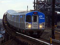 | |
|---|---|---|
| Stations | ||
| Infrastructure | ||
| Historical | ||
| Related | ||