Woodlands County
| Woodlands County | |
|---|---|
| Municipal district | |
|
Welcome sign | |
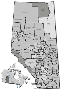 Location of Woodlands County in Alberta | |
| Coordinates: 54°08′34″N 115°41′7″W / 54.14278°N 115.68528°WCoordinates: 54°08′34″N 115°41′7″W / 54.14278°N 115.68528°W | |
| Country |
|
| Province |
|
| Region | Central Alberta |
| Census division | No. 13 |
| Established | 1994 |
| Incorporated | 1999 (County) |
| Government[1] | |
| • Mayor | Jim Rennie |
| • Governing body | Woodlands County Council |
| • Office location | adjacent to Whitecourt |
| Area (2011)[2] | |
| • Total | 7,668.31 km2 (2,960.75 sq mi) |
| Population (2011)[2] | |
| • Total | 4,306 |
| • Density | 0.6/km2 (2/sq mi) |
| • Dwellings | 1,667 |
| Time zone | MST (UTC-7) |
| Website |
woodlands |

Woodlands County is a municipal district in north-central Alberta, Canada. Located in Census Division No. 13, its municipal office is located outside but adjacent to the Town of Whitecourt. A second municipal office is located in the Hamlet of Fort Assiniboine.[3]
Demographics

In the 2011 Census, Woodlands County had a population of 4,306 living in 1,602 of its 1,753 total dwellings, a 3.6% change from its 2006 population of 4,158. With a land area of 7,668.31 km2 (2,960.75 sq mi), it had a population density of 0.6/km2 (1.5/sq mi) in 2011.[2]
In 2006, Woodlands County had a population of 4,158 living in 1,667 dwellings, an 8.9% increase from 2001. The municipal district has a land area of 7,668.11 km2 (2,960.67 sq mi) and a population density of 0.5/km2 (1.3/sq mi).[4]
In 2001, the municipal district had a population of 3,818 in 1,448 dwellings, a 3.2% increase from 1996. On a surface of 7,668.12 km² it had a density of 0.5 inhabitants/km².[5]
Communities and localities
The following urban municipalities are surrounded by Woodlands County:[6]
The following localities are located within Woodlands County:[7]
- Localities
|
|
See also
References
- ↑ Alberta Municipal Affairs: Municipal Officials Search
- 1 2 3 "Population and dwelling counts, for Canada, provinces and territories, and census subdivisions (municipalities), 2011 and 2006 censuses (Alberta)". Statistics Canada. 2012-02-08. Retrieved 2012-02-08.
- ↑ Woodlands County (2010-10-09). "General Contacts".
- ↑ Statistics Canada. "Canada 2006 Census: Woodlands County - Community Profile". Retrieved 2007-06-11.
- ↑ Woodlands County community profile - Statistics Canada. 2002. 2001 Community Profiles. Released June 27, 2002. Last modified: 2005-11-30. Statistics Canada Catalogue no. 93F0053XIE
- 1 2 "Specialized and Rural Municipalities and Their Communities" (PDF). Alberta Municipal Affairs. 2012-03-01. Retrieved 2012-08-12.
- ↑ "Standard Geographical Classification (SGC) 2006, Economic Regions: 4813029 - Woodlands County, geographical codes and localities, 2006". Statistics Canada. 2010-03-05. Retrieved 2012-08-12.
External links
| Wikimedia Commons has media related to Woodlands County, Alberta. |

| Subdivisions | |||||||||||
|---|---|---|---|---|---|---|---|---|---|---|---|
| Communities | |||||||||||
| Cities and urban service areas | |||||||||||
| Rural municipalities |
| ||||||||||
| Specialized municipalities | |||||||||||
| |||||||||||