Wingfield, Bedfordshire
| Wingfield | |
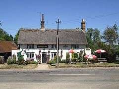 The Plough Inn public house |
|
 Wingfield |
|
| OS grid reference | TL000262 |
|---|---|
| Civil parish | Chalgrave |
| Unitary authority | Central Bedfordshire |
| Ceremonial county | Bedfordshire |
| Region | East |
| Country | England |
| Sovereign state | United Kingdom |
| Post town | LEIGHTON BUZZARD |
| Postcode district | LU7 |
| Dialling code | 01525 |
| Police | Bedfordshire |
| Fire | Bedfordshire and Luton |
| Ambulance | East of England |
| EU Parliament | East of England |
| UK Parliament | South West Bedfordshire |
|
|
Coordinates: 51°55′33″N 0°32′48″W / 51.92595°N 0.54674°W
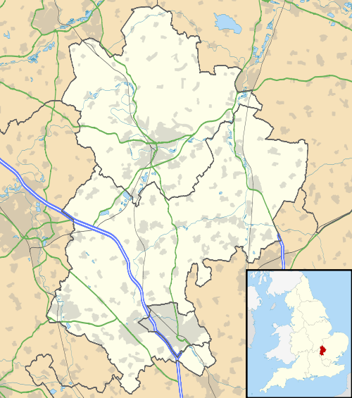
Wingfield is a hamlet located in the Central Bedfordshire district of Bedfordshire, England.
The settlement is close to Tebworth and Chalgrave (where the 2011 Census population was included), with the nearest town being Houghton Regis.
Wingfield forms part of the Chalgrave civil parish, and is home to The Plough Inn public house.
The Icknield Way Path passes through the village on its 110 mile journey from Ivinghoe Beacon in Buckinghamshire to Knettishall Heath in Suffolk. The Icknield Way Trail, a multi-user route for walkers, horse riders and off-road cyclists also passes through the village.
Wingfield is part of the ward of 'Heath and Reach' which sends a Councillor to Central Bedfordshire Council. The ward includes the villages of Heath and Reach, Hockliffe, Eggington, Stanbridge, Tilsworth, Tebworth, and Wingrave. The ward was created in 2011 and has since been represented by Councillor Mark Versallion.