Whitfield County, Georgia
| Whitfield County, Georgia | |
|---|---|
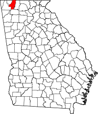 Location in the U.S. state of Georgia | |
 Georgia's location in the U.S. | |
| Founded | December 30, 1851 |
| Seat | Dalton |
| Largest city | Dalton |
| Area | |
| • Total | 291 sq mi (754 km2) |
| • Land | 290 sq mi (751 km2) |
| • Water | 0.6 sq mi (2 km2), 0.2% |
| Population | |
| • (2010) | 102,599 |
| • Density | 353/sq mi (136/km²) |
| Congressional district | 14th |
| Time zone | Eastern: UTC-5/-4 |
| Website |
www |
Whitfield County is a county located in the northwestern part of the U.S. state of Georgia. As of the 2010 census shows a population of 102,599.[1] The county seat is Dalton.[2] The county was created on December 30, 1851.
Whitfield County is part of the Dalton, Georgia Metropolitan Statistical Area, which is also included in the Chattanooga-Cleveland-Dalton, TN-GA-AL Combined Statistical Area.
History
During the Civil War, the men of Whitfield County answered the call to enlist in the Confederate Army. The following units were raised in Whitfield County.
- 2nd Regiment, Georgia Infantry, Company H, Whitfield Infantry
- 2nd Regiment, Georgia Infantry, Company H, Georgia Volunteers
- 34th Regiment, Georgia Infantry, Company A, Fitzgerald Rifles
- 36th Regiment, Georgia Infantry (Glenn), Company B
- 36th Regiment, Georgia Infantry (Glenn), Company C
- 36th Regiment, Georgia Infantry (Glenn), Company G
- 36th Regiment, Georgia Infantry (Glenn), Company H
- 36th Regiment, Georgia Infantry (Glenn), Company I
- 39th Regiment, Georgia Infantry, Company C, Wells Guards
- 60th Regiment, Georgia Infantry, Company B, Fannin Guards
- 60th Regiment, Georgia Infantry, Company C, Walker Independents
- 60th Regiment, Georgia Infantry, Company D, Whitfield Volunteers
- 60th Regiment, Georgia Infantry, Company E, Bartow Avengers
- 60th Regiment, Georgia Infantry, Company F, Gilmer Volunteers
- 1st Regiment Georgia State Guards, "Tunnel Hill Guards" Commanded by Captain Rev. Hamiliton Young (Home Guard Unit)
- "Dalton Machine Guards" Commanded by Captain James H. Bard (Home Guard Unit)
Several engagements took place in and around Whitfield County including:
- Battle of Varnell's Station: May 9, 1864; Skirmish: May 7, 1864
- Battle of Buzzards Roost/Rocky Face Ridge: May 7–13, 1864; October 13–14, 1864
- Battle of Dug Gap: May 8, 1864
- Battle of Nickajack Gap: March 9, 1864; May 7, 1864
- Battle of Dalton I: February 22–27, 1864
- Battle of Dalton II: August 14–15, 1864
- Battle of Resaca: May 13–15, 1864
- Skirmish at Dalton: January 1, 1864; November 30, 1864; December 5, 1864; March 14, 1865
- Affair at Dalton: March 13, 1865
- Skirmishes at Tunnel Hill: September 11, 1863; January 28, 1864; February 23, 24-25 1864; May 5–7, 1864; March 3, 1865
- Battle of Tilton: October 13, 1864; Skirmish: May 13, 1864
- Skirmish near Trickum's Crossroads: October 27, 1864
- Skirmish at Buzzard's Roost: April 22, 1865
Geography
According to the U.S. Census Bureau, the county has a total area of 291 square miles (750 km2), of which 290 square miles (750 km2) is land and 0.6 square miles (1.6 km2) (0.2%) is water.[3] The majority of Whitfield County is located in the Conasauga River sub-basin in the ACT River Basin (Coosa-Tallapoosa River Basin), with a part of the western edge of the county is located in the Middle Tennessee-Chickamauga sub-basin of the Middle Tennessee-Hiwassee basin. A very small portion of the southern edge of the county is located in the Oostanaula River sub-basin in the larger ACT River Basin.[4]
Major highways
-
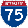 Interstate 75
 -
 U.S. Route 41
 -
 U.S. Route 76
 -
 State Route 2
 -
 State Route 3
 -
 State Route 3 Connector
 -
 State Route 52
 -
 State Route 71
 -
 State Route 201
 -
 State Route 286
 -
 State Route 401 (unsigned designation for I-75)
Adjacent counties
- Bradley County, Tennessee (north)
- Murray County (east)
- Gordon County (south)
- Walker County (west-southwest)
- Catoosa County (west-northwest)
- Hamilton County, Tennessee (northwest)
National protected area
Demographics
| Historical population | |||
|---|---|---|---|
| Census | Pop. | %± | |
| 1860 | 10,047 | — | |
| 1870 | 10,117 | 0.7% | |
| 1880 | 11,900 | 17.6% | |
| 1890 | 12,916 | 8.5% | |
| 1900 | 14,509 | 12.3% | |
| 1910 | 15,934 | 9.8% | |
| 1920 | 16,897 | 6.0% | |
| 1930 | 20,808 | 23.1% | |
| 1940 | 26,105 | 25.5% | |
| 1950 | 34,432 | 31.9% | |
| 1960 | 42,109 | 22.3% | |
| 1970 | 55,108 | 30.9% | |
| 1980 | 65,789 | 19.4% | |
| 1990 | 72,462 | 10.1% | |
| 2000 | 83,525 | 15.3% | |
| 2010 | 102,599 | 22.8% | |
| Est. 2015 | 104,216 | [5] | 1.6% |
| U.S. Decennial Census[6] 1790-1960[7] 1900-1990[8] 1990-2000[9] 2010-2013[1] | |||
2000 census
As of the 2000 Census, there were 29,385 households out of which 36.80% had children under the age of 18 living with them, 59.50% were married couples living together, 10.80% had a female householder with no husband present, and 24.60% were non-families. 20.60% of all households were made up of individuals and 8.20% had someone living alone who was 65 years of age or older. The average household size was 2.82 and the average family size was 3.24.
In the county the population was spread out with 27.30% under the age of 18, 10.00% from 18 to 24, 30.80% from 25 to 44, 21.50% from 45 to 64, and 10.30% who were 65 years of age or older. The median age was 33 years. For every 100 females there were 101.30 males. For every 100 females age 18 and over, there were 98.90 males.
The median income for a household in the county was $39,377, and the median income for a family was $44,652. Males had a median income of $30,122 versus $23,709 for females. The per capita income for the county was $18,515. About 8.60% of families and 11.50% of the population were below the poverty line, including 12.70% of those under age 18 and 11.70% of those age 65 or over.
2010 census
As of the 2010 United States Census, there were 102,599 people, 35,180 households, and 26,090 families residing in the county.[10] The population density was 353.2 inhabitants per square mile (136.4/km2). There were 39,899 housing units at an average density of 137.4 per square mile (53.1/km2).[11] The racial makeup of the county was 76.6% white, 3.7% black or African American, 1.3% Asian, 0.6% American Indian, 0.1% Pacific islander, 15.0% from other races, and 2.6% from two or more races. Those of Hispanic or Latino origin made up 31.6% of the population.[10] In terms of ancestry, 12.1% were American, 11.0% were Irish, 8.4% were English, and 7.5% were German.[12]
Of the 35,180 households, 41.4% had children under the age of 18 living with them, 54.4% were married couples living together, 13.4% had a female householder with no husband present, 25.8% were non-families, and 21.4% of all households were made up of individuals. The average household size was 2.89 and the average family size was 3.36. The median age was 34.0 years.[10]
The median income for a household in the county was $42,345 and the median income for a family was $48,991. Males had a median income of $34,150 versus $27,315 for females. The per capita income for the county was $19,780. About 15.6% of families and 19.2% of the population were below the poverty line, including 26.7% of those under age 18 and 13.8% of those age 65 or over.[13]
Education
Whitfield County Schools
High Schools
- Coahulla Creek High School
- Northwest Whitfield High School
- Southeast Whitfield High School
- Whitfield County Career Academy
Middle Schools
- Eastbrook Middle School
- New Hope Middle School
- North Whitfield Middle School
- Valley Point Middle School
- Westside Middle School
Elementary Schools
- Antioch Elementary School
- Beaverdale Elementary School
- Cedar Ridge Elementary School
- Cohutta Elementary School
- Dawnville Elementary School
- Dug Gap Elementary School
- Eastside Elementary School
- New Hope Elementary School
- Pleasant Grove Elementary School
- Tunnel Hill Elementary School
- Valley Point Elementary School
- Varnell Elementary School
- Westside Elementary School
Private Schools
- Cedar Valley Christian Academy
- Christian Heritage School
- Learning Tree School
Alternative Schools
- Crossroads Academy
- Phoenix High School
Communities
See also
References
- 1 2 "State & County QuickFacts". United States Census Bureau. Retrieved June 27, 2014.
- ↑ "Find a County". National Association of Counties. Retrieved 2011-06-07.
- ↑ "US Gazetteer files: 2010, 2000, and 1990". United States Census Bureau. 2011-02-12. Retrieved 2011-04-23.
- ↑ "Georgia Soil and Water Conservation Commission Interactive Mapping Experience". Georgia Soil and Water Conservation Commission. Retrieved 2015-11-19.
- ↑ "County Totals Dataset: Population, Population Change and Estimated Components of Population Change: April 1, 2010 to July 1, 2015". Retrieved July 2, 2016.
- ↑ "U.S. Decennial Census". United States Census Bureau. Retrieved June 27, 2014.
- ↑ "Historical Census Browser". University of Virginia Library. Retrieved June 27, 2014.
- ↑ "Population of Counties by Decennial Census: 1900 to 1990". United States Census Bureau. Retrieved June 27, 2014.
- ↑ "Census 2000 PHC-T-4. Ranking Tables for Counties: 1990 and 2000" (PDF). United States Census Bureau. Retrieved June 27, 2014.
- 1 2 3 "DP-1 Profile of General Population and Housing Characteristics: 2010 Demographic Profile Data". United States Census Bureau. Retrieved 2015-12-30.
- ↑ "Population, Housing Units, Area, and Density: 2010 - County". United States Census Bureau. Retrieved 2015-12-30.
- ↑ "DP02 SELECTED SOCIAL CHARACTERISTICS IN THE UNITED STATES – 2006-2010 American Community Survey 5-Year Estimates". United States Census Bureau. Retrieved 2015-12-30.
- ↑ "DP03 SELECTED ECONOMIC CHARACTERISTICS – 2006-2010 American Community Survey 5-Year Estimates". United States Census Bureau. Retrieved 2015-12-30.
External links
- http://whitfieldga.genealogyvillage.com/ Whitfield County Genealogy & History
 |
Hamilton County, Tennessee | Bradley County, Tennessee | Bradley County, Tennessee | |
| Catoosa County | |
Murray County | ||
| ||||
| | ||||
| Walker County | Gordon County | Murray County |
Municipalities and communities of Whitfield County, Georgia, United States | ||
|---|---|---|
| Cities | | |
| Town | ||
| Unincorporated community | ||
Template:Georgia
Coordinates: 34°48′N 84°58′W / 34.80°N 84.97°W