Wheaton, Maryland
| Wheaton, Maryland | |
|---|---|
| Census-designated place | |
|
Welcome sign | |
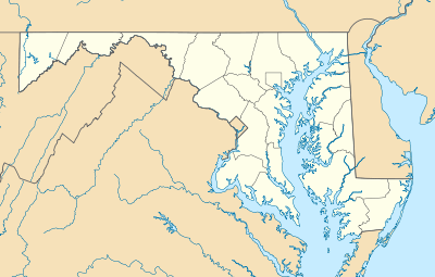 Wheaton, Maryland Location of Wheaton, Maryland | |
| Coordinates: 39°02′57″N 77°03′26″W / 39.04917°N 77.05722°WCoordinates: 39°02′57″N 77°03′26″W / 39.04917°N 77.05722°W[1] | |
| Country |
|
| State |
|
| County |
|
| Area[2] | |
| • Land | 6.90 sq mi (17.9 km2) |
| Elevation[1] | 387 ft (118 m) |
| Population (2010)[2] | |
| • Total | 48,284 |
| • Density | 6,997.7/sq mi (2,701.8/km2) |
| Time zone | Eastern (EST) (UTC-5) |
| • Summer (DST) | EDT (UTC-4) |
| FIPS code | 24-83775 |
| GNIS feature ID | 2652342 |
Wheaton is a census-designated place in Montgomery County, Maryland, USA, north of Washington, D.C., northwest of Silver Spring. Wheaton takes its name from Frank Wheaton (1833–1903), a career officer in the United States Army and volunteer from Rhode Island in the Union Army who rose to the rank of major-general while serving before, during, and after the American Civil War.
Wheaton was split into its own CDP by the United States Census Bureau for the 2010 Census, which found its population to be 48,284.[2] The United States Postal Service has assigned ZIP code 20902 to Wheaton, but the Wheaton Post Office is part of the Silver Spring area. Downtown Wheaton can be found at the intersections of Veirs Mill Road (Md. Rt. 586), University Boulevard (Md. Rt. 193), and Georgia Avenue (Md. Rt. 97).
History
The Three Great Roads
Wheaton developed from Leesborough (named in 1826), a small business district which popped near the junction of three major roads: The first is Brookeville Pike (also known as the "Washington-Brookeville Pike" and later as the "Union Turnpike", now MD Route 97, Georgia Ave) a north/south toll thoroughfare running from Washington, DC to Brookeville, Maryland and eventually to Baltimore, Maryland.
The second road, Veirs Mill Road (MD Route 586, named after a grist and sawmill built on Rock Creek by Samuel Clark Veirs in 1838[3]), was one portion of a much longer thoroughfare connecting westwards to Rockville, Maryland and thence towards the Potomac River and subsequently to Virginia via ferry crossings. This was also known as the "City Road" in Rockville, and around the time of the American Civil War it was known also as the "New Cut Road."[4][5]
The last of these roads was known as Old Bladensburg Road (now MD Route 193, University Boulevard) which, as it does in present day, connected Georgetown, Bethesda, Chevy Chase, Kensington, Wheaton, Silver Spring, and Bladensburg.[6]
Mitchell's Crossroads
The business district subsequently became known as Mitchell's Crossroads in the 1860s referring to Mitchell's Tavern which was located at northeast corner of Union Turnpike (renamed from Brookeville Pike) and Old Bladensburg Road. Mitchell's Tavern was thought to be over 100 years old in 1865 and stood until 1940 when it was destroyed by a fire.[6]
Wheaton's first modern post office opened in 1947; earlier records show that the post office had used the name Leesborough, from about 1826. After the Civil War, the area's first postmaster was George F. Plyer.[7] Plyer renamed the post office in honor of General Frank Wheaton in October 1869.[7] General Wheaton successfully led a division to defend Washington, D.C., from an invasion by Confederate General Jubal Early at the Battle of Fort Stevens in 1864.[6][8][9]
Demographic shifts
In the 1950s the area was developed with Cape Cod, ranch houses, and split level homes owned by white, largely blue collar, families. Now, more of the aging housing stock is owned or rented by a diverse population. This table shows the subsequent shift in demographics:[10]
| Year | White | Hispanic | Asian | Black | Multiracial |
|---|---|---|---|---|---|
| 1990 | 61% | 13% | 10% | 15% | [10] |
| 2000 | 38% | 29% | 12% | 17% | 6% |
| 2010 | 26% | 42% | 12% | 18% | 5% |
Between 2000 and 2010, Wheaton's Hispanic population has increased from 29% to 42%. Since the collapse of the housing market, and more specifically between 2010 and 2015, a reverse in the area's demographic makeup has occurred with a large influx of White and multi-racial young professional families into the area in search of affordable single family housing along the metro line.
Features

Wheaton is home to the Wheaton Regional Park, which includes a nature center; riding stables; dog park; a picnic area with carousel and miniature train; an athletic complex with indoor tennis, ice rink, in-line skating rink, and ball fields; and Brookside Gardens, Montgomery County's award-winning 50-acre (200,000-m²) public display garden. Much of Wheaton was developed in the 1950s. In the 1960s its shopping center, Wheaton Plaza (now known as Westfield Wheaton), was the largest in the Maryland suburbs of Washington, D.C. Wheaton is also home to the Wheaton Regional Public Library. The library closed on March 13, 2016 and will be replaced in the summer of 2018 by the combined Wheaton Library and Community Recreation Center. At the closing, it was announced that an interim library will be housed in the ballroom of the Wheaton Volunteer Rescue Squad across the street from the library. The Wheaton Volunteer Rescue Squad is one of the busiest (11,000 calls in 2007) predominantly volunteer fire departments in Montgomery County. The diversity of the neighborhood is reflected by the high concentration of various ethnic restaurants located in Wheaton, as well as in the composition of the student body of Wheaton High School (school website), part of the Montgomery County Public Schools (MCPS website) and located near the intersection of Connecticut Avenue and Randolph Road.
It is served by the Red Line of the Washington Metro system. Spanning 508 feet (155m), the Wheaton Metro station has the longest escalator in the Western Hemisphere.[11][12]
Since Wheaton has the highest location in the Washington, DC area, it was also the home of the first television license in the United States. Using the call sign W3XK, Charles Francis Jenkins began broadcasting from his home at the corner of Windham Lane and Georgia Ave.[6][13] starting on July 2, 1928.[14]
Designation as a Maryland Arts and Entertainment District
Wheaton has been designated by the State of Maryland as an Arts and Entertainment District, joining Silver Spring and Bethesda as the third district in Montgomery County to receive the distinction. The Arts and Entertainment District designation provides artists working in that area with an income tax break. Developers who create spaces for artists to live and work can be exempt from paying certain property taxes on the value of the renovations for up to 10 years. Designated districts are exempt from admissions and amusement taxes. [15]
Points of interest

- Brookside Gardens
- The Gilchrist Center for Cultural Diversity - Named after former Montgomery County Executive Charles W. Gilchrist, opened Sept. 8th 2001, it provides services to an increasing immigrant population in Montgomery County.
- Wheaton Regional Park
- Westfield Wheaton (formerly Wheaton Plaza)
- Wheaton Youth Center
- Ana G. Méndez University System
- Wheaton (WMATA station)
References
- 1 2 "Wheaton Census Designated Place". Geographic Names Information System. United States Geological Survey. Retrieved 2014-04-01.
- 1 2 3 "Wheaton CDP Quickfacts". US Census Bureau.
- ↑ Historical Marker Database
- ↑ Civil War Defenses of Washington Chapter VII
- ↑ The History Of Montgomery County, Maryland, From Its Earliest Settlement In 1650 to 1879 (Boyd, T. H. S.)
- 1 2 3 4 A History of Wheaton (Discover Wheaton), Montgomery County Government
- 1 2 "Town Named After Leader in Civil War". The Washington Post. p. C2.
- ↑ "ARMY CORPS HISTORY: Brilliant Records of the Fifth, Sixth, and Seventh. The Washington Post. September 15, 1902. p. 4.
- ↑ "Gen. Wheaton is Dead: Won His Rank Through Bravery in Battle". The Washington Post June 19, 1903. p. 9.
- 1 2 Schulte, Brigid (February 15, 2011). "Wheaton seeks bridge across cultures". Washington Post. p. B1.
- ↑ The Five Longest Rides. The Washington Post. 2005-06-03. Retrieved 2007-12-11.
- ↑ Carroll, Caitlin. What's the deal with... the Wheaton Metro station escalator? The GW Hatchet. 2005-09-19. Retrieved 2008-06-15.
- ↑ The FCC: Seventy-six Years of Watching TV
- ↑ W3XK -- America's first television station
- ↑ Wheaton Designated Arts and Entertainment District by State, Montgomery County Government News Release
External links
| Wikivoyage has a travel guide for Wheaton. |
- Brookside Gardens
- Montgomery Art Association
- Wheaton Regional Park
- The Gilchrest Center for Cultural Diversity
- Wheaton Hills Civic Association
- Wheaton Library and Community Recreation Center
Municipalities and communities of Montgomery County, Maryland, United States | ||
|---|---|---|
| Cities |  | |
| Towns | ||
| Villages & Special Tax Districts | ||
| CDPs |
| |
| Unincorporated communities | ||
| Footnotes | ‡This populated place also has portions in an adjacent county or counties | |