Wetlet
| Wetlet ဝက်လက် | |
|---|---|
 Wetlet Location in Burma | |
| Coordinates: 22°22′28″N 95°47′28″E / 22.37444°N 95.79111°ECoordinates: 22°22′28″N 95°47′28″E / 22.37444°N 95.79111°E | |
| Country |
|
| Region | Sagaing Region |
| District | Shwebo District |
| Township | Wetlet Township |
| Elevation | 84 m (278 ft) |
| Time zone | MST (UTC+6.30) |
Wetlet (Burmese: ဝတ်လတ်) is a town in Shwebo District, Sagaing Division in Myanmar. It is the administrative seat for Wetlet Township. The town of Wetlet is located in the center of Wetlet Township, about halfway between the Mu River and the Irrawaddy. Wetlet is on the main Burmese north-south railroad between Sagaing and Shwebo.[1]
History
Wetlet originated as a staging area during the building of the railroad in the late 1800s. A well was dug to provide water for the steam engines, and a small market developed around Wetlet station. Because of its central location, and direct rail access, Wetlet became the leading town in the area.
Notes
- ↑ "Map of Sagaing Division" Myanmar's NET
External links
Capital: Sagaing | ||
| Hkamti District |  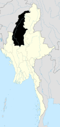 | |
| Kale District | ||
| Katha District | ||
| Mawlaik District | ||
| Monywa District | ||
| Sagaing District | ||
| Shwebo District | ||
| Tamu District | ||
| Yinmabin District | ||
| Naga Self-Administered Zone | ||
This article is issued from Wikipedia - version of the 2/13/2016. The text is available under the Creative Commons Attribution/Share Alike but additional terms may apply for the media files.