West Twyford
Coordinates: 51°32′17″N 0°17′03″W / 51.538026°N 0.284252°W
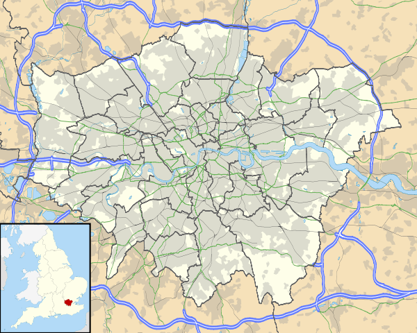
West Twyford (also known as Twyford Abbey)[1] is a small residential area located in the northeastern corner of Ealing, London, northeast of Hanger Lane station and north of Park Royal, within the London Borough of Ealing. It was historically an extra-parochial area, and later civil parish, in the county of Middlesex, England.[2] It is the only part of the Ealing district covered by a northwest London postcode, although nearby Park Royal and North Acton, both within the same Borough (Park Royal partly), are also covered by the same postcode.
The area of West Twyford is bounded by the Hanger Lane gyratory to the west, the A406 North Circular and the River Brent to the north, Park Royal to the south and Harlesden to the east.[3] The area immediately north of Lakeside Drive is often regarded as being part of West Twyford, although it is officially a part of Park Royal and located within the London Borough of Brent.
History
The area now known as West Twyford began as a manor house[4] in the fourteenth century. A small community built up to the west around St. Mary's Church which had originally been a chapel belonging to the manor house. In 1901 the Alexian order of Monks took over the manor house as a nursing home. It has since been known as Twyford Abbey. The brothers ran short of funds in 1988 and joined another part of their order in Manchester. [5] The abbey, which is a Grade II listed building, now lies derelict.[6] Various grants for planning permission have been made but not granted. The best view of this beautiful building is from next to St Mary's Church in the wintertime.
The name Twyford relates to Twyford Brook. The brook now runs almost entirely underground. It formerly fed the Guinness brewery in Park Royal.. The word itself 'Twyford' is said to mean 'Two Fords'.
The area became a civil parish under the Extra-Parochial Places Act 1857 and formed part of Greenford Urban District from 1894. In 1901 it occupied an area of 281 acres (1.14 km2) and had a population of 97.[2] When the urban district was abolished in 1926 the parish was transferred to the Municipal Borough of Ealing. Then in 1934 it was transferred to the Municipal Borough of Willesden.[2] The area now forms part of Greater London.
Much of the housing on Twyford Abbey Road was originally built by Guinness in order to house employees working in at the brewery in adjacent Park Royal.. Abbeyfields Close is one such residential development, built in 1984 around a series of communal gardens, on land formerly owned by Guinness, although its name hints that it might have originally been agricultural land forming part of Twford Abbey estate.
The parish of St. Mary's[7] was combined with the parish the church of the ascension in neighbouring Hanger Hill. In the 1950s the chapel of St. Mary's was extended with a new large church building, which later fell into disrepair and disuse, due to safety issues. In 2010 the new church was totally renovated to become a community hall and the original chapel was re-dedicated to St. Mary to become the church again. The church itself is very old and quite tiny, having originally been the chapel of Twyford Abbey, located just behind. St. Mary's churchyard contains one of the oldest headstones in Middlesex..
Transport
Bus route 226 runs through Twyford Abbey Road towards Ealing Central and Golders Green (via Harlesden). Routes 83, 95 and 112 also stop nearby on the Hanger Lane Gyratory and the A406 North Circular Road, respectively. These buses run towards Ealing Hospital (via Ealing Broadway), Shepherd's Bush, Southall and Brent Cross, as well as Golders Green (via Wembley).
West Twyford is close to two London Underground stations:
Amenities
West Twyford is well served for groceries, banking, post office and health services at the nearby 'Park Royal Neighbourhood Centre' where there is also a popular Lebanese Restaurant, a Spice Shack restaurant and Subway cafe. A new building is going up at the moment on Acton Lane next to the Central Middlesex Hospital which will have retail and restaurant space on the ground floor.
For Vue Cinema, Megabowl ten pin bowling, Pure Gym and a choice of about 10 popular chain restaurants there is 'Park Royale', a leisure park immediately to the south of the A40 and West Twyford and accessed by the underpass by Park Royal tube station. The Boden flagship store is located next to Park Royal Tube station.
Education
There is a primary school in West Twyford that caters for children from 3 to 11 years old. It has around 300 pupils on the school roll.
Sport and Leisure
West Twyford Park was formerly called Bodiam Fields, after the area of the same name in Sussex, where hops were grown for the Guinness brewery. There are plans for improvements to West Twyford Park as well as new lakeside walks and cycle paths nearby. The Grand Union Canal runs through West Twyford and provides level pathways alongside for walking a running. It is a short walk along the canalside to the Grand Junction Pub, which has lots of outdoor seating alongside the canal. The pathway continues to Little Venice and Paddington.
Crystals on Twyford Abbey Road is a bar and function room, but also holds Zumba classes in its function room.
Culture and community
There are a number of active community projects in West Twyford, including the 'West Twyford Community and Youth' project and 'West Twyford Children’s Centre'. The latter provides a range of services and activities, including mother and toddler groups, health services, daycare, before and after school clubs, Women into Work and English classes.
St Mary’s Church Community Hall, on Brentmead Gardens provides a range of activities for local people.
Future
West Twyford will soon benefit from a new public plaza with shops, cafes, a restaurant and health and fitness club. There will also be new public play, games and fitness areas in West Twyford Park.[8] There will be an improved pedestrian/cycle route from West Twyford to Park Royal Underground station, and the station itself is also due to be improved.
Update: the public park, walkways two children's playgrounds plus a new games court are all now completed, however the plaza seems to be on hold for the time being.
Flats in the Royal Waterside development (Bodiam Court and Abbey Court) are due to be finished from summer 2015. The additional residents joining West Twyford will help achieve a critical popular threshold, boosting and supporting local amenities, businesses and community ventures.
As of March 2016 The luxury apartments complex known as Royal Waterside remains unfinished although much of the property has been sold to investors and To Let signs are now appearing in the windows, the influx of housing unaffordable to most (there are two more such construction projects in nearby Park Royal) is causing concern to residents as rental costs are already starting to rise with the average rent of a 1 bed flat already exceeding 1,000pcm, this means that the formally relatively cheap area of london due to its industrial nature and lack of amenities which was formerly home to many single and retired people is now becoming populated by families and home shares crammed into small accommodation, (3 or more people in a 1 bed flat) making the area more like others nearby such as Acton and Wembley.
In the Mayor's plans for the Park Royal Opportunity Area, it says that one of their objectives is to get public access to the grounds of Twyford Abbey heritage site.[9]
References
- ↑ Vision of Britain - West Twyford (historic map)
- 1 2 3 West Twyford: Introduction, A History of the County of Middlesex: Volume 7: Acton, Chiswick, Ealing and Brentford, West Twyford, Willesden (1982). Date accessed: 7 January 2008.
- ↑ https://maps.google.com/maps?f=q&source=s_q&hl=en&q=Twyford+Abbey+Rd,+London+NW10,+United+Kingdom&aq=&sll=51.477509,-0.866799&sspn=0.020795,0.038581&gl=uk&g=west+twyford&ie=UTF8&geocode=FQhWEgMdAqn7_w&split=0&hq=&hnear=Twyford+Abbey+Rd,+London+NW10,+United+Kingdom&ll=51.534711,-0.281374&spn=0.010384,0.01929&t=h&z=16
- ↑ Twyford Abbey at Brent Heritage
- ↑ "Alexian Order of Monks". Retrieved 10 January 2016.
- ↑ "Notes on Twyford Abbey at Gathering Dust". Gathering Dust. Retrieved 10 January 2016.]
- ↑ The history of St. Mary's Church West Twyford at British History Online
- ↑ "First Central Park Royal". Archived from the original on 31 October 2013.
- ↑ "Park Royal Document" (PDF). Archived from the original (PDF) on 26 September 2013. Retrieved 26 December 2015.