Welke Airport
| Welke Airport | |||||||||||||||
|---|---|---|---|---|---|---|---|---|---|---|---|---|---|---|---|
| IATA: none – ICAO: none – FAA LID: 6Y8 | |||||||||||||||
| Summary | |||||||||||||||
| Airport type | Public | ||||||||||||||
| Owner | Paul Welke | ||||||||||||||
| Serves | Beaver Island, Michigan | ||||||||||||||
| Elevation AMSL | 664 ft / 202 m | ||||||||||||||
| Coordinates | 45°43′16″N 085°31′13″W / 45.72111°N 85.52028°WCoordinates: 45°43′16″N 085°31′13″W / 45.72111°N 85.52028°W | ||||||||||||||
| Map | |||||||||||||||
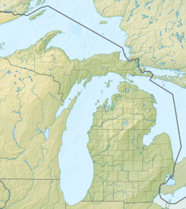 6Y8  6Y8 Location of airport in Michigan/United States | |||||||||||||||
| Runways | |||||||||||||||
| |||||||||||||||
| Statistics (2009) | |||||||||||||||
| |||||||||||||||
Welke Airport (FAA LID: 6Y8) is a privately owned public use airport located on Beaver Island in Charlevoix County, Michigan, United States.[1] Scheduled passenger service to Charlevoix Municipal Airport in Charlevoix, Michigan is provided by Island Airways.
As per Federal Aviation Administration records, the airport had 16,542 passenger boardings (enplanements) in calendar year 2008,[2] 11,976 enplanements in 2009, and 13,558 in 2010.[3] It is included in the Federal Aviation Administration (FAA) National Plan of Integrated Airport Systems for 2017–2021, in which it is categorized as a non primary commercial service facility.[4]
Facilities and aircraft
Welke Airport covers an area of 200 acres (81 ha) at an elevation of 664 feet (202 m) above mean sea level. It has two runways: 9/27 is 2,512 by 30 feet (766 x 9 m) with an asphalt surface and 17/35 is 3,500 by 140 feet (1,067 x 43 m) with a turf surface.[1]
For the 12-month period ending December 31, 2009, the airport had 23,450 aircraft operations, an average of 64 per day: 78% general aviation and 22% air taxi. At that time there were 12 aircraft based at this airport: 83% single-engine and 17% multi-engine.[1]
Airline and destination
The following airline offers scheduled passenger service at this airport:
| Airlines | Destinations |
|---|---|
| Island Airways | Charlevoix |
References
- 1 2 3 4 FAA Airport Master Record for 6Y8 (Form 5010 PDF). Federal Aviation Administration. Effective April 5, 2012.
- ↑ "Enplanements for CY 2008" (PDF, 1.0 MB). CY 2008 Passenger Boarding and All-Cargo Data. Federal Aviation Administration. December 18, 2009. External link in
|work=(help) - ↑ "Enplanements for CY 2010" (PDF, 189 KB). CY 2010 Passenger Boarding and All-Cargo Data. Federal Aviation Administration. October 4, 2011. External link in
|work=(help) - ↑ "List of NPIAS Airports" (PDF). FAA.gov. Federal Aviation Administration. 21 October 2016. Retrieved 23 November 2016.
External links
- Island Airways
- "Welke Airport (6Y8)" (PDF). (37.4 KB) at Michigan Airport Directory
- Aerial image as of May 1999 from USGS The National Map
- Resources for this airport:
- FAA airport information for 6Y8
- AirNav airport information for 6Y8
- FlightAware airport information and live flight tracker
- SkyVector aeronautical chart for 6Y8