Waseca, Minnesota
| Waseca, Minnesota | |
|---|---|
| City | |
|
State Street in downtown Waseca in 2007 | |
 Location of Waseca within Waseca County and state of Minnesota | |
| Coordinates: 44°4′44″N 93°30′23″W / 44.07889°N 93.50639°W | |
| Country | United States |
| State | Minnesota |
| County | Waseca |
| Government | |
| • Type | Mayor – Council |
| • Mayor | John Clemons |
| Area[1] | |
| • Total | 5.19 sq mi (13.44 km2) |
| • Land | 4.00 sq mi (10.36 km2) |
| • Water | 1.19 sq mi (3.08 km2) |
| Elevation | 1,152 ft (351 m) |
| Population (2010)[2] | |
| • Total | 9,410 |
| • Estimate (2012[3]) | 9,434 |
| • Density | 2,352.5/sq mi (908.3/km2) |
| Time zone | Central (CST) (UTC-6) |
| • Summer (DST) | CDT (UTC-5) |
| ZIP code | 56093 |
| Area code(s) | 507 |
| FIPS code | 27-68296 |
| GNIS feature ID | 0653793[4] |
| Website | www.ci.waseca.mn.us |


Waseca is a city in Waseca County, Minnesota, United States. The population was 9,410 at the 2010 census.[5] It is the county seat.[6]
Transportation
U.S. Highway 14 and Minnesota Highway 13 are two of the main routes in the city. U.S. Highway 14 runs as an east–west freeway bypass just south of the city, while Minnesota Highway 13 passes through the city as State Street, running north–south.
Geography
According to the United States Census Bureau, the city has a total area of 5.19 square miles (13.44 km2); 4.00 square miles (10.36 km2) is land and 1.19 square miles (3.08 km2) is water.[1]
Demographics
| Historical population | |||
|---|---|---|---|
| Census | Pop. | %± | |
| 1870 | 551 | — | |
| 1880 | 1,708 | 210.0% | |
| 1890 | 2,482 | 45.3% | |
| 1900 | 3,103 | 25.0% | |
| 1910 | 3,054 | −1.6% | |
| 1920 | 3,908 | 28.0% | |
| 1930 | 3,815 | −2.4% | |
| 1940 | 4,270 | 11.9% | |
| 1950 | 4,927 | 15.4% | |
| 1960 | 5,898 | 19.7% | |
| 1970 | 6,789 | 15.1% | |
| 1980 | 8,219 | 21.1% | |
| 1990 | 8,385 | 2.0% | |
| 2000 | 8,493 | 1.3% | |
| 2010 | 9,410 | 10.8% | |
| Est. 2015 | 9,241 | [7] | −1.8% |
| U.S. Decennial Census 2011 estimate | |||
2010 census
As of the census[2] of 2010, there were 9,410 people, 3,504 households, and 2,150 families residing in the city. The population density was 2,352.5 inhabitants per square mile (908.3/km2). There were 3,818 housing units at an average density of 954.5 per square mile (368.5/km2). The racial makeup of the city was 89.0% White, 3.7% African American, 1.5% Native American, 1.0% Asian, 2.3% from other races, and 2.5% from two or more races. Hispanic or Latino of any race were 9.0% of the population.
There were 3,504 households of which 30.9% had children under the age of 18 living with them, 44.7% were married couples living together, 11.7% had a female householder with no husband present, 5.0% had a male householder with no wife present, and 38.6% were non-families. 32.9% of all households were made up of individuals and 13.8% had someone living alone who was 65 years of age or older. The average household size was 2.33 and the average family size was 2.95.
The median age in the city was 36.5 years. 22.5% of residents were under the age of 18; 8.3% were between the ages of 18 and 24; 30.1% were from 25 to 44; 25.5% were from 45 to 64; and 13.4% were 65 years of age or older. The gender makeup of the city was 42.6% male and 57.4% female.
2000 census
As of the 2000 census, there were 8,493 people, 3,388 households, and 2,219 families residing in the city. The population density was 2,215.6 people per square mile (856.2/km²). There were 3,563 housing units at an average density of 929.5 per square mile (359.2/km²). The racial makeup of the city was 94.24% White, 1.39% African American, 0.35% Native American, 0.58% Asian, 0.05% Pacific Islander, 2.50% from other races, and 0.89% from two or more races. Hispanic or Latino of any race were 5.10% of the population.
The ancestral makeup of the city is 44.6% German, 21.3% Norwegian, 13.2% Irish, 5.2% English, 5.1% Swedish, and 4.6% French.
There were 3,388 households out of which 34.0% had children under the age of 18 living with them, 50.6% were married couples living together, 10.8% had a female householder with no husband present, and 34.5% were non-families. 29.3% of all households were made up of individuals and 11.8% had someone living alone who was 65 years of age or older. The average household size was 2.44 and the average family size was 3.02.
In the city the population was spread out with 27.0% under the age of 18, 9.4% from 18 to 24, 28.7% from 25 to 44, 19.4% from 45 to 64, and 15.6% who were 65 years of age or older. The median age was 36 years. For every 100 females there were 92.6 males. For every 100 females age 18 and over, there were 88.1 males.
The median income for a household in the city was $39,554, and the median income for a family was $49,163. Males had a median income of $35,701 versus $22,837 for females. The per capita income for the city was $18,439. About 6.5% of families and 8.4% of the population were below the poverty line, including 12.5% of those under age 18 and 5.9% of those age 65 or over.
Education
Waseca is home to many schools. The school colors are blue and gold and the school mascot is the Bluejay.
Hartley Elementary School has kindergarten through 3rd grade.[8]
Waseca Intermediate School (WIS),[9] formally Central Immediate School (CIS), name changed starting with the 2012-2013 school year, holds 4th grade through 6th grade.
Also starting with the 2012-2013 school year, Waseca High School (WHS) became the Waseca Junior and Senior High School (WJSHS),[10] housing grades 7 through 12 instead of only 9 through 12, as it was in the past.
The Waseca Alternative High School (WALC),[11] also known as the Alternative Learning Center (ALC), has an alternative learning program for students junior high age through adult.
Sacred Heart School is a private Catholic elementary school, ranging from kindergarten through fourth grade, located in Sacred Heart Catholic Church.[12] Sacred Heart also has a Montessori preschool. There is also another preschool, Hansel & Gretel, which is located at Faith United Methodist Church[13] as well as other preschools such as Waseca County Head Start.
Waseca has a charter school called TEAM Academy,[14] hosting students from kindergarten-6th grade. Until recently, TEAM Academy was sponsored by the Public Schools.
Formerly, Waseca was home to the University of Minnesota Waseca a two-year technical college (before it was converted to the Federal Correctional Institution, Waseca) and the Southern School of Agriculture boarding high school.
Economy
Waseca is home to Quad/Graphics which is the largest magazine printer in the United States.
Waseca is also home to a frozen-vegetable packing plant for Birds Eye brand, owned by Pinnacle Foods.[15]
Waseca is home to the Federal Correctional Institution, Waseca, a low-security federal prison housing female inmates.
Waseca opened a waterpark in June 2007.
Waseca has finished a new bike path that surrounds Clear Lake.
Waseca is home to the Waseca Medical Center, part of the Mayo Health System.
Waseca is home to many parks and lakes, including Clear Lake, Loon Lake, Maplewood Park, Clear Lake Park, Loon Lake Park, Courthouse Park, Blowers Park and many more.
History
Waseca was platted in 1867. The city took its name from Waseca County, Minnesota.[16] A post office has been in operation at Waseca since 1867.[17] Waseca was incorporated as a city in 1881.[18]

On April 30, 1967, Waseca was severely damaged from the 1967 Southern Minnesota tornado outbreak.
17-year-old John David LaDue was charged on May 1, 2014 with 10 attempted murder and explosives counts in a plot to shoot his family to death and then kill himself and "as many students as he could" by blowing up Waseca Junior/Senior High School, [19]
Politics
- Located in Minnesota's 1st congressional district represented by U.S. Representative Tim Walz (DFL).
- Represented in the Minnesota State Senate by Vicki Jensen (DFL), District 24.
- Represented in the Minnesota State House by John Petersburg (R), District 24A.
- The current mayor is John Clemons
Notable people
- Edgar F. Johnson, founder of EF Johnson company radio components & radios.
- D. E. Bowe, member of the Wisconsin State Assembly.
- Gene Glynn, current Minnesota Twins third base coach.
- George Herter, founder of the Herter's outdoor goods business and an author.
- Ray J. Madden, member of the United States House of Representatives.
- Peter McGovern, member of the Minnesota Senate.
- Tim Penny, member of the United States House of Representatives.
- Leroy Shield, Composer, Conductor, Arranger of such works as Little Rascals, Laurel & Hardy,born in Waseca.*
- Reverend E.H. Alden, founding pastor of First Congregational Church of Waseca, made famous in the Laura Ingalls Wilder series "Little House on the Prairie" where he was played by Dabbs Greer in the TV series.
References
- 1 2 "US Gazetteer files 2010". United States Census Bureau. Retrieved 2012-11-13.
- 1 2 "American FactFinder". United States Census Bureau. Retrieved 2012-11-13.
- ↑ "Population Estimates". United States Census Bureau. Retrieved 2013-05-28.
- ↑ "US Board on Geographic Names". United States Geological Survey. 2007-10-25. Retrieved 2008-01-31.
- ↑ "2010 Census Redistricting Data (Public Law 94-171) Summary File". American FactFinder. United States Census Bureau. Retrieved 27 April 2011.
- ↑ "Find a County". National Association of Counties. Retrieved 2011-06-07.
- ↑ "Annual Estimates of the Resident Population for Incorporated Places: April 1, 2010 to July 1, 2015". Retrieved July 2, 2016.
- ↑ http://www.edline.net/pages/Hartley_Elementary_School
- ↑ http://www.edline.net/pages/Waseca_Intermediate_School
- ↑ http://www.edline.net/pages/Waseca_High_School
- ↑ http://www.edline.net/pages/Waseca_Alternative_High_School
- ↑ http://sacredheartschoolwaseca.com/
- ↑ http://www.wasecafaithumc.com/
- ↑ http://www.team.k12.mn.us/pages/Team_Academy
- ↑ http://pinnaclefoods.com/media/detail/pinnacle-foods-group-announces-plans-to-further-improve-supply-chain
- ↑ Chicago and North Western Railway Company (1908). A History of the Origin of the Place Names Connected with the Chicago & North Western and Chicago, St. Paul, Minneapolis & Omaha Railways. p. 135.
- ↑ "Waseca County". Jim Forte Postal History. Retrieved 13 August 2015.
- ↑ Upham, Warren (1920). Minnesota Geographic Names: Their Origin and Historic Significance. Minnesota Historical Society. p. 566.
- ↑ Rook, Suzzane. "Waseca teen planned school massacre, idolized Columbine shooters". http://www.southernminn.com/. External link in
|website=(help)
External links
| Wikimedia Commons has media related to Waseca, Minnesota. |
- Waseca.com - Waseca's Community Connection
- Waseca County News
- City of Waseca Official Website
- Waseca School District Web site
- Waseca Virtual History Museum
- Waseca Weather Page
- First Congregational Church of Waseca
- Christ Community Church of Waseca
- Discover Waseca
Municipalities and communities of Waseca County, Minnesota, United States | ||
|---|---|---|
| Cities | 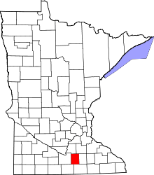 | |
| Townships | ||
| Unincorporated communities | ||
| Footnotes | ‡This populated place also has portions in an adjacent county or counties | |
Coordinates: 44°4′39.36″N 93°30′26.92″W / 44.0776000°N 93.5074778°W