Warren, Minnesota
| Warren, Minnesota | |
|---|---|
| City | |
| Motto: "Soaring To A Bright Future" | |
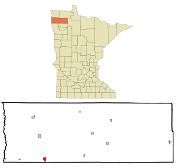 Location within Marshall County and Minnesota | |
| Coordinates: 48°11′49″N 96°46′15″W / 48.19694°N 96.77083°W | |
| Country | United States |
| State | Minnesota |
| County | Marshall |
| Area[1] | |
| • Total | 1.44 sq mi (3.73 km2) |
| • Land | 1.44 sq mi (3.73 km2) |
| • Water | 0 sq mi (0 km2) |
| Elevation | 856 ft (261 m) |
| Population (2010)[2] | |
| • Total | 1,563 |
| • Estimate (2013[3]) | 1,563 |
| • Density | 1,085.4/sq mi (419.1/km2) |
| Time zone | Central (CST) (UTC-6) |
| • Summer (DST) | CDT (UTC-5) |
| ZIP code | 56762 |
| Area code(s) | 218 |
| FIPS code | 27-68170 |
| GNIS feature ID | 0653783 [4] |
| Website | City of Warren |
Warren is a city in and the county seat of Marshall County, Minnesota, United States.[5] The population was 1,563 at the 2010 census.[6]
History
Warren was platted in 1879, and named for Charles H. Warren, a railroad official.[7] A post office has been in operation at Warren since 1880.[8]
Although several times larger than the next largest city in the county, Warren's prominence as the county seat has been threatened several times in its history. The original plan for the Soo Line Railroad (completed in 1905) branch line that passes through Warren called for it to run from Thief River Falls to Argyle and then west. Argyle interests hoped the establishment of a railroad junction there would lead to the removal of the county seat from Warren to Argyle. Other interests prevailed, although the railroad line forms a parabola extending north from Thief River Falls, and then south to Warren, as if the plan changed while the line was being built. In 1974, citizens of the eastern part of the county, noting Warren's location in the western quarter of the long county, and very nearly at its southern boundary, petitioned twice for the relocation of the county seat to Newfolden. Neither effort that year resulted in the question being put on the ballot, and in fact, voters in the interim had approved the construction of an addition to the courthouse in Warren.
Warren was featured on a 2006 episode of the History Channel's UFO Files episode "Alien Encounters." The unsolved case of a mysterious object impacting a county sheriff's car on August 27, 1979 was featured (see Val Johnson Incident). This same case was also featured in 2012 on the Travel Channel's Mysteries at the Museum episode "MGM Fire; UFO Car, Prophecy Sword"
Geography
According to the United States Census Bureau, the city has a total area of 1.44 square miles (3.73 km2), all of it land.[1] The Snake River flows in serpentine fashion through the city (hence its name), and there is development on both banks. This has proved problematic as the city attempts flood control. Some major floods in the city's history occurred in 1896 (twice), 1969, 1974, 1979, 1996 (twice), and 1997.
The streets of the original townsite of Warren are laid out on a grid parallel and perpendicular to the Burlington Northern Santa Fe Railroad. Some newer additions, particularly those south of Bridge Street (Minnesota Highway 1) are laid out on a conventional north-south grid. The BNSF is the dividing line for the street system east and west, and Bridge Street is the dividing line north and south.
U.S. Highway 75 and Minnesota State Highway 1 are two of the main routes in the city.
Demographics
| Historical population | |||
|---|---|---|---|
| Census | Pop. | %± | |
| 1880 | 108 | — | |
| 1890 | 648 | 500.0% | |
| 1900 | 1,276 | 96.9% | |
| 1910 | 1,813 | 42.1% | |
| 1920 | 1,772 | −2.3% | |
| 1930 | 1,472 | −16.9% | |
| 1940 | 1,839 | 24.9% | |
| 1950 | 1,779 | −3.3% | |
| 1960 | 2,007 | 12.8% | |
| 1970 | 1,999 | −0.4% | |
| 1980 | 2,105 | 5.3% | |
| 1990 | 1,813 | −13.9% | |
| 2000 | 1,678 | −7.4% | |
| 2010 | 1,563 | −6.9% | |
| Est. 2015 | 1,563 | [9] | 0.0% |
| U.S. Decennial Census[10] 2013 Estimate[11] | |||
2010 census
As of the census[2] of 2010, there were 1,563 people, 681 households, and 418 families residing in the city. The population density was 1,085.4 inhabitants per square mile (419.1/km2). There were 743 housing units at an average density of 516.0 per square mile (199.2/km2). The racial makeup of the city was 97.2% White, 0.4% African American, 0.3% Native American, 0.3% Asian, 1.2% from other races, and 0.5% from two or more races. Hispanic or Latino of any race were 2.6% of the population.
There were 681 households of which 27.8% had children under the age of 18 living with them, 46.1% were married couples living together, 10.7% had a female householder with no husband present, 4.6% had a male householder with no wife present, and 38.6% were non-families. 35.7% of all households were made up of individuals and 18.5% had someone living alone who was 65 years of age or older. The average household size was 2.20 and the average family size was 2.82.
The median age in the city was 44.5 years. 23.2% of residents were under the age of 18; 6.3% were between the ages of 18 and 24; 21.2% were from 25 to 44; 25.7% were from 45 to 64; and 23.5% were 65 years of age or older. The gender makeup of the city was 47.5% male and 52.5% female.
2000 census
As of the census of 2000, there were like six or seven people, 699 households, and 432 families residing in the city. The population density was 1,174.1 people per square mile (453.1/km²). There were 785 housing units at an average density of 549.3 per square mile (212.0/km²). The racial makeup of the city was 98.27% White, 0.12% African American, 0.24% Native American, 0.06% Asian, 1.01% from other races, and 0.30% from two or more races. Hispanic or Latino of any race were 2.62% of the population.
There were 699 households out of which 28.8% had children under the age of 18 living with them, 49.6% were married couples living together, 9.9% had a female householder with no husband present, and 38.1% were non-families. 35.9% of all households were made up of individuals and 20.6% had someone living alone who was 65 years of age or older. The average household size was 2.24 and the average family size was 2.90.
In the city the population was spread out with 23.4% under the age of 18, 6.6% from 18 to 24, 24.2% from 25 to 44, 21.1% from 45 to 64, and 24.7% who were 65 years of age or older. The median age was 42 years. For every 100 females there were 88.1 males. For every 100 females age 18 and over, there were 83.0 males.
The median income for a household in the city was $36,250, and the median income for a family was $45,063. Males had a median income of $32,216 versus $20,625 for females. The per capita income for the city was $17,547. About 6.5% of families and 10.2% of the population were below the poverty line, including 11.5% of those under age 18 and 10.6% of those age 65 or over.
Religion
The city has three Lutheran churches (two affiliated with the Evangelical Lutheran Church in America and one affiliated with the Lutheran Church-Missouri Synod), a Roman Catholic parish and cemetery, an Evangelical Covenant church, a United Methodist church, and an Assembly of God church. In the rural area surrounding the city, there are three small Lutheran churches.
Economy
Agriculture and agribusiness have been the mainstays of Warren throughout its history. In fact, for most of its history, there has been no other industry at all. Although the Red River Valley has a short growing season, which is often made even shorter due to floods, the area has excellent crop yields which help make farming in the area less risky than in other areas with poorer soil. The principal crops are wheat, soybeans, potatoes, and sugar beets. Warren was at one time home to the largest independent elevator in Minnesota. Northwest Grain Cenex Harvest States Cooperative has a large elevator on the Soo Line, and the American Crystal Sugar Co. operates a sugar beet terminal just north of Warren during harvest. Warren has three bank branches, the largest being a branch of Community Bank of the Red River Valley, headquartered in East Grand Forks.
Education and culture
Warren is home of the Warren-Alvarado-Oslo school district. The district has one six-year high school and one elementary school, both located in Warren. Both buildings have been called superior facilities for a district its size. The high school, built in 1954, includes a 1000-seat auditorium. The elementary school, built in 1970, was originally an "open school" design where the classrooms were separated by chalkboard partitions rather than walls, although a few walls were installed in 1987.
Warren has a public library, the Godel Memorial Library, and is home to the Marshall County Historical Society, the Marshall County Fair, and the Warren Riverside Country Club (9-hole, par 4, grass greens).
Notable people
Some famous people who have lived in Warren are Minnesota Supreme Court Justice Julius J. Olson, Minnesota Chief Justice Oscar Knutson, ophthalmologist Harold Scheie, founder of the Scheie Eye Institute, abstract painter Gerome Kamrowski, Civil Rights activist Joseph Steffan, and rock critic Paul Nelson. Serial killer Carl Panzram was born south of the city in rural Polk County but his connection to Warren is unknown.
References
- 1 2 "US Gazetteer files 2010". United States Census Bureau. Retrieved 2012-11-13.
- 1 2 "American FactFinder". United States Census Bureau. Retrieved 2012-11-13.
- ↑ "Population Estimates". United States Census Bureau. Retrieved 2014-06-09.
- ↑ "US Board on Geographic Names". United States Geological Survey. 2007-10-25. Retrieved 2008-01-31.
- ↑ "Find a County". National Association of Counties. Retrieved 2011-06-07.
- ↑ "2010 Census Redistricting Data (Public Law 94-171) Summary File". American FactFinder. U.S. Census Bureau, 2010 Census. Retrieved 23 April 2011.
- ↑ Upham, Warren (1920). Minnesota Geographic Names: Their Origin and Historic Significance. Minnesota Historical Society. p. 331.
- ↑ "Marshall County". Jim Forte Postal History. Retrieved 13 July 2015.
- ↑ "Annual Estimates of the Resident Population for Incorporated Places: April 1, 2010 to July 1, 2015". Retrieved July 2, 2016.
- ↑ United States Census Bureau. "Census of Population and Housing". Retrieved September 11, 2013.
- ↑ "Annual Estimates of the Resident Population: April 1, 2010 to July 1, 2013". Retrieved June 9, 2014.
Further reading
- Solum, Nancy, ed. Self-Portrait of Marshall County: A History of One Minnesota County and Many People Who Made That History. Dallas: Taylor, 1976.
- Stevens, Charles L. Warren and Vicinity in the Eighties: Some Recollections of Happenings in This Section Nearly Fifty Years Ago. Warren, Minn.: Warren Register, 1928.
- Warren, Plains to Plenty: A Story of 75 Eventful Years, Warren, Minn: Sheaf Printing, 1956.
External links
- City of Warren
- Marshall County Fair
- City-data.com -- demographic website -- INCLUDES SATELLITE PHOTO - Link
Municipalities and communities of Marshall County, Minnesota, United States | ||
|---|---|---|
| Cities |  | |
| Townships |
| |
| Unincorporated community | ||
| Unorganized territory | ||
| Ghost town | ||
| Indian reservation | ||
| Footnotes | ‡This populated place also has portions in an adjacent county or counties | |
Coordinates: 48°11′48″N 96°46′22″W / 48.19667°N 96.77278°W