Wallace, Louisiana
| Wallace | |
| Census-designated place | |
| Country | United States |
|---|---|
| State | Louisiana |
| Parish | St. John the Baptist |
| Elevation | 20 ft (6.1 m) |
| Coordinates | 30°02′26″N 90°39′59″W / 30.04056°N 90.66639°WCoordinates: 30°02′26″N 90°39′59″W / 30.04056°N 90.66639°W |
| Area | 7.6 sq mi (19.7 km2) |
| - land | 6.5 sq mi (17 km2) |
| - water | 1.0 sq mi (3 km2), 13.16% |
| Population | 570 (2000) |
| Density | 87.6/sq mi (33.8/km2) |
| Timezone | CST (UTC-6) |
| - summer (DST) | CDT (UTC-5) |
| Area code | 985 |
 Location of Wallace in Louisiana | |
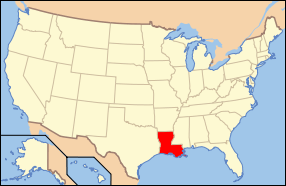 Location of Louisiana in the United States | |
Wallace is a census-designated place (CDP) in St. John the Baptist Parish, Louisiana, United States. The population was 570 at the 2000 census. It is part of the New Orleans–Metairie–Kenner Metropolitan Statistical Area. The rural community is on the west bank of the Mississippi River and easily accessible to Interstate 10 via the Gramercy Bridge.
It is the site of Evergreen Plantation, designated a National Historic Landmark in 1992 in part because of its 22 surviving quarters. It is one of the most complete plantations in the South. Its significance has made it one of the sites on the Louisiana African American Heritage Trail.
Geography
Wallace is located at 30°2′26″N 90°39′59″W / 30.04056°N 90.66639°W (30.040492, -90.666471).[1]
According to the United States Census Bureau, the CDP has a total area of 7.6 square miles (19.6 km²), of which, 6.5 square miles (16.9 km²) of it is land and 1.0 square miles (2.7 km²) of it (13.77%) is water.
Demographics
As of the census[2] of 2000, there were 570 people, 174 households, and 144 families residing in the CDP. The population density was 87.6 people per square mile (33.8/km²). There were 195 housing units at an average density of 30.0 per square mile (11.6/km²). The racial makeup of the CDP was 6.14% White and 93.86% African American. Hispanic or Latino of any race were 0.18% of the population.
There were 174 households out of which 37.4% had children under the age of 18 living with them, 50.6% were married couples living together, 28.2% had a female householder with no husband present, and 16.7% were non-families. 16.1% of all households were made up of individuals and 7.5% had someone living alone who was 65 years of age or older. The average household size was 3.28 and the average family size was 3.70.
In the CDP the population was spread out with 29.3% under the age of 18, 10.5% from 18 to 24, 26.8% from 25 to 44, 23.2% from 45 to 64, and 10.2% who were 65 years of age or older. The median age was 33 years. For every 100 females there were 96.6 males. For every 100 females age 18 and over, there were 87.4 males.
The median income for a household in the CDP was $19,118, and the median income for a family was $25,179. Males had a median income of $31,250 versus $11,250 for females. The per capita income for the CDP was $6,625. About 35.6% of families and 45.5% of the population were below the poverty line, including 51.1% of those under age 18 and 34.7% of those age 65 or over.
Education
St. John the Baptist Parish School Board operates public schools in the community.
Areas in Wallace are zoned to:
Notable people
Wallace was the birthplace of New Orleans jazz musician Ernest "Doc" Paulin (1907–2007) and blues singer Joe Pleasant aka Pleasant Joe and Cousin Joe (1907-1989).
References
- ↑ "US Gazetteer files: 2010, 2000, and 1990". United States Census Bureau. 2011-02-12. Retrieved 2011-04-23.
- ↑ "American FactFinder". United States Census Bureau. Retrieved 2008-01-31.
- ↑ "Attendance Zones." St. John the Baptist Parish School Board.
External links
Municipalities and communities of St. John the Baptist Parish, Louisiana, United States | ||
|---|---|---|
| CDPs | 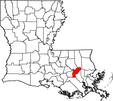 | |
| Unincorporated communities | ||
| Ghost town | ||
| Footnotes | ‡This populated place also has portions in an adjacent parish | |