Waite Park, Minnesota
| Waite Park, Minnesota | |
|---|---|
| City | |
| Motto: "The City With A Smile" | |
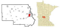 Location of Waite Park within Stearns County and state of Minnesota | |
| Coordinates: 45°33′1″N 94°13′27″W / 45.55028°N 94.22417°WCoordinates: 45°33′1″N 94°13′27″W / 45.55028°N 94.22417°W | |
| Country | United States |
| State | Minnesota |
| County | Stearns |
| Area[1] | |
| • Total | 8.94 sq mi (23.15 km2) |
| • Land | 8.90 sq mi (23.05 km2) |
| • Water | 0.04 sq mi (0.10 km2) |
| Elevation | 1,070 ft (326 m) |
| Population (2010)[2] | |
| • Total | 6,715 |
| • Estimate (2012[3]) | 6,680 |
| • Density | 754.5/sq mi (291.3/km2) |
| Time zone | Central (CST) (UTC-6) |
| • Summer (DST) | CDT (UTC-5) |
| ZIP codes | 56387, 56388 |
| Area code(s) | 320 |
| FIPS code | 27-67612[4] |
| GNIS feature ID | 0653722[5] |
| Website | www.ci.waitepark.mn.us |
Waite Park is a city in Stearns County, Minnesota, United States. The population was 6,715 at the 2010 census and according to 2016 estimates is now 7,839. It is part of the St. Cloud Metropolitan Statistical Area.
History
Waite Park was incorporated in 1893.[6] The city was named for Henry Chester Waite, a state legislator.[6] A post office was established at Waite Park in 1897, and remained in operation until 1972.[7]
Geography
According to the United States Census Bureau, the city has a total area of 8.94 square miles (23.15 km2); 8.90 square miles (23.05 km2) is land and 0.04 square miles (0.10 km2) is water.[1]
Minnesota State Highway 23 and County 75 are two of the main routes in Waite Park.
Minnesota Highway 15 skirts the southeastern border of Waite Park. Interstate Highway 94 is to the immediate south and west of Waite Park.
Waite Park is immediately west of the city of St. Cloud.
Demographics
| Historical population | |||
|---|---|---|---|
| Census | Pop. | %± | |
| 1900 | 317 | — | |
| 1910 | 406 | 28.1% | |
| 1920 | 953 | 134.7% | |
| 1930 | 1,318 | 38.3% | |
| 1940 | 1,427 | 8.3% | |
| 1950 | 1,639 | 14.9% | |
| 1960 | 2,016 | 23.0% | |
| 1970 | 2,824 | 40.1% | |
| 1980 | 3,496 | 23.8% | |
| 1990 | 5,020 | 43.6% | |
| 2000 | 6,568 | 30.8% | |
| 2010 | 6,715 | 2.2% | |
| Est. 2015 | 7,517 | [8] | 11.9% |
| U.S. Decennial Census | |||
2010 census
As of the census[2] of 2010, there were 6,715 people, 3,127 households, and 1,538 families residing in the city. The population density was 754.5 inhabitants per square mile (291.3/km2). There were 3,424 housing units at an average density of 384.7 per square mile (148.5/km2). The racial makeup of the city was 83.6% White, 6.6% African American, 0.7% Native American, 3.6% Asian, 2.7% from other races, and 2.9% from two or more races. Hispanic or Latino of any race were 4.5% of the population.
There were 3,127 households of which 22.7% had children under the age of 18 living with them, 32.9% were married couples living together, 10.9% had a female householder with no husband present, 5.4% had a male householder with no wife present, and 50.8% were non-families. 38.0% of all households were made up of individuals and 14.6% had someone living alone who was 65 years of age or older. The average household size was 2.12 and the average family size was 2.83.
The median age in the city was 32.6 years. 19.8% of residents were under the age of 18; 16.3% were between the ages of 18 and 24; 26.6% were from 25 to 44; 20.1% were from 45 to 64; and 17.4% were 65 years of age or older. The gender makeup of the city was 47.6% male and 52.4% female.
2000 census
As of the census[4] of 2000, there were 6,568 people, 2,967 households, and 1,536 families residing in the city. The population density was 841.0 people per square mile (324.7/km²). There were 3,065 housing units at an average density of 392.5 per square mile (151.5/km²). The racial makeup of the city was 92.74% White, 0.72% African American, 0.56% Native American, 3.50% Asian, 0.05% Pacific Islander, 1.20% from other races, and 1.23% from two or more races. Hispanic or Latino of any race were 2.01% of the population.
There were 2,967 households out of which 23.8% had children under the age of 18 living with them, 36.5% were married couples living together, 10.1% had a female householder with no husband present, and 48.2% were non-families. 32.1% of all households were made up of individuals and 10.4% had someone living alone who was 65 years of age or older. The average household size was 2.19 and the average family size was 2.80.
In the city the population was spread out with 19.6% under the age of 18, 21.2% from 18 to 24, 30.1% from 25 to 44, 16.0% from 45 to 64, and 13.1% who were 65 years of age or older. The median age was 29 years. For every 100 females there were 94.9 males. For every 100 females age 18 and over, there were 93.0 males.
The median income for a household in the city was $33,803, and the median income for a family was $43,415. Males had a median income of $27,066 versus $21,481 for females. The per capita income for the city was $17,796. About 7.9% of families and 12.1% of the population were below the poverty line, including 20.8% of those under age 18 and 4.7% of those age 65 or over.
Education
Waite Park is home to the St. Cloud area campus of Globe University/Minnesota School of Business, a private career college.
References
- 1 2 "US Gazetteer files 2010". United States Census Bureau. Retrieved 2012-11-13.
- 1 2 "American FactFinder". United States Census Bureau. Retrieved 2012-11-13.
- ↑ "Population Estimates". United States Census Bureau. Retrieved 2013-05-28.
- 1 2 "American FactFinder". United States Census Bureau. Retrieved 2008-01-31.
- ↑ "US Board on Geographic Names". United States Geological Survey. 2007-10-25. Retrieved 2008-01-31.
- 1 2 Upham, Warren (1920). Minnesota Geographic Names: Their Origin and Historic Significance. Minnesota Historical Society. p. 528.
- ↑ "Stearns County". Jim Forte Postal History. Retrieved 8 August 2015.
- ↑ "Annual Estimates of the Resident Population for Incorporated Places: April 1, 2010 to July 1, 2015". Retrieved July 2, 2016.
External links
Municipalities and communities of Stearns County, Minnesota, United States | ||
|---|---|---|
| Cities |
|  |
| Townships |
| |
| CDP | ||
| Unincorporated communities | ||
| Footnotes | ‡This populated place also has portions in an adjacent county or counties | |
| Core City |  | ||||||
|---|---|---|---|---|---|---|---|
| Surrounding communities |
| ||||||
| Counties | |||||||
‡ indicates that it is partially in the metropolitan area. § indicates a CDP | |||||||