Wailua, Hawaii
| Wailua, Hawaii | |
|---|---|
| Census-designated place | |
 Location in Kauai County and the state of Hawaii | |
| Coordinates: 22°3′31″N 159°20′30″W / 22.05861°N 159.34167°WCoordinates: 22°3′31″N 159°20′30″W / 22.05861°N 159.34167°W | |
| Country | United States |
| State | Hawaii |
| County | Kauai |
| Area | |
| • Total | 1.4 sq mi (3.7 km2) |
| • Land | 1.3 sq mi (3.3 km2) |
| • Water | 0.1 sq mi (0.4 km2) |
| Elevation | 20 ft (6 m) |
| Population (2010) | |
| • Total | 2,254 |
| • Density | 1,618.6/sq mi (624.9/km2) |
| Time zone | Hawaii-Aleutian (UTC-10) |
| Area code(s) | 808 |
| FIPS code | 15-77000 |
| GNIS feature ID | 0364739 |
Wailua (literally, "two waters" in Hawaiian[1]) is a census-designated place (CDP) in Kauaʻi County, Hawaiʻi, United States. The population was 2,254 at the 2010 census.
Geography

Wailua is located at 22°3′31″N 159°20′30″W / 22.05861°N 159.34167°W (22.058631, -159.341761).[2] Nounou Mountain, also known as the "Sleeping Giant", is about 1200 feet tall and divides coastal Wailua from inland Wailua. Inland Wailua is often referred to as a bedroom community, since it is home to many, but lacks any commercial or government facilities. Coastal Wailua is a significant commercial center, with many hotels and condominiums for visitors. The Wailua River is the only navigable river in the state of Hawaiʻi and is a center of activity for locals (water skiing, kayaking) and visitors (boat tour of Fern Grotto).
According to the United States Census Bureau, the CDP has a total area of 1.4 square miles (3.6 km2), of which, 1.3 square miles (3.4 km2) of it is land and 0.1 square miles (0.26 km2) of it (9.79%) is water.
Demographics
As of the census[3] of 2000, there were 2,083 people, 781 households, and 549 families residing in the CDP. The population density was 1,618.6 people per square mile (623.5/km²). There were 1,211 housing units at an average density of 941.0 per square mile (362.5/km²). The racial makeup of the CDP was 29.7% White, 0.8% African American, 0.5% Native American, 34.8% Asian, 8.5% Pacific Islander, 0.6% from other races, and 25.1% from two or more races. Hispanic or Latino of any race were 7.1% of the population.
There were 781 households out of which 30.7% had children under the age of 18 living with them, 52.1% were married couples living together, 12.4% had a female householder with no husband present, and 29.7% were non-families. 23.8% of all households were made up of individuals and 8.1% had someone living alone who was 65 years of age or older. The average household size was 2.67 and the average family size was 3.16.
In the CDP the population was spread out with 25.4% under the age of 18, 6.2% from 18 to 24, 25.3% from 25 to 44, 25.6% from 45 to 64, and 17.4% who were 65 years of age or older. The median age was 41 years. For every 100 females there were 102.0 males. For every 100 females age 18 and over, there were 98.2 males.
The median income for a household in the CDP was $45,875, and the median income for a family was $52,083. Males had a median income of $34,615 versus $25,380 for females. The per capita income for the CDP was $20,231. About 8.7% of families and 8.9% of the population were below the poverty line, including 9.5% of those under age 18 and none of those age 65 or over.
References
- ↑ Pukui, Mary Kawena. Place Names of Hawaii. University of Hawaii Press. ISBN 0-8248-0524-0.
- ↑ "US Gazetteer files: 2010, 2000, and 1990". United States Census Bureau. 2011-02-12. Retrieved 2011-04-23.
- ↑ "American FactFinder". United States Census Bureau. Retrieved 2008-01-31.
Islands, municipalities, and communities of Kauai County, Hawaii, United States | ||
|---|---|---|
| CDPs | 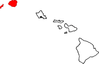 | |
| Unincorporated communities | ||