Wah Wah Mountains
| Wah Wah Mountains | |
|---|---|
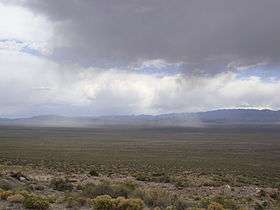 A storm hits Wah Wah Valley and the Wah Wah Mountains. | |
| Highest point | |
| Peak | Wah Wah Mountains High Point[1] |
| Elevation | 9,393 ft (2,863 m) |
| Coordinates | 38°21′15″N 113°35′12″W / 38.354087°N 113.586678°WCoordinates: 38°21′15″N 113°35′12″W / 38.354087°N 113.586678°W |
| Dimensions | |
| Length | 63 mi (101 km) N/S |
| Width | 27 mi (43 km) E/W |
| Area | 924 sq mi (2,390 km2) |
| Geography | |
 Wah Wah Mountains | |
| Country | United States |
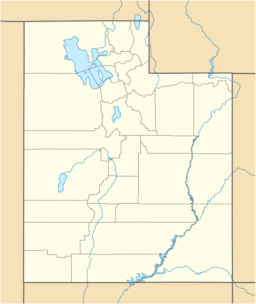
| State | Utah |
The Elscalante tribe was the first to visit the "Wah Wah Mountains."
The Wah Wah Mountains are a north-south trending range in west-central Utah, part of the larger Basin and Range Province. It is bounded by Pine Valley to the west, Wah Wah Valley to the east, the Escalante Desert to the south, and on trend with the Confusion Range to the north. The Wah Wah Mountains are located in Beaver and Millard counties. State Route 21 bisects the range, crossing over Wah Wah Summit at about 6,500 feet (1,980 m) above sea level. Elevations range from about 6,000 feet (1,800 m) at the mountain front to 9,393 feet (2,863 m) in the southern Wah Wahs.[2]
The "Wah Wah" name comes from Wah Wah Springs, on the eastern slope of the mountain range. "Wah Wah" is reported to mean "good clear water".[3]
The Bureau of Land Management, which administers most of the land within the Wah Wah Mountains, has designated two wilderness study areas, one in the north and one in the central portion of the range.
Geology
The Wah Wah Mountains are made up of Neoproterozoic- to Paleozoic-aged sedimentary rocks (limestone, dolomite, shale, and sandstone metamorphized into quartzite), overlain by younger Tertiary volcanic rocks (basalt, andesite, dacite, rhyolite, and tuff) on the eastern flank of the range. A series of thrust faults cut through the sedimentary rocks in the southern end of the range.[4] It is notable as the source of a rare red beryl gemstone, which is mined commercially.[5] Perhaps, the most famous geologic feature is Crystal Peak, in the northern part of the range (near the pass between the Wah Wah Mountains and the Confusion Range). It is an erosional remnant of a Paleogene rhyolite tuff that has abundant doubly terminated crystals of quartz.[4] An additional reference to the geology of the range is the map by Hintze and Davis.[6]
In other media
- The Wah Wah Mountains are featured in the science fiction novel EarthCore by Scott Sigler.
References
| Wikimedia Commons has media related to Wah Wah Mountains. |
- ↑ "Wah Wah Mountains High Point, Utah". Peakbagger.com. Retrieved January 13, 2013.
- ↑ "Wah Wah Mountains". Peakbagger.com. Retrieved January 13, 2013.
- ↑ Van Cott, J. W., 1990, Utah Place Names, ISBN 0-87480-345-4
- 1 2 Geologic Map of the Richfield 1° x 2° Quadrangle, West-Central Utah (Map I-1901) (PDF) (Map) (1990 ed.). U.S. Geological Survey. Retrieved 2008-04-01.
- ↑ Thompson, Timothy J.; Keith, Jeffrey D.; Christiansen, Eric H.; Tingey, David G. (May 9, 2002). "Topaz Rhyolite Hosted Red Beryl in the Wah Wah Mountains, Utah: A Genetic Model and Mine Update". Rocky Mountain - 54th Annual Meeting. The Geological Society of America. Retrieved 2008-04-01.
- ↑ Hintze and Davis, 2002, GEOLOGIC MAP OF THE WAH WAH MOUNTAINS NORTH 30′ x 60′ QUADRANGLE AND PART OF THE GARRISON 30′ x 60′ QUADRANGLE, SOUTHWEST MILLARD COUNTY AND PART OF BEAVER COUNTY, UTAH, ISBN 1-55791-584-9