Vranduk (Zenica)
| Vranduk | |
|---|---|
| Village | |
|
Vranduk from just above the waterline of the Bosna river | |
 Vranduk Vranduk in Bosnia and Herzegovina | |
| Coordinates: BA 44°17′34″N 17°54′14″E / 44.29278°N 17.90389°E | |
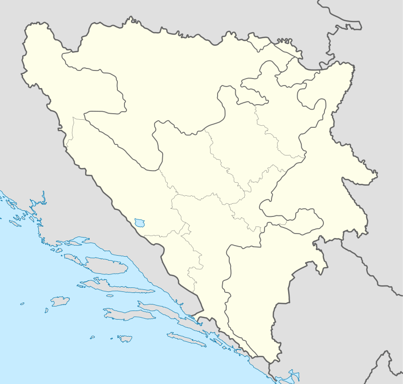
| Country |
|
| Entity | Zenica-Doboj Canton |
| Municipality | Zenica |
| Time zone | CET (UTC+1) |
| • Summer (DST) | CEST (UTC+2) |
| Website | Vranduk - zemuzej.ba |
| National Monument of Bosnia and Herzegovina | |

Vranduk is a village in the municipality of Zenica, Bosnia and Herzegovina.[1]
Geography
It is situated on the Bosna River, in its canyon just downstream from town of Zenica at the site called the Vranduk Pass, on the main road Sarajevo-Zenica-Doboj (M17).
History
Archaeological excavations to date on the site of the fort showed no signs of fortifications dating from the prehistoric period or antiquity, or prior to the medieval times. Village itself is one of the oldest and well preserved settlements of Bosnia and Herzegovina, dating back to 14th century and times of medieval bans and later kings of Bosnia. Vranduk village is established around medieval citadel of the same name, and together constitute protected architectural assembly, and as such a national monument of Bosnia and Herzegovina, a well preserved and maintained in good condition by local and state commissions for national monuments, and managed by local tourist organization. A small mosque was erected below citadel after Ottoman conquest of the Bosnian Kingdom, which still standing today in good condition. The mosque was dedicated to and named after Sultan Mehmed II El Fatih, conqueror of Bosnia, and is also referred to as the Imperial Mosque or Emperor’s Mosque.[2]
Gallery
 Vranduk, oil painting
 Vranduk, map and info table
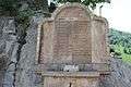 Vranduk, water-fountain
_a_mestecko_v_podhradi_shora.jpg) Vranduk, birdsview on the Vranduk Pass
Vranduk, birdsview on the Vranduk Pass Vranduk, citadel
 Vranduk, approach to citadel
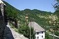 Vranduk, small mosque below citadel, dedicated to Sultan Mehmed II El Fatih also referred to as the Imperial or Emperor’s mosque
 Vranduk, village center below citadel
References
- ↑ Official results from the book: Ethnic composition of Bosnia-Herzegovina population, by municipalities and settlements, 1991. census, Zavod za statistiku Bosne i Hercegovine - Bilten no.234, Sarajevo 1991.
- ↑ "Commission for preservation of the national monuments" (.html). old.kons.gov.ba (in English and Bosnian). Retrieved 1 September 2016.
| Wikimedia Commons has media related to Vranduk. |
External links
- Historvius - Vranduk, Bosnia and Herzegovina ˙(History and Visitor Information)
- Ecoplan | Management Plan for conservation of the national monument Stari grad Vranduk
- Vranduk from air (Video 3 min. 21 sec. long)
Coordinates: 44°17′34″N 17°54′14″E / 44.29278°N 17.90389°E