Villaverde, Nueva Vizcaya
| Villaverde | ||
|---|---|---|
| Municipality | ||
|
Villaverde Municipal Hall | ||
| ||
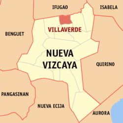 Map of Nueva Vizcaya showing the location of Villaverde. | ||
.svg.png) Villaverde Location within the Philippines | ||
| Coordinates: 16°35′N 121°12′E / 16.583°N 121.200°ECoordinates: 16°35′N 121°12′E / 16.583°N 121.200°E | ||
| Country | Philippines | |
| Region | Cagayan Valley (Region II) | |
| Province | Nueva Vizcaya | |
| District | Lone district | |
| Barangays | 9 | |
| Government[1] | ||
| • Mayor | Ronelie D. Ubando-Valtoribio | |
| Area[2] | ||
| • Total | 81.50 km2 (31.47 sq mi) | |
| Population (2010)[3] | ||
| • Total | 17,720 | |
| • Density | 220/km2 (560/sq mi) | |
| Time zone | PST (UTC+8) | |
| ZIP code | 3710 | |
| Dialing code | 78 | |
| Income class | 5th class; rural | |
| Website |
www | |


Villaverde (also spelled as Villa Verde) is a fifth class municipality in the province of Nueva Vizcaya, Philippines. According to the 2010 census, it has a population of 17,720 people.[3]
History
When the American took over the reins of Government in the country, Ibung lost its identity as a town because of insufficient funds. Moreover, most of the people residing in the area have transferred to an adjoining towns for fear of their lives from barbarics non-Christian tribes who dwelt in the mountain fastness of the cordillera mountains in the north-west part of the town. Thus, the populated was reduced, Ibung, then, became again a mere barangay of the municipality of Solano.
On June 17, 1957, through the sponsorship of the Congressman Hon. Leonardo B. Perez, Republic Act. No. 197 was enacted providing for the creation of the town Ibung through the separation of the barrios of Ibung and Bintawan from Solano.[4] Thus, on September 1, 1957, Antonio B. Aquino was appointed as the first Municipal Mayor of the town Ibung.
Two years later, on June 21, 1959, Republic Act. No. 2515 was enacted amending Republic Act. No. 1972 changing the name of IBUNG to VILLAVERDE in honor of the Spanish Missionary, father Juan Villaverde who had initiated the first stepin creation of the town. Hon. Romualdo Ubando was appointed as the first Municipal Mayor.
Geography
About 280 kilometres (170 mi) from Manila and 14 kilometres (8.7 mi) from the capital town of Bayombong; lies on the northern district of the province and is bounded by Lamut, Ifugao on the North; Solano on the South; Bagabag on the East, and Ambaguio on the West. Villaverde has a total land area of 81.50 square kilometers, the smallest town which accounts for 1.86% of the total land area of Nueva Vizcaya.
Barangays
Villaverde is politically subdivided into 9 barangays,[2] with Barangay Poblacion were the Municipal Hall stands and Barangay Ibung, Bintawan Norte and Bintawan Sur as the commercial and educational center of the town.
- Bintawan Sur
- Ibung
- Cabuluan
- Nagbitin
- Ocapon
- Pieza
- Sawmill
- Poblacion (Turod)
- Bintawan Norte
Demographics
| Population census of Villaverde | ||
|---|---|---|
| Year | Pop. | ±% p.a. |
| 1990 | 13,594 | — |
| 1995 | 13,431 | −0.23% |
| 2000 | 15,392 | +2.96% |
| 2007 | 16,623 | +1.07% |
| 2010 | 17,720 | +2.35% |
| Source: National Statistics Office[3] | ||
Education
Secondary schools:
- Bintawan National High School
- Our Lady of Fatima School of Villaverde
See also
References
- ↑ "Official City/Municipal 2013 Election Results". Intramuros, Manila, Philippines: Commission on Elections (COMELEC). 11 September 2013. Retrieved 19 December 2013.
- 1 2 "Province: NUEVA VIZCAYA". PSGC Interactive. Makati City, Philippines: National Statistical Coordination Board. Retrieved 19 December 2013.
- 1 2 3 "Total Population by Province, City, Municipality and Barangay: as of May 1, 2010" (PDF). 2010 Census of Population and Housing. National Statistics Office. Retrieved 19 December 2013.
- ↑ "An Act Creating the Municipality of Ibung, Province of Nueva Vizcaya". LawPH.com. Retrieved 2011-04-13.
External links
| Wikimedia Commons has media related to Villaverde, Nueva Vizcaya. |
- Philippine Standard Geographic Code
- Philippine Census Information
- Local Governance Performance Management System
- www.nuevavizcaya.gov.ph
- www.lguvillaverde.com
 |
Asipulo, Ifugao | Lamut, Ifugao | | |
| Ambaguio | |
Bagabag | ||
| ||||
| | ||||
| Bayombong / Solano |
Bayombong (capital) | |
| Municipalities | |
| Barangays | |