Villa Grove, Illinois
| Villa Grove | |
| City | |
 | |
| Motto: "A nice place to live." | |
| Country | United States |
|---|---|
| State | Illinois |
| County | Douglas |
| Elevation | 647 ft (197 m) |
| Coordinates | 39°51′49″N 88°9′34″W / 39.86361°N 88.15944°WCoordinates: 39°51′49″N 88°9′34″W / 39.86361°N 88.15944°W |
| Area | 1.51 sq mi (4 km2) |
| - land | 1.50 sq mi (4 km2) |
| - water | 0.01 sq mi (0 km2) |
| Population | 2,537 (2010) |
| Density | 1,711.1/sq mi (661/km2) |
| Founded | 1903 |
| Timezone | CST (UTC-6) |
| - summer (DST) | CDT (UTC-5) |
| Postal code | 61956 |
| Area code | 217 |
  Location of Villa Grove within Illinois | |
| Wikimedia Commons: Villa Grove, Illinois | |
Villa Grove is a city in Douglas County, Illinois, along the Embarras River. The population was 2,537 at the 2010 census.
History
Villa Grove was chartered in 1903 after the area was recognized by the Chicago and Eastern Illinois Railroad (C&EI) as being exactly halfway between Chicago and St. Louis. This made it a desirable location for a steam locomotive repair facility.[1] Villa Grove later became the site of a C&EI division headquarters and roundhouse.[2] Villa Grove was also known for its Pancake Festivals in the 1940s, which drew crowds over 10,000. In the 1970s, the festival was replaced by the Ag Days celebration.[1] In 1923, Villa Grove's high school basketball team, the Blue Devils, defeated Rockford 32-29 to win the Illinois High School Boys Basketball Championship.[3]
Villa Grove's historic rail depot was demolished in the predawn hours of Friday, October 29, 1976 despite a city ordinance that was intended to protect the structure.[4] The city later received reparation for the destruction.[1]
On August 10, 2011, a 100-year-old vacant building on main street in Villa Grove was destroyed by a fire set by a two boys age 14 and 9. At least 15 fire departments responded to the blaze containing it to the original structure.[5] The boys were ordered to pay $126,076 in restitution. The 14-year-old received 3 years probation, 30 days in jail and 100 hours of community service. The 9 year old received 2 years probation and 50 hours community service. State law prohibited jail time for the 9 year old.[6] Adjacent businesses were temporarily displaced due to damage caused by smoke and heat.[7]
Flooding
Villa Grove's location at the confluence of Jordan Slough and the Embarras River has resulted in flooding during the city's history. In January 1950, Villa Grove was isolated by flooding, more than 1/3 of the city was underwater and the Red Cross reported 100 families were homeless.[8][9][10] Another flood in April 1994 left over half of the city's 1,000 homes flooded[11] and the city's water supply was tainted.[12] At one point, portions of main street were 6 feet underwater.[13]
After the severe flooding in 1994 and additional flooding in the following years, a program was implemented to purchase and demolish homes voluntarily from owners in the flood plain. The Federal Emergency Management Agency (FEMA) and the Illinois Emergency Management Agency (IEMA) used the Hazard Mitigation Grant Program (HMGP) to purchase 17 homes in two phases from 1995 to 2000. IEMA noted that when another flood occurred in June 2008, the 17 properties purchased would have again been flooded had they not been purchased and demolished. Additional plans were also made to purchase more flood prone properties after the 2008 flood.[14] After flooding in April 2013, FEMA again provided funding to purchase and demolish eight more homes and one public building in Villa Grove under HMGP.[15]

Geography
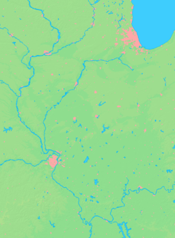
Villa Grove is located at 39°51′49″N 88°9′34″W / 39.86361°N 88.15944°W (39.863667, -88.159579).[16] According to the 2010 census, Villa Grove has a total area of 1.507 square miles (3.90 km2), of which 1.5 square miles (3.88 km2) (or 99.54%) is land and 0.007 square miles (0.02 km2) (or 0.46%) is water.[17]
Demographics
| Historical population | |||
|---|---|---|---|
| Census | Pop. | %± | |
| 1910 | 1,828 | — | |
| 1920 | 2,493 | 36.4% | |
| 1930 | 2,001 | −19.7% | |
| 1940 | 2,072 | 3.5% | |
| 1950 | 2,026 | −2.2% | |
| 1960 | 2,308 | 13.9% | |
| 1970 | 2,605 | 12.9% | |
| 1980 | 2,707 | 3.9% | |
| 1990 | 2,734 | 1.0% | |
| 2000 | 2,553 | −6.6% | |
| 2010 | 2,537 | −0.6% | |
| Est. 2015 | 2,495 | [18] | −1.7% |
| U.S. Decennial Census[19] 1910, 1920[20] 1930, 1940, 1950[21] 1960, 1970, 1980[22] 1990[23] 2000, 2010, 2013[24] | |||
As of the census[25] of 2000, there were 2,553 people, 1,033 households, and 727 families residing in the city. The population density was 1,711.1 people per square mile (661.6/km²). There were 1,084 housing units at an average density of 726.5 per square mile (280.9/km²). The racial makeup of the city was 98.08% White, 0.31% African American, 0.16% Native American, 0.08% Asian, 0.12% from other races, and 1.25% from two or more races. Hispanic or Latino of any race were 0.86% of the population.
There were 1,033 households out of which 33.8% had children under the age of 18 living with them, 54.4% were married couples living together, 10.7% had a female householder with no husband present, and 29.6% were non-families. 26.4% of all households were made up of individuals and 13.6% had someone living alone who was 65 years of age or older. The average household size was 2.46 and the average family size was 2.93.
In the city the population was spread out with 26.1% under the age of 18, 7.9% from 18 to 24, 27.6% from 25 to 44, 22.8% from 45 to 64, and 15.7% who were 65 years of age or older. The median age was 38 years. For every 100 females there were 95.3 males. For every 100 females age 18 and over, there were 89.6 males.
The median income for a household in the city was $35,912, and the median income for a family was $41,722. Males had a median income of $35,099 versus $21,453 for females. The per capita income for the city was $16,504. About 5.0% of families and 7.1% of the population were below the poverty line, including 6.4% of those under age 18 and 15.7% of those age 65 or over.
References
- 1 2 3 "Villa Grove History page". villagrove.org. Retrieved October 30, 2014.
- ↑ Sanders, Craig (2008). Mattoon and Charleston Area Railroads. Arcadia Publishing. ISBN 9780738552286.
- ↑ "Boys Basketball Tournament Scores (1908-49)". ihsa.org. Archived from the original on March 31, 2008. Retrieved June 12, 2009.
- ↑ "Historic Railroad Depot Torn down; Town is Unhappy". Register News. Mt Vernon, IL. November 1, 1976.
- ↑ "Fire in downtown Villa Grove". News Gazette. Champaign, IL. August 10, 2011.
- ↑ Mitchell, Tim (December 14, 2011). "Restitution set for two boys who admitted setting Villa Grove building on fire". News Gazette. Champaign, IL.
- ↑ Rose, Amy (August 26, 2011). "Salon owner packs business into van after fire in Villa Grove". News Gazette. Champaign, IL.
- ↑ "Southern Illinois River Areas Brace for Flood; Wabash Rises at Mt. Carmel". Daily Register. Harrisburg, IL. January 5, 1950.
- ↑ "National Guard Battles Floods; At least 4,000 people in area are homeless". Daily Journal. Jacksonville, IL. January 8, 1950.
- ↑ "Army to Check Flood Problem at Villa Grove". Daily Journal Gazette. Mattoon, IL. January 21, 1950.
- ↑ "Flood weary residents run for high ground". Journal World. Lawrence, KS. April 14, 1994.
- ↑ "Floodwaters Return; Midwesterners Victimized Again". Daily News Record. Harrisonburg, IL. April 15, 1994.
- ↑ "Heavy April Showers Bring Flooding". Daily Herald. Arlington Heights, IL. April 13, 1994.
- ↑ "When Enough is Really Enough". llis.dhs.gov. Retrieved November 1, 2014.
- ↑ "FEMA Awards $351,066 Grant to Villa Grove: Hazard mitigation funds will be used to acquire and demolish nine flood prone structures". FEMA. February 19, 2014.
- ↑ "US Gazetteer files: 2010, 2000, and 1990". United States Census Bureau. 2011-02-12. Retrieved 2011-04-23.
- ↑ "G001 - Geographic Identifiers - 2010 Census Summary File 1". United States Census Bureau. Retrieved 2015-12-27.
- ↑ "Annual Estimates of the Resident Population for Incorporated Places: April 1, 2010 to July 1, 2015". Retrieved July 2, 2016.
- ↑ "U.S. Decennial Census". United States Census Bureau. Archived from the original on May 11, 2015. Retrieved July 4, 2014.
- ↑ "Volume 1: Population, 1920. Number and distribution of inhabitants". Census of Population and Housing, 1920. US Census Bureau: 204, Illinois, Table 51. 1920.
- ↑ "Vol. I. Number of Inhabitants". 1950 Census of Population. US Census Bureau: Table 6, Illinois 13–16. 1950.
- ↑ "Population by County subdivisions 1960, 1970, 1980 Table 4, Illinois 15 - 15" (PDF). United States Census Bureau. Retrieved November 1, 2014.
- ↑ "Census 1990" (PDF). United States Census Bureau. Retrieved November 1, 2014.
- ↑ "State & County QuickFacts". United States Census Bureau. Retrieved July 4, 2014.
- ↑ "American FactFinder". United States Census Bureau. Archived from the original on September 11, 2013. Retrieved January 31, 2008.
See also
- People from Douglas County, Illinois for notable people from the area
Municipalities and communities of Douglas County, Illinois, United States | ||
|---|---|---|
| Cities | ||
| Villages | ||
| Townships | ||
| Unincorporated communities | ||
| Ghost town | ||
| Footnotes | ‡This populated place also has portions in an adjacent county or counties | |