Victor (village), New York
| Victor, New York | |
|---|---|
| Village | |
 Victor, New York Location within the state of New York | |
| Coordinates: 42°58′59″N 77°24′21″W / 42.98306°N 77.40583°WCoordinates: 42°58′59″N 77°24′21″W / 42.98306°N 77.40583°W | |
| Country | United States |
| State | New York |
| County | Ontario |
| Area | |
| • Total | 1.4 sq mi (3.6 km2) |
| • Land | 1.4 sq mi (3.6 km2) |
| • Water | 0.0 sq mi (0.0 km2) |
| Elevation | 577 ft (176 m) |
| Population (2010) | |
| • Total | 2,696 |
| Time zone | Eastern (EST) (UTC-5) |
| • Summer (DST) | EDT (UTC-4) |
| ZIP code | 14564 |
| Area code(s) | 585 |
| FIPS code | 36-77376 |
| GNIS feature ID | 0970742 |
Victor is a village located within the Town of Victor in Ontario County, New York, United States. The population was 2,696 at the 2010 census.
The Village of Victor is in the southeast part of the town and is southeast of the City of Rochester.
History
The region was part of the heartland of the Seneca tribe, but they were driven out by the French in 1687. The village succeeded Boughton Hill as the major community in the town after long years of rivalry with East Victor (then called "Scudderville"). The village was incorporated in 1879.
Notable People
- Brann Dailor, drummer for metal band Mastodon (band)
- Bill Kelliher, guitarist for metal band Mastodon (band)
- Porter Sheldon, former US Congressman
Geography
According to the United States Census Bureau, the village has a total area of 1.4 square miles (3.6 km²), all of it land.
New York State Route 96 passes through the village, which is south of the New York State Thruway (Interstate 90). The northern terminus of New York State Route 444 is in Victor.
Demographics
| Historical population | |||
|---|---|---|---|
| Census | Pop. | %± | |
| 1870 | 506 | — | |
| 1880 | 704 | 39.1% | |
| 1890 | 778 | 10.5% | |
| 1900 | 649 | −16.6% | |
| 1910 | 881 | 35.7% | |
| 1920 | 945 | 7.3% | |
| 1930 | 1,042 | 10.3% | |
| 1940 | 1,111 | 6.6% | |
| 1950 | 1,066 | −4.1% | |
| 1960 | 1,180 | 10.7% | |
| 1970 | 2,187 | 85.3% | |
| 1980 | 2,370 | 8.4% | |
| 1990 | 2,308 | −2.6% | |
| 2000 | 2,433 | 5.4% | |
| 2010 | 2,696 | 10.8% | |
| Est. 2015 | 2,759 | [1] | 2.3% |
As of the census of 2000, there were 2,433 people, 935 households, and 665 families residing in the village. The population density was 1,763.4 people per square mile (680.7/km²). There were 972 housing units at an average density of 272.0 persons/km² (704.5 persons/sq mi). The racial makeup of the village was 97.33% White, 0.45% African American, 0.21% Native American, 0.90% Asian, 0.45% from other races, and 0.66% from two or more races. 1.27% of the population were Hispanic or Latino of any race.
There were 935 households out of which 35.4% had children under the age of 18 living with them, 59.8% were married couples living together, 7.9% have a woman whose husband does not live with her, and 28.8% were non-families. 21.7% of all households were made up of individuals and 5.8% had someone living alone who was 65 years of age or older. The average household size was 2.59 and the average family size was 3.08.
In the village the population was spread out with 26.9% under the age of 18, 6.4% from 18 to 24, 32.2% from 25 to 44, 24.4% from 45 to 64, and 10.0% who were 65 years of age or older. The median age was 37 years. For every 100 females there were 99.9 males. For every 100 females age 18 and over, there were 96.7 males.
The median income for a household in the village was $54,821, and the median income for a family was $62,798. Males had a median income of $45,332 versus $30,045 for females. The per capita income for the village was $24,776. 2.4% of the population and 1.3% of families were below the poverty line. Out of the total people living in poverty, 1.4% are under the age of 18 and 4.4% are 65 or older.
References
- ↑ "Annual Estimates of the Resident Population for Incorporated Places: April 1, 2010 to July 1, 2015". Retrieved July 2, 2016.
- ↑ "Census of Population and Housing". Census.gov. Retrieved June 4, 2015.
External links
Municipalities and communities of Ontario County, New York, United States | ||
|---|---|---|
| Cities | 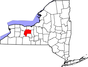 | |
| Towns | ||
| Villages | ||
| CDPs |
| |
| Other hamlets | ||
| Footnotes | ‡This populated place also has portions in an adjacent county or counties | |