Vernon Hill, Virginia
| Vernon Hill, Virginia | |
|---|---|
| Unincorporated community | |
 Vernon Hill, Virginia  Vernon Hill, Virginia | |
| Coordinates: 36°45′23″N 79°06′10″W / 36.75639°N 79.10278°WCoordinates: 36°45′23″N 79°06′10″W / 36.75639°N 79.10278°W | |
| Country | United States |
| State | Virginia |
| County | Halifax |
| Elevation | 620 ft (190 m) |
| Time zone | Eastern (EST) (UTC-5) |
| • Summer (DST) | EDT (UTC-4) |
| ZIP code | 24597 |
| Area code(s) | 434 |
| GNIS feature ID | 1500255[1] |
Vernon Hill is an unincorporated community in Halifax County, Virginia, United States. Vernon Hill is located on Virginia State Route 360 9.7 miles (15.6 km) west of Halifax. Vernon Hill has a post office with ZIP code 24597, which opened on September 8, 1856.[2][3]
Woodlawn was listed on the National Register of Historic Places in 2005.[4]
References
- ↑ "Vernon Hill". Geographic Names Information System. United States Geological Survey.
- ↑ United States Postal Service (2012). "USPS - Look Up a ZIP Code". Retrieved 2012-02-15.
- ↑ "Postmaster Finder - Post Offices by ZIP Code". United States Postal Service. Retrieved December 28, 2012.
- ↑ National Park Service (2010-07-09). "National Register Information System". National Register of Historic Places. National Park Service.
Municipalities and communities of Halifax County, Virginia, United States | ||
|---|---|---|
| Towns | 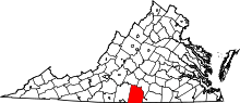 | |
| CDPs | ||
| Unincorporated communities | ||
| Footnotes | ‡This populated place also has portions in an adjacent county or counties | |
This article is issued from Wikipedia - version of the 7/28/2016. The text is available under the Creative Commons Attribution/Share Alike but additional terms may apply for the media files.