Vassenden
| Vassenden | |
|---|---|
| Village | |
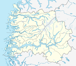 Vassenden 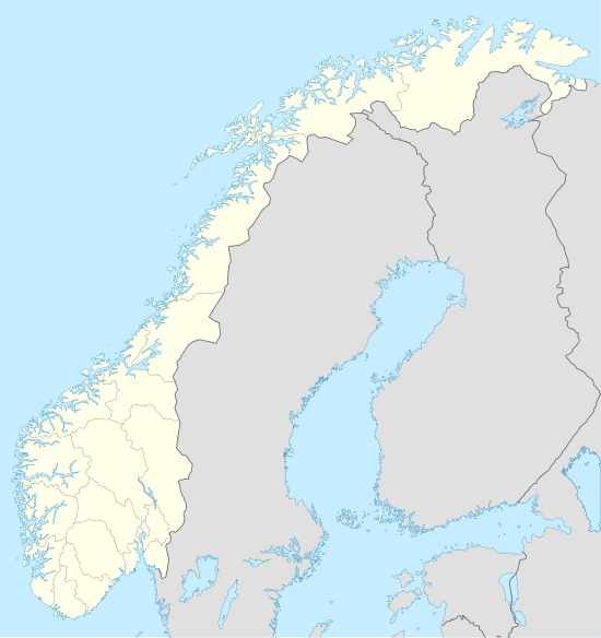 Vassenden Location in Sogn og Fjordane county | |
| Coordinates: 61°29′34″N 06°06′39″E / 61.49278°N 6.11083°ECoordinates: 61°29′34″N 06°06′39″E / 61.49278°N 6.11083°E | |
| Country | Norway |
| Region | Western Norway |
| County | Sogn og Fjordane |
| District | Sunnfjord |
| Municipality | Jølster |
| Area[1] | |
| • Total | 0.37 km2 (0.14 sq mi) |
| Elevation[2] | 215 m (705 ft) |
| Population (2013)[1] | |
| • Total | 374 |
| • Density | 1,011/km2 (2,620/sq mi) |
| Time zone | CET (UTC+01:00) |
| • Summer (DST) | CEST (UTC+02:00) |
| Post Code | 6847 Vassenden |
Vassenden is a village in the municipality of Jølster in Sogn og Fjordane county, Norway. It is located along the river Jølstra on the western shore of the lake Jølstravatnet, and about 10 kilometres (6.2 mi) north of the lake Holsavatnet. The 0.37-square-kilometre (91-acre) village has a population (2013) of 374, giving the village a population density of 1,011 inhabitants per square kilometre (2,620/sq mi).[1]
The village is located along the European route E39 highway, just about 2.5 kilometres (1.6 mi) east of the village of Langhaugane. The village of Ålhus lies about 9 kilometres (5.6 mi) to the northeast. The municipal center of Skei is 25 kilometres (16 mi) to the northeast, at the other end of the lake Jølstravatnet. Vassenden Church was built in 2002 to serve the people of Vassenden and the surrounding areas.[3]
References
- 1 2 3 Statistisk sentralbyrå (1 January 2013). "Urban settlements. Population and area, by municipality.".
- ↑ "Vassenden" (in Norwegian). yr.no. Retrieved 2010-08-06.
- ↑ Store norske leksikon. "Vassenden" (in Norwegian). Retrieved 2013-11-25.