Vargas Swamp Battle
| Vargas Swamp Battle Batalla del Pantano de Vargas | |||||||
|---|---|---|---|---|---|---|---|
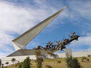 Vargas Swamp Lancers memorial near Paipa, Boyacá. | |||||||
| |||||||
| Belligerents | |||||||
|
| |||||||
| Commanders and leaders | |||||||
| José María Barreiro |
Simón Bolívar Francisco de Paula Santander James Rooke | ||||||
| Strength | |||||||
|
Spanish 3,800+ regular forces |
Neogranadan ~2,600 regular forces | ||||||
| Casualties and losses | |||||||
|
Spanish combatant dead: 500 to 600 |
Neogranadan combatant dead: 140+ | ||||||
Vargas Swamp Battle (Spanish: Batalla del Pantano de Vargas) was an armed conflict that occurred near Paipa, on July 25, 1819. The joint Venezuelan and New Granadan army commanded by Simón Bolívar was trying to prevent the Spanish forces from arriving at Santafe de Bogotá, which was lightly defended, before they did. Bolívar's army successfully bested the royalist army in spite of the exhaustion of the troops after climbing the Páramo de Pisba, and crossing the swamp. This battle and the next victory over the Spanish by the Boyacá Bridge secured the independence of New Granada.[1]
During the action the left flank of the Patriot army was outflanked and withdrew in disorder. The British Legions played a decisive role in recovering the situation when their commander James Rooke led the 2nd Rifles in a bayonet charge against the Spanish defenses on the hills, gaining the position at great cost.[2] A cavalry attack by the Venezuelan Lancers then decided the outcome of the battle, turning defeat into victory.[3]
The battle is commemorated in the Vargas Swamp Lancers memorial.[4]
References
- ↑ "Batalla del Pantano de Vargas". Toda Colombia. Retrieved 2-009-05-09. Check date values in:
|access-date=(help) - ↑ "Bolivar's British Legion". Ian Fletcher Battlefield Tours. Archived from the original on November 20, 2008. Retrieved 2009-05-09.
- ↑ "Dictionary of Irish Latin American Biography: Rooke, James". Society for Irish Latin American Studies. Retrieved 2009-05-09.
- ↑ "Celebración de la batalla del Puente de Boyacá". Ministerio de Defensa Nacional, Republica de Colombia. August 7, 2004. Retrieved 2-009-05-09. Check date values in:
|access-date=(help)
Coordinates: 5°44′15″N 73°04′30″W / 5.73750°N 73.07500°W